Estimated Value: $620,012 - $829,000
5
Beds
5
Baths
3,502
Sq Ft
$202/Sq Ft
Est. Value
About This Home
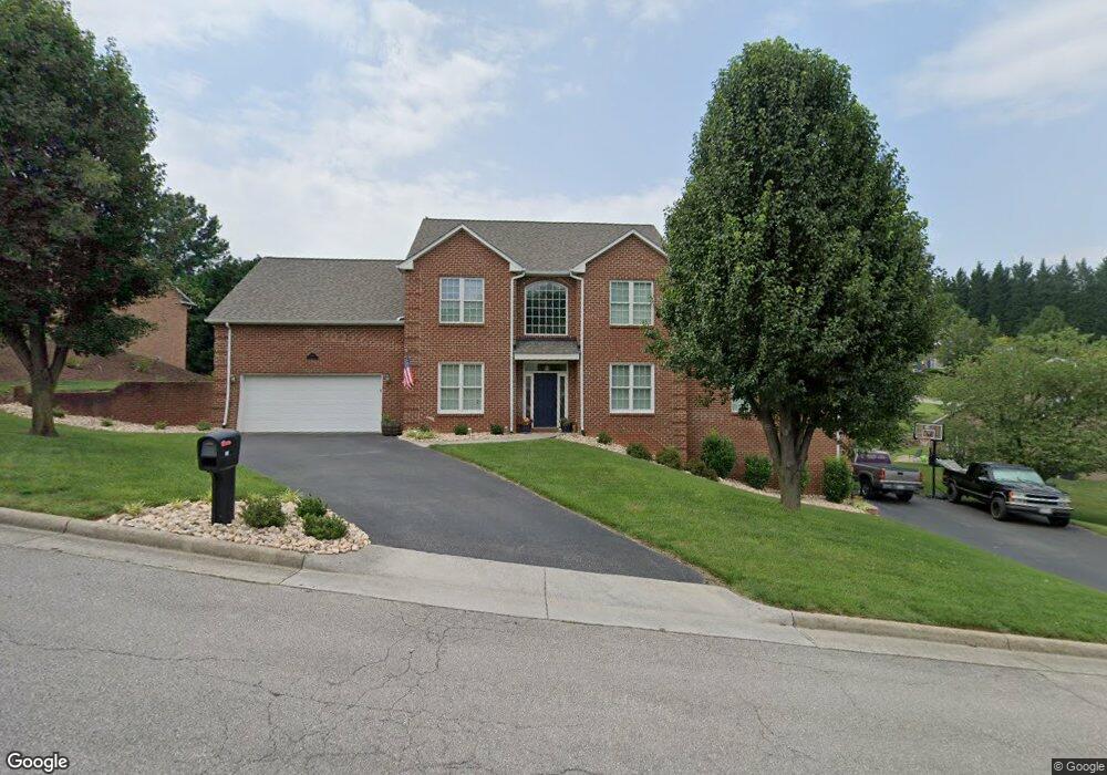
This home is located at 123 Ferrum Dr, Salem, VA 24153 and is currently estimated at $706,503, approximately $201 per square foot. 123 Ferrum Dr is a home located in Salem City with nearby schools including East Salem Elementary School, Andrew Lewis Middle School, and Salem High School.
Ownership History
Date
Name
Owned For
Owner Type
Purchase Details
Closed on
Oct 24, 2020
Sold by
Salem Enterprises Llc
Bought by
Hall Shannon B and Hall Amanda C
Current Estimated Value
Home Financials for this Owner
Home Financials are based on the most recent Mortgage that was taken out on this home.
Original Mortgage
$396,000
Outstanding Balance
$351,579
Interest Rate
2.8%
Mortgage Type
New Conventional
Estimated Equity
$354,924
Create a Home Valuation Report for This Property
The Home Valuation Report is an in-depth analysis detailing your home's value as well as a comparison with similar homes in the area
Home Values in the Area
Average Home Value in this Area
Purchase History
| Date | Buyer | Sale Price | Title Company |
|---|---|---|---|
| Hall Shannon B | $440,000 | Performance Title & Setmnt |
Source: Public Records
Mortgage History
| Date | Status | Borrower | Loan Amount |
|---|---|---|---|
| Open | Hall Shannon B | $396,000 |
Source: Public Records
Tax History Compared to Growth
Tax History
| Year | Tax Paid | Tax Assessment Tax Assessment Total Assessment is a certain percentage of the fair market value that is determined by local assessors to be the total taxable value of land and additions on the property. | Land | Improvement |
|---|---|---|---|---|
| 2025 | $3,380 | $572,800 | $78,900 | $493,900 |
| 2024 | $3,247 | $541,200 | $75,000 | $466,200 |
| 2023 | $5,948 | $495,700 | $69,500 | $426,200 |
| 2022 | $5,582 | $465,200 | $64,500 | $400,700 |
| 2021 | $5,384 | $448,700 | $61,100 | $387,600 |
| 2020 | $5,165 | $430,400 | $58,300 | $372,100 |
| 2019 | $5,029 | $419,100 | $58,300 | $360,800 |
| 2018 | $4,914 | $416,400 | $55,600 | $360,800 |
| 2017 | $5,104 | $432,500 | $55,600 | $376,900 |
| 2016 | $5,104 | $432,500 | $55,600 | $376,900 |
| 2015 | $5,186 | $439,500 | $55,000 | $384,500 |
| 2014 | $5,186 | $439,500 | $55,000 | $384,500 |
Source: Public Records
Map
Nearby Homes
- 23 Upland Dr
- The Nantucket Plan at Simms Farm
- The Beechwood Plan at Simms Farm
- The Hemlock Plan at Simms Farm
- The Magnolia Plan at Simms Farm
- The Madison Plan at Simms Farm
- The Avery Plan at Simms Farm
- The Williamsburg Plan at Simms Farm
- The Ashton Plan at Simms Farm
- The Margate Plan at Simms Farm
- The Georgetown Plan at Simms Farm
- The Jefferson Plan at Simms Farm
- The Washington Plan at Simms Farm
- The Lexington B Plan at Simms Farm
- 180 Forest Dr
- 137 Parker Ln
- 134 Parker Ln
- 121 Parker Ln
- 122 Parker Ln
- 1943 Maylin Dr