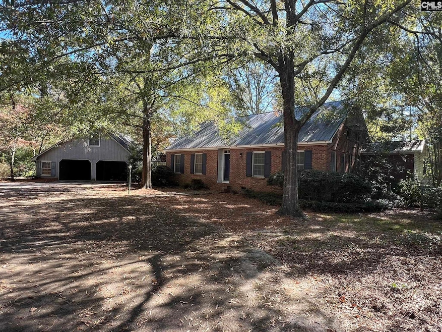
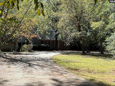
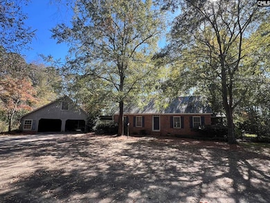
123 Hollow Ln Leesville, SC 29070
Estimated payment $2,112/month
Highlights
- Private Pool
- Traditional Architecture
- 1 Fireplace
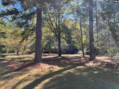
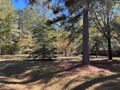
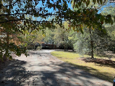
- 4.04 Acre Lot
- Main Floor Primary Bedroom
- No HOA
About This Home
Beautiful home, sitting on very private 4.04 acres. Enjoy the scenic ponds throughout the neighborhood, or relax by the pool on the patio. Once the interior is updated, this property will make an absolutely amazing estate for it's future owner. This inviting home is waiting for you! The listing agent owns interest in property. Disclaimer: CMLS has not reviewed and, therefore, does not endorse vendors who may appear in listings.
Home Details
Home Type
- Single Family
Est. Annual Taxes
- $1,585
Year Built
- Built in 1982
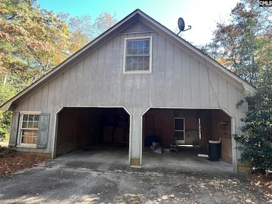
Parking
- 2 Car Detached Garage
Home Design
- Traditional Architecture
- Four Sided Brick Exterior Elevation
- Vinyl Construction Material
Interior Spaces
- 2,935 Sq Ft Home
- 2-Story Property
- 1 Fireplace
- Crawl Space
Bedrooms and Bathrooms
- 4 Bedrooms
- Primary Bedroom on Main
Schools
- Batesburg-Leesville Elementary And Middle School
- Batesburg-Leesville High School
Utilities
- Central Heating and Cooling System
- Well
- Septic System
Additional Features
- Private Pool
- 4.04 Acre Lot
Community Details
- No Home Owners Association
- Little Creek Estates Subdivision
Map
Home Values in the Area
Average Home Value in this Area
Tax History
| Year | Tax Paid | Tax Assessment Tax Assessment Total Assessment is a certain percentage of the fair market value that is determined by local assessors to be the total taxable value of land and additions on the property. | Land | Improvement |
|---|---|---|---|---|
| 2024 | $1,585 | $10,275 | $1,440 | $8,835 |
| 2023 | $1,585 | $10,275 | $1,440 | $8,835 |
| 2022 | $1,587 | $10,275 | $1,440 | $8,835 |
| 2020 | $1,326 | $10,275 | $1,440 | $8,835 |
| 2019 | $1,356 | $9,687 | $1,440 | $8,247 |
| 2018 | $1,310 | $9,687 | $1,440 | $8,247 |
| 2017 | $1,208 | $9,687 | $1,440 | $8,247 |
| 2016 | $953 | $9,685 | $1,440 | $8,245 |
| 2014 | $1,071 | $10,349 | $1,438 | $8,911 |
| 2013 | -- | $10,350 | $1,440 | $8,910 |
Property History
| Date | Event | Price | List to Sale | Price per Sq Ft |
|---|---|---|---|---|
| 11/05/2025 11/05/25 | Pending | -- | -- | -- |
| 10/31/2025 10/31/25 | For Sale | $375,000 | -- | $128 / Sq Ft |
Purchase History
| Date | Type | Sale Price | Title Company |
|---|---|---|---|
| Deed | $200,000 | None Listed On Document | |
| Warranty Deed | -- | None Listed On Document | |
| Warranty Deed | $294,500 | None Available |
Mortgage History
| Date | Status | Loan Amount | Loan Type |
|---|---|---|---|
| Open | $223,400 | Construction | |
| Previous Owner | $44,175 | Future Advance Clause Open End Mortgage | |
| Previous Owner | $235,600 | New Conventional |
Source: Consolidated MLS (Columbia MLS)
MLS Number: 620758
APN: 006100-06-071
Disclaimer: Certain information contained herein is derived from information provided by parties other than Homes.com. All information provided is deemed reliable, but is not guaranteed to be accurate and should be independently verified.
![]() IDX information is provided exclusively for personal, non-commercial use, and may not be used for any purpose other than to identify prospective properties consumers may be interested in purchasing. Information is deemed reliable but not guaranteed.
IDX information is provided exclusively for personal, non-commercial use, and may not be used for any purpose other than to identify prospective properties consumers may be interested in purchasing. Information is deemed reliable but not guaranteed.
- 1153 W Hampton Rd
- 6657 Augusta Hwy
- 1015 Sandpit Rd Unit 17
- 1015 Sandpit Rd Unit 3
- 1015 Sandpit Rd Unit 29
- 1015 Sandpit Rd Unit 12
- 1015 Sandpit Rd Unit 38
- 1015 Sandpit Rd Unit 10
- 1015 Sandpit Rd Unit 19
- 1015 Sandpit Rd Unit 14
- 0 Windmill Rd Unit 619450
- 715 Old Columbia Rd
- 5346 Augusta Hwy
- TBD Old Field Rd Unit 3
- TBD Old Field Rd Unit 9
- TBD Old Field Rd Unit 6
- TBD Old Field Rd Unit 1
- TBD Old Field Rd Unit 5
- TBD Old Field Rd Unit 4
- TBD Old Field Rd Unit 7
