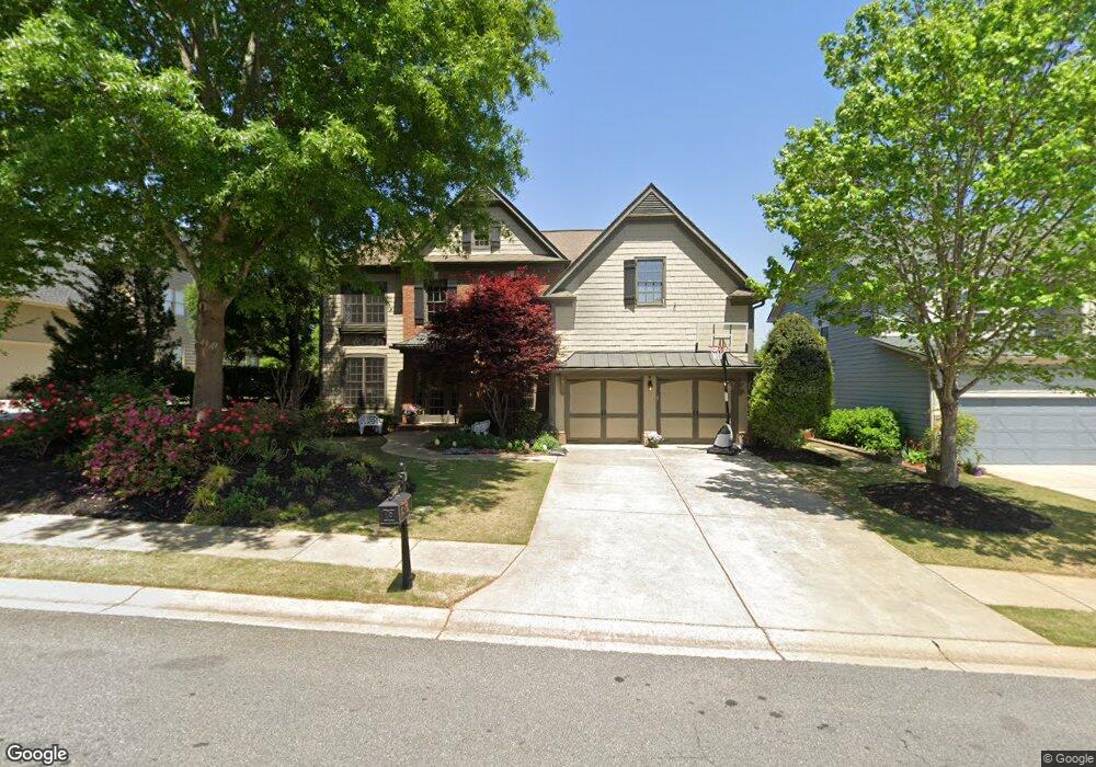
123 Johnston Farm Ln Woodstock, GA 30188
Estimated Value: $828,817 - $896,000
5
Beds
4
Baths
3,485
Sq Ft
$247/Sq Ft
Est. Value
About This Home
This home is located at 123 Johnston Farm Ln, Woodstock, GA 30188 and is currently estimated at $862,409, approximately $247 per square foot. 123 Johnston Farm Ln is a home located in Cherokee County with nearby schools including Woodstock Elementary School, Woodstock Middle School, and Woodstock High School.
Ownership History
Date
Name
Owned For
Owner Type
Purchase Details
Closed on
Aug 3, 2023
Sold by
Wendland Cathyjo
Bought by
Wendland Cathyjo
Current Estimated Value
Purchase Details
Closed on
May 8, 2023
Sold by
Colby Norman
Bought by
Wendland Cathyjo
Purchase Details
Closed on
May 10, 2011
Sold by
Toll Ga Lp
Bought by
Wendland Cathyjo and Colby Norman
Home Financials for this Owner
Home Financials are based on the most recent Mortgage that was taken out on this home.
Original Mortgage
$262,500
Interest Rate
3.5%
Mortgage Type
New Conventional
Create a Home Valuation Report for This Property
The Home Valuation Report is an in-depth analysis detailing your home's value as well as a comparison with similar homes in the area
Home Values in the Area
Average Home Value in this Area
Purchase History
| Date | Buyer | Sale Price | Title Company |
|---|---|---|---|
| Wendland Cathyjo | -- | -- | |
| Wendland Cathyjo | -- | -- | |
| Wendland Cathyjo | $375,000 | -- |
Source: Public Records
Mortgage History
| Date | Status | Borrower | Loan Amount |
|---|---|---|---|
| Previous Owner | Wendland Cathyjo | $262,500 |
Source: Public Records
Tax History Compared to Growth
Tax History
| Year | Tax Paid | Tax Assessment Tax Assessment Total Assessment is a certain percentage of the fair market value that is determined by local assessors to be the total taxable value of land and additions on the property. | Land | Improvement |
|---|---|---|---|---|
| 2024 | $7,139 | $315,640 | $68,000 | $247,640 |
| 2023 | $687 | $255,400 | $68,000 | $187,400 |
| 2022 | $5,796 | $234,200 | $46,000 | $188,200 |
| 2021 | $4,578 | $195,720 | $35,680 | $160,040 |
| 2020 | $5,561 | $188,920 | $34,000 | $154,920 |
| 2019 | $4,494 | $191,520 | $32,000 | $159,520 |
| 2018 | $4,323 | $181,760 | $32,000 | $149,760 |
| 2017 | $4,234 | $439,500 | $32,000 | $143,800 |
| 2016 | $4,068 | $415,000 | $26,000 | $140,000 |
| 2015 | $3,868 | $385,800 | $26,000 | $128,320 |
| 2014 | $3,674 | $360,800 | $26,000 | $118,320 |
Source: Public Records
Map
Nearby Homes
- 135 Johnston Farm Ln
- 344 Spotted Ridge Cir
- 823 Mackay Creek
- 800 Homestead Dr
- 273 Mitchell Ln
- 900 Sweetwater Grove
- 320 Lincoln St
- 308 Lincoln St
- 101 Henderson St
- 444 Hathaway Ave
- 130 Whitfield Way
- 320 Antebellum Place
- 8175 Main St
- 405 Nettle Ct
- The Mew Townhome Plan at Ruisseau
- 8200 Main St Unit 1208
- 8200 Main St Unit 1306
- 8200 Main St Unit 1206
- 121 Johnston Farm Ln
- 125 Johnston Farm Ln
- 131 Johnston Farm Ln
- 122 Johnston Farm Ln
- 127 Johnston Farm Ln
- 300 Ashgrove Ct
- 119 Johnston Farm Ln
- 201 Fox Pointe Ct
- 117 Johnston Farm Ln
- 124 Johnston Farm Ln
- 203 Fox Pointe Ct
- 0 Fox Pointe Ct Unit 7236464
- 0 Fox Pointe Ct Unit 7612575
- 0 Fox Pointe Ct Unit 8669864
- 0 Fox Pointe Ct
- 200 Fox Pointe Ct
- 128 Johnston Farm Ln
- 302 Ashgrove Ct
- 205 Fox Pointe Ct
- 116 Johnston Farm Ln
