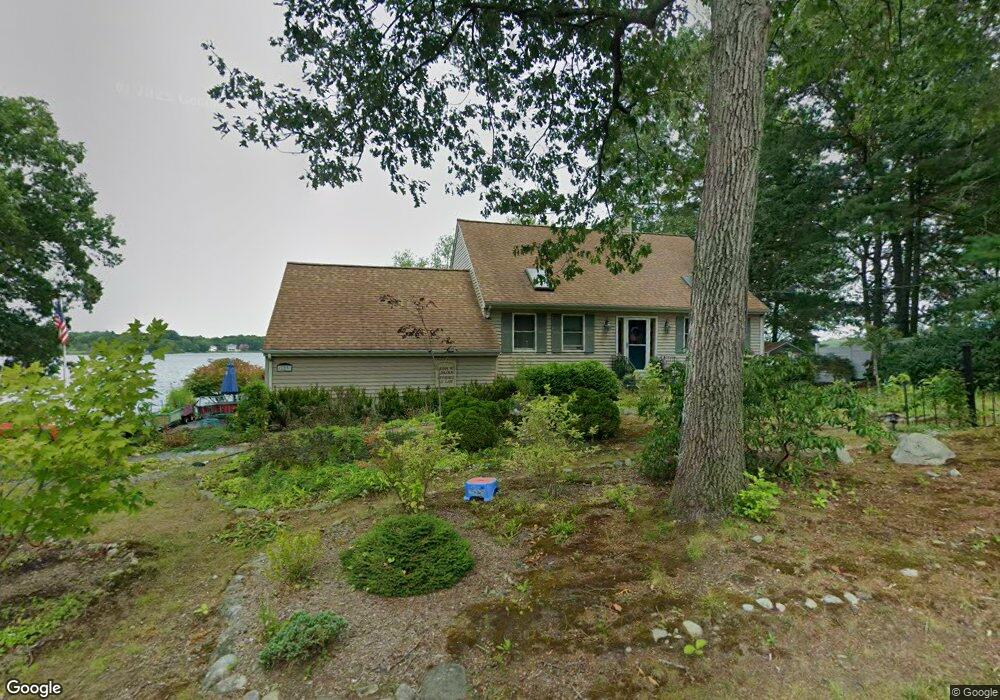
123 King Philip Rd Norton, MA 02766
Estimated Value: $571,000 - $669,000
2
Beds
3
Baths
1,736
Sq Ft
$364/Sq Ft
Est. Value
About This Home
This home is located at 123 King Philip Rd, Norton, MA 02766 and is currently estimated at $631,105, approximately $363 per square foot. 123 King Philip Rd is a home located in Bristol County with nearby schools including L.G. Nourse Elementary School, Henri A. Yelle Elementary School, and Norton Middle School.
Ownership History
Date
Name
Owned For
Owner Type
Purchase Details
Closed on
Feb 9, 2022
Sold by
Lincoln Rt
Bought by
King Susan M
Current Estimated Value
Purchase Details
Closed on
Aug 18, 2003
Sold by
Lincoln Jean M
Bought by
Lincoln Rt
Create a Home Valuation Report for This Property
The Home Valuation Report is an in-depth analysis detailing your home's value as well as a comparison with similar homes in the area
Home Values in the Area
Average Home Value in this Area
Purchase History
| Date | Buyer | Sale Price | Title Company |
|---|---|---|---|
| King Susan M | -- | None Available | |
| Lincoln Rt | -- | -- | |
| Lincoln Rt | -- | -- |
Source: Public Records
Tax History Compared to Growth
Tax History
| Year | Tax Paid | Tax Assessment Tax Assessment Total Assessment is a certain percentage of the fair market value that is determined by local assessors to be the total taxable value of land and additions on the property. | Land | Improvement |
|---|---|---|---|---|
| 2025 | $71 | $546,600 | $217,800 | $328,800 |
| 2024 | $7,050 | $544,400 | $190,100 | $354,300 |
| 2023 | $6,673 | $513,700 | $179,300 | $334,400 |
| 2022 | $6,500 | $455,800 | $163,000 | $292,800 |
| 2021 | $6,127 | $410,400 | $155,300 | $255,100 |
| 2020 | $5,899 | $398,600 | $150,700 | $247,900 |
| 2019 | $5,760 | $386,600 | $145,000 | $241,600 |
| 2018 | $5,459 | $360,100 | $145,000 | $215,100 |
| 2017 | $5,329 | $346,700 | $145,000 | $201,700 |
| 2016 | $5,167 | $331,000 | $145,000 | $186,000 |
| 2015 | $5,216 | $338,900 | $155,100 | $183,800 |
| 2014 | $4,998 | $325,200 | $147,700 | $177,500 |
Source: Public Records
Map
Nearby Homes
- 127 King Philip Rd
- 30 Samoset St
- 145 Burt St Unit 1
- 139 Burt St Unit 6
- 4 Stanley Rd
- 132 S Washington St Unit 132
- 260 S Washington St
- 17 Lloyd Cir Unit 36
- 24 Lloyd Cir Unit 34
- 16 Lloyd Cir Unit 30
- 135 S Washington St
- Lot 3B Hill St
- O Leonard St
- 1 Carlton Dr
- 38 S Washington St
- 14 Downing Dr
- 195 E Main St
- 15 S Washington St
- 0 S Washington St Unit 73437419
- 152 Pine St Unit 23
- 117 King Philip Rd
- 127 King Philip Rd
- 118 King Philip Rd
- 116 King Philip Rd
- 115 King Philip Rd
- 129 King Philip Rd
- 112 King Philip Rd
- 113 King Philip Rd
- 131 King Philip Rd
- 111 King Philip Rd
- 109 King Philip Rd
- 114 King Philip Rd
- 107A King Philip Rd
- 107 King Philip Rd
- 105 King Philip Rd
- 110 King Philip Rd
- 103 King Philip Rd
- 101 King Philip Rd
- 106 King Philip Rd
- 106 King Philip Rd Unit 106