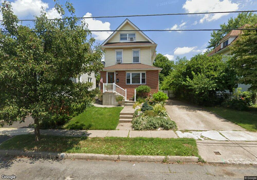
123 Oakland Ave Audubon, NJ 08106
Estimated Value: $331,840 - $454,000
--
Bed
--
Bath
1,418
Sq Ft
$283/Sq Ft
Est. Value
About This Home
This home is located at 123 Oakland Ave, Audubon, NJ 08106 and is currently estimated at $400,960, approximately $282 per square foot. 123 Oakland Ave is a home located in Camden County with nearby schools including Haviland Avenue School, Mansion Avenue School, and Audubon Junior/Senior High School.
Ownership History
Date
Name
Owned For
Owner Type
Purchase Details
Closed on
Oct 30, 2013
Sold by
Smith Jason A and Smith Monika
Bought by
Jm Smith Management Llc
Current Estimated Value
Purchase Details
Closed on
Jul 15, 2003
Sold by
Muldoon Bernard
Bought by
Smith Jason A and Linowska Monika
Home Financials for this Owner
Home Financials are based on the most recent Mortgage that was taken out on this home.
Original Mortgage
$102,000
Outstanding Balance
$44,018
Interest Rate
5.46%
Estimated Equity
$356,942
Purchase Details
Closed on
Mar 22, 2000
Sold by
Baker Thomas F
Bought by
Muldoon Bernard
Home Financials for this Owner
Home Financials are based on the most recent Mortgage that was taken out on this home.
Original Mortgage
$68,000
Interest Rate
8.4%
Create a Home Valuation Report for This Property
The Home Valuation Report is an in-depth analysis detailing your home's value as well as a comparison with similar homes in the area
Home Values in the Area
Average Home Value in this Area
Purchase History
| Date | Buyer | Sale Price | Title Company |
|---|---|---|---|
| Jm Smith Management Llc | -- | None Available | |
| Smith Jason A | $127,500 | -- | |
| Muldoon Bernard | $85,000 | -- |
Source: Public Records
Mortgage History
| Date | Status | Borrower | Loan Amount |
|---|---|---|---|
| Open | Smith Jason A | $102,000 | |
| Previous Owner | Muldoon Bernard | $68,000 |
Source: Public Records
Tax History Compared to Growth
Tax History
| Year | Tax Paid | Tax Assessment Tax Assessment Total Assessment is a certain percentage of the fair market value that is determined by local assessors to be the total taxable value of land and additions on the property. | Land | Improvement |
|---|---|---|---|---|
| 2025 | $8,304 | $205,700 | $84,000 | $121,700 |
| 2024 | $8,028 | $205,700 | $84,000 | $121,700 |
| 2023 | $8,028 | $205,700 | $84,000 | $121,700 |
| 2022 | $7,815 | $205,700 | $84,000 | $121,700 |
| 2021 | $7,489 | $205,700 | $84,000 | $121,700 |
| 2020 | $7,418 | $205,700 | $84,000 | $121,700 |
| 2019 | $7,319 | $205,700 | $84,000 | $121,700 |
| 2018 | $7,228 | $205,700 | $84,000 | $121,700 |
| 2017 | $7,078 | $205,700 | $84,000 | $121,700 |
| 2016 | $6,893 | $205,700 | $84,000 | $121,700 |
| 2015 | $6,669 | $205,700 | $84,000 | $121,700 |
| 2014 | $6,605 | $205,700 | $84,000 | $121,700 |
Source: Public Records
Map
Nearby Homes
- 112 W Merchant St
- 110 Beloit Ave
- 227 W Graisbury Ave
- 241 Mansion Ave
- 2 Creston Ave
- 256 S White Horse Pike
- 332 W Merchant St
- 229 S Lecato Ave
- 138 S Haviland Ave
- 29 Payson Ave
- 114 Walnut St
- 218 Walnut St
- 21 N Davis Ave
- 249 S Davis Ave
- 412 W Cedar Ave
- 24 E Holly Ave
- 130 E Cedar Ave
- 300 W Holly Ave
- 208 E Pine St
- 310 Cuthbert Blvd
- 119 Oakland Ave
- 127 Oakland Ave
- 117 Oakland Ave
- 115 Oakland Ave
- 133 Oakland Ave
- 120 W Atlantic Ave
- 124 W Atlantic Ave
- 114 W Atlantic Ave
- 118 W Merchant St
- 111 Oakland Ave
- 116 W Merchant St
- 114 W Atlantic - Unit "C" - 2nd Floor Ave
- 124 W Merchant St
- 114 W Merchant St Unit A
- 114 W Merchant St
- 141 Oakland Ave
- 120 W Merchant St
- 120 W Merchant St Unit D
- 120 W Merchant St Unit C
- 120 W Merchant St Unit A,B