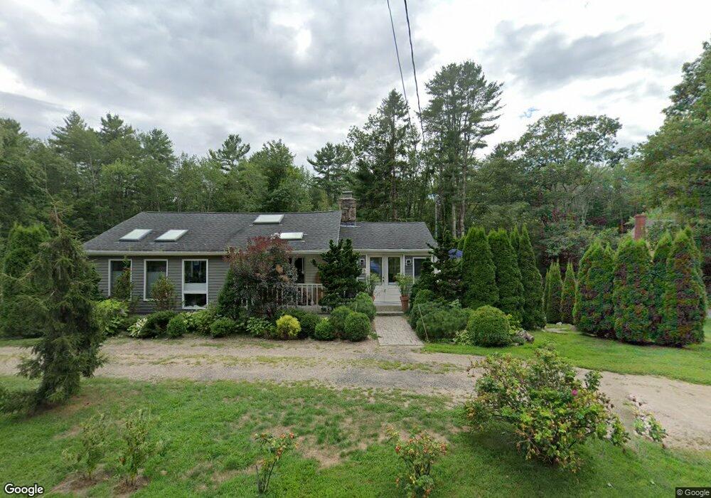
123 Port Rd Kennebunk, ME 04043
Estimated Value: $714,983
2
Beds
2
Baths
2,010
Sq Ft
$356/Sq Ft
Est. Value
About This Home
This home is located at 123 Port Rd, Kennebunk, ME 04043 and is currently estimated at $714,983, approximately $355 per square foot. 123 Port Rd is a home located in York County with nearby schools including Kennebunk High School and The New School.
Ownership History
Date
Name
Owned For
Owner Type
Purchase Details
Closed on
Jun 23, 2011
Sold by
Lipman Harvey A
Bought by
Nahil John G
Current Estimated Value
Home Financials for this Owner
Home Financials are based on the most recent Mortgage that was taken out on this home.
Original Mortgage
$218,400
Interest Rate
4.63%
Mortgage Type
Purchase Money Mortgage
Create a Home Valuation Report for This Property
The Home Valuation Report is an in-depth analysis detailing your home's value as well as a comparison with similar homes in the area
Home Values in the Area
Average Home Value in this Area
Purchase History
| Date | Buyer | Sale Price | Title Company |
|---|---|---|---|
| Nahil John G | -- | -- |
Source: Public Records
Mortgage History
| Date | Status | Borrower | Loan Amount |
|---|---|---|---|
| Closed | Nahil John G | $218,400 |
Source: Public Records
Tax History Compared to Growth
Tax History
| Year | Tax Paid | Tax Assessment Tax Assessment Total Assessment is a certain percentage of the fair market value that is determined by local assessors to be the total taxable value of land and additions on the property. | Land | Improvement |
|---|---|---|---|---|
| 2024 | $4,226 | $249,300 | $145,200 | $104,100 |
| 2023 | $4,001 | $249,300 | $145,200 | $104,100 |
| 2022 | $3,640 | $249,300 | $145,200 | $104,100 |
| 2021 | $3,553 | $249,300 | $145,200 | $104,100 |
| 2020 | $3,845 | $249,300 | $145,200 | $104,100 |
| 2019 | $3,600 | $249,300 | $145,200 | $104,100 |
| 2018 | $3,257 | $186,100 | $93,600 | $92,500 |
| 2017 | $3,343 | $186,100 | $93,600 | $92,500 |
| 2016 | $3,208 | $186,100 | $93,600 | $92,500 |
| 2015 | $2,847 | $186,100 | $93,600 | $92,500 |
| 2014 | $2,773 | $186,100 | $93,600 | $92,500 |
Source: Public Records
Map
Nearby Homes
- Lot#39 Bufflehead Cove Ln
- 3 Breakwater Ct Unit 1
- 7 Christensen Ln
- 28 River Locks Rd
- 15 Christensen Ln Unit B1
- 12 Beach Ave
- 12 Wallace St
- 20 Ephraim Tyler Way Unit 20
- 12 Ephraim Tyler Way
- 4 Ephraim Tyler Way
- 14 Rachel Dr
- 60 Ocean Ave
- 20 Surf Ln
- 47 Maine St Unit 4
- 24 School St
- 77 North St
- 9 Arundel Rd
- 147 Beach Ave Unit 42
- 175 Beach Ave Unit 2
- 143 Beach Ave Unit 205
- 1 Emery Ln
- 122 Port Rd
- 3 Emery Ln
- 133 Port Rd
- 130 Port Rd
- 117 Port Rd
- 135 Port Rd
- 134 Port Rd
- 26 Bufflehead Cove Ln
- 8 Emery Ln
- 0 Bufflehead Cove Ln Unit 1509071
- 0 Bufflehead Cove Ln Unit 1489088
- 3 Commons Ln
- 110 Port Rd
- 7 Emery Ln
- 0 Morning Walk Ln Unit 1278827
- 6 Morning Walk Ln
- 10 Bufflehead Cove Ln
- 138 Port Rd
- 2 Morning Walk Ln