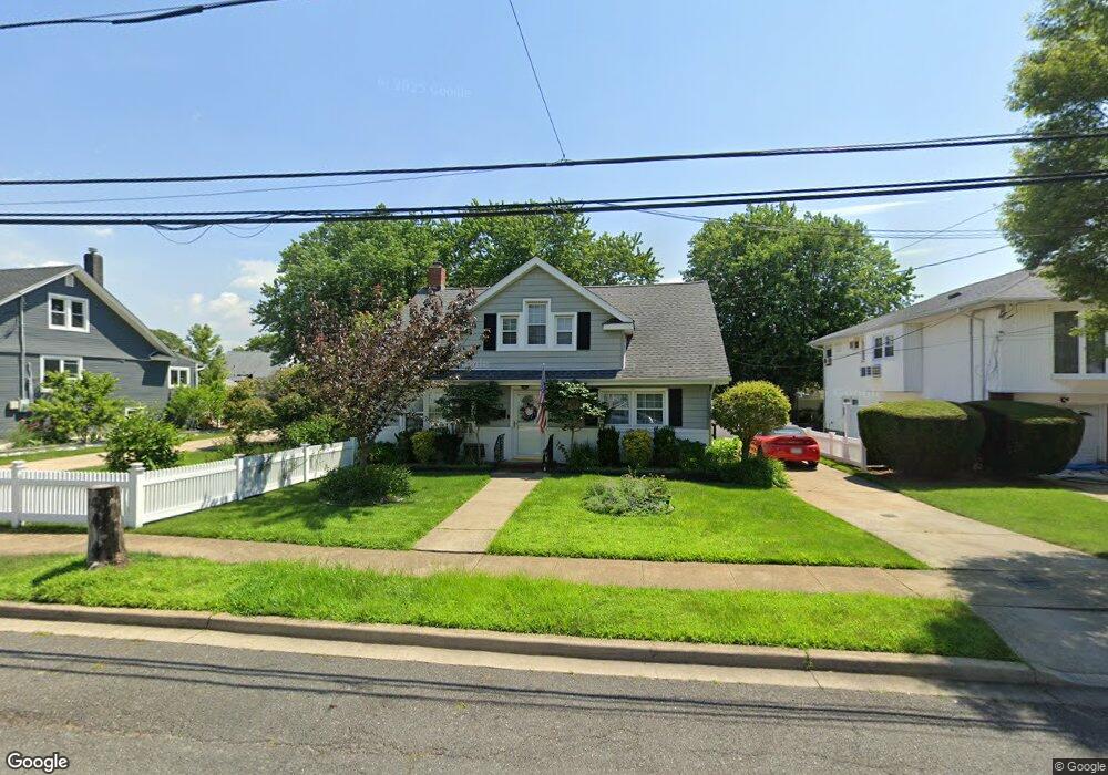
123 S Bay Ave Freeport, NY 11520
Estimated Value: $564,000 - $630,867
3
Beds
1
Bath
1,572
Sq Ft
$380/Sq Ft
Est. Value
About This Home
This home is located at 123 S Bay Ave, Freeport, NY 11520 and is currently estimated at $597,434, approximately $380 per square foot. 123 S Bay Ave is a home located in Nassau County with nearby schools including Columbus Avenue School, Caroline G. Atkinson Intermediate School, and John W Dodd Middle School.
Ownership History
Date
Name
Owned For
Owner Type
Purchase Details
Closed on
Jan 17, 2020
Sold by
Reichert Trust
Bought by
Dolan Michael T and Pizarro Mehgan
Current Estimated Value
Home Financials for this Owner
Home Financials are based on the most recent Mortgage that was taken out on this home.
Original Mortgage
$350,550
Outstanding Balance
$310,558
Interest Rate
3.74%
Mortgage Type
New Conventional
Estimated Equity
$286,877
Purchase Details
Closed on
Sep 9, 2009
Sold by
Reichert Michael and Reichert Leslie J
Bought by
Reichert Steven M
Create a Home Valuation Report for This Property
The Home Valuation Report is an in-depth analysis detailing your home's value as well as a comparison with similar homes in the area
Home Values in the Area
Average Home Value in this Area
Purchase History
| Date | Buyer | Sale Price | Title Company |
|---|---|---|---|
| Dolan Michael T | $369,000 | Old Republic National Title | |
| Reichert Steven M | -- | -- |
Source: Public Records
Mortgage History
| Date | Status | Borrower | Loan Amount |
|---|---|---|---|
| Open | Dolan Michael T | $350,550 |
Source: Public Records
Tax History Compared to Growth
Tax History
| Year | Tax Paid | Tax Assessment Tax Assessment Total Assessment is a certain percentage of the fair market value that is determined by local assessors to be the total taxable value of land and additions on the property. | Land | Improvement |
|---|---|---|---|---|
| 2025 | $7,525 | $349 | $151 | $198 |
| 2024 | $730 | $335 | $145 | $190 |
| 2023 | $7,374 | $351 | $152 | $199 |
| 2022 | $7,374 | $351 | $152 | $199 |
| 2021 | $10,705 | $356 | $154 | $202 |
| 2020 | $8,168 | $496 | $452 | $44 |
| 2019 | $721 | $496 | $452 | $44 |
| 2018 | $552 | $496 | $0 | $0 |
| 2017 | $2,730 | $496 | $427 | $69 |
| 2016 | $3,379 | $525 | $407 | $118 |
| 2015 | $589 | $554 | $392 | $162 |
| 2014 | $589 | $554 | $392 | $162 |
| 2013 | $585 | $583 | $412 | $171 |
Source: Public Records
Map
Nearby Homes
- 119 S Bay Ave
- 173 Cedar St
- 31 Casino St Unit PH
- 310 Miller Ave
- 171 Westside Ave
- 322 Miller Ave
- 494 S Ocean Ave Unit 1H
- 494 S Ocean Ave Unit 3A
- 209 Nassau Ave
- 374 Miller Ave
- 159 Branch Ave
- 437 Ray St
- 232 Nassau Ave
- 16 Johnson Place
- 226 Westside Ave Unit B
- 570 S Ocean Ave
- 587 S Bayview Ave
- 65 Adams St
- 153 Westend Ave
- 208 Sportsmans Ave
- 137 S Bay Ave
- 137 S Bay Ave
- 150 Cedar St
- 264 Roosevelt Ave
- 268 Roosevelt Ave
- 260 Roosevelt Ave
- 260 Roosevelt Ave
- 138 Cedar St
- 134 S Bay Ave
- 138 Cedar St
- 111 S Bay Ave
- 111 S Bay Ave
- 138 S Bay Ave
- 256 Roosevelt Ave
- 256 Roosevelt Ave
- 120 S Bay Ave
- 120 S Bay Ave Unit B
- 120 S Bay Ave Unit A
- 160 Cedar St
- 252 Roosevelt Ave