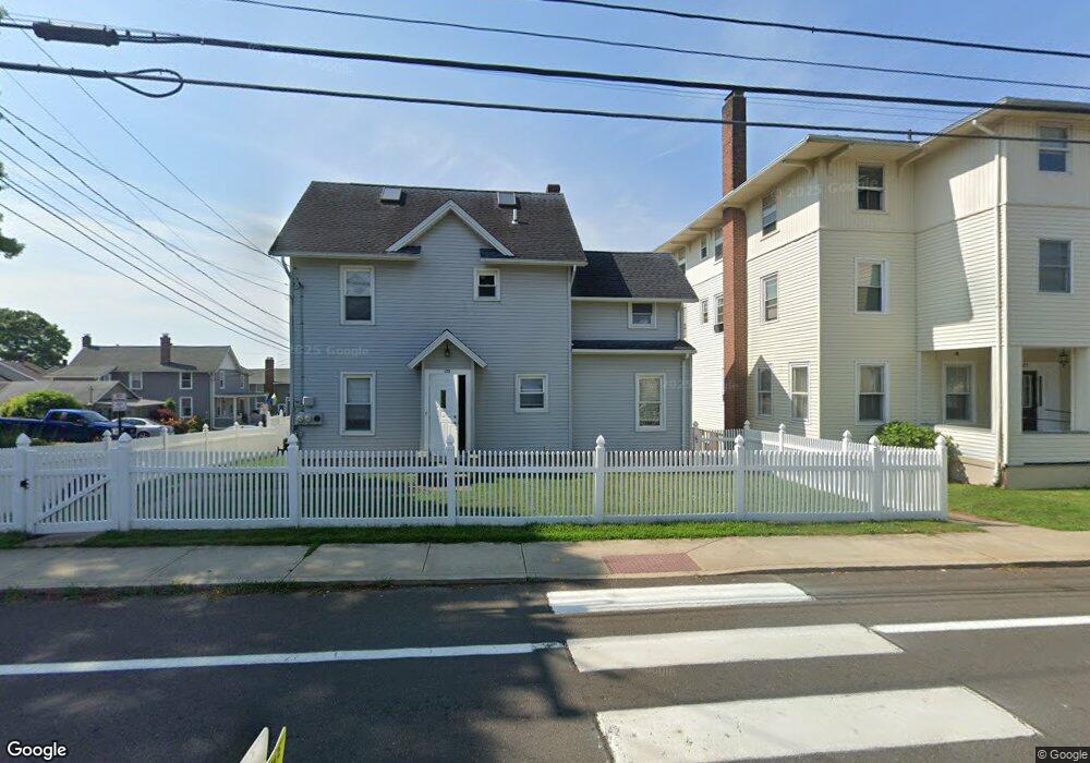
123 Shore Dr Branford, CT 06405
Estimated Value: $426,000 - $799,000
2
Beds
4
Baths
2,150
Sq Ft
$289/Sq Ft
Est. Value
About This Home
This home is located at 123 Shore Dr, Branford, CT 06405 and is currently estimated at $621,867, approximately $289 per square foot. 123 Shore Dr is a home located in New Haven County with nearby schools including Francis Walsh Intermediate School, Branford High School, and East Shoreline Catholic Academy.
Ownership History
Date
Name
Owned For
Owner Type
Purchase Details
Closed on
Dec 16, 2011
Sold by
Oleary Deirdre A
Bought by
Oleary Peter
Current Estimated Value
Purchase Details
Closed on
Jun 17, 2003
Sold by
Com Oleary Inc
Bought by
Oleary Peter D and Oleary Deirdre A
Home Financials for this Owner
Home Financials are based on the most recent Mortgage that was taken out on this home.
Original Mortgage
$160,000
Interest Rate
5.77%
Create a Home Valuation Report for This Property
The Home Valuation Report is an in-depth analysis detailing your home's value as well as a comparison with similar homes in the area
Home Values in the Area
Average Home Value in this Area
Purchase History
| Date | Buyer | Sale Price | Title Company |
|---|---|---|---|
| Oleary Peter | -- | -- | |
| Oleary Peter D | $200,000 | -- |
Source: Public Records
Mortgage History
| Date | Status | Borrower | Loan Amount |
|---|---|---|---|
| Previous Owner | Oleary Peter D | $6,500 | |
| Previous Owner | Oleary Peter D | $160,000 |
Source: Public Records
Tax History Compared to Growth
Tax History
| Year | Tax Paid | Tax Assessment Tax Assessment Total Assessment is a certain percentage of the fair market value that is determined by local assessors to be the total taxable value of land and additions on the property. | Land | Improvement |
|---|---|---|---|---|
| 2025 | $9,035 | $422,200 | $212,500 | $209,700 |
| 2024 | $8,175 | $268,200 | $136,700 | $131,500 |
| 2023 | $8,016 | $268,200 | $136,700 | $131,500 |
| 2022 | $7,898 | $268,200 | $136,700 | $131,500 |
| 2021 | $7,898 | $268,200 | $136,700 | $131,500 |
| 2020 | $7,756 | $268,200 | $136,700 | $131,500 |
| 2019 | $7,352 | $252,900 | $123,800 | $129,100 |
| 2018 | $7,243 | $252,900 | $123,800 | $129,100 |
| 2017 | $7,200 | $252,900 | $123,800 | $129,100 |
| 2016 | $6,932 | $252,900 | $123,800 | $129,100 |
| 2015 | $6,811 | $252,900 | $123,800 | $129,100 |
| 2014 | $6,069 | $231,300 | $111,000 | $120,300 |
Source: Public Records
Map
Nearby Homes
- 105 Beckett Ave
- 25 Gray Ledge Rd
- 55 Hilton Ave
- 18 Spice Bush Ln
- 14 Vernon St
- 86 Wheaton Rd
- 90 Turtle Bay Dr
- 74 Turtle Bay Dr Unit 74
- 66 Turtle Bay Dr Unit 66
- 330 Short Beach Rd Unit C9
- 19 Clark Ave
- 25 Florence Rd Unit 71
- 2 Mansfield Grove Rd Unit 266
- 2 Mansfield Grove Rd Unit 374
- 73 Briarwood Ln Unit E
- 30 Silver Sands Rd Unit C-9
- 102 Vista Dr
- 1 Mansfield Grove Rd Unit 306
- 1 Mansfield Grove Rd Unit 205
- 1 Mansfield Grove Rd Unit 206
- 117 Shore Dr Unit 2
- 117 Shore Dr Unit 8
- 117 Shore Dr Unit 6
- 117 Shore Dr
- 129 Shore Dr
- 130 Shore Dr
- 126 Shore Dr
- 109 Shore Dr
- 13 Pentecost St
- 137 Shore Dr
- 20 Pentecost St
- 5 Court St
- 132 Shore Dr Unit 2nd Floor
- 56 Beckett Ave
- 54 Beckett Ave
- 19 Pentecost St
- 106 Shore Dr
- 54 Beckett Ave
- 139 Shore Dr
- 103 Shore Dr