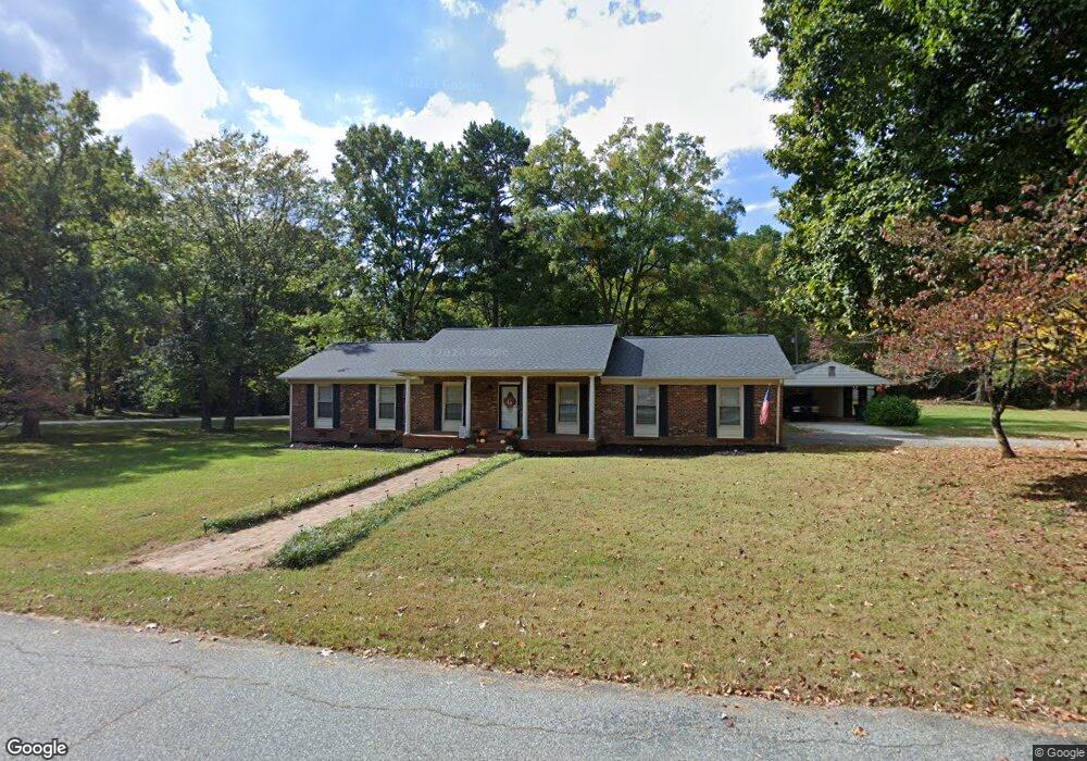
123 Sunset Cir Mocksville, NC 27028
Estimated Value: $253,000 - $332,000
3
Beds
2
Baths
1,598
Sq Ft
$181/Sq Ft
Est. Value
About This Home
This home is located at 123 Sunset Cir, Mocksville, NC 27028 and is currently estimated at $289,739, approximately $181 per square foot. 123 Sunset Cir is a home located in Davie County with nearby schools including Mocksville Elementary School, South Davie Middle, and Davie County High School.
Ownership History
Date
Name
Owned For
Owner Type
Purchase Details
Closed on
May 8, 2023
Sold by
Tippett Kimberly N and Tippett Billy Wayne
Bought by
Grant Parker F and Grant Alexis C
Current Estimated Value
Home Financials for this Owner
Home Financials are based on the most recent Mortgage that was taken out on this home.
Original Mortgage
$237,000
Outstanding Balance
$230,326
Interest Rate
6.32%
Mortgage Type
New Conventional
Estimated Equity
$59,414
Purchase Details
Closed on
Oct 1, 2000
Purchase Details
Closed on
Mar 1, 1992
Create a Home Valuation Report for This Property
The Home Valuation Report is an in-depth analysis detailing your home's value as well as a comparison with similar homes in the area
Home Values in the Area
Average Home Value in this Area
Purchase History
| Date | Buyer | Sale Price | Title Company |
|---|---|---|---|
| Grant Parker F | $235,000 | None Listed On Document | |
| -- | $123,000 | -- | |
| -- | $88,500 | -- |
Source: Public Records
Mortgage History
| Date | Status | Borrower | Loan Amount |
|---|---|---|---|
| Open | Grant Parker F | $237,000 |
Source: Public Records
Tax History Compared to Growth
Tax History
| Year | Tax Paid | Tax Assessment Tax Assessment Total Assessment is a certain percentage of the fair market value that is determined by local assessors to be the total taxable value of land and additions on the property. | Land | Improvement |
|---|---|---|---|---|
| 2025 | $1,622 | $235,560 | $57,580 | $177,980 |
| 2024 | $1,300 | $168,230 | $51,000 | $117,230 |
| 2023 | $1,300 | $168,230 | $51,000 | $117,230 |
| 2022 | $1,300 | $168,230 | $51,000 | $117,230 |
| 2021 | $1,300 | $168,230 | $51,000 | $117,230 |
| 2020 | $1,172 | $150,680 | $51,000 | $99,680 |
| 2019 | $1,172 | $150,680 | $51,000 | $99,680 |
| 2018 | $1,172 | $150,680 | $51,000 | $99,680 |
| 2017 | $1,157 | $150,680 | $0 | $0 |
| 2016 | $1,187 | $154,540 | $0 | $0 |
| 2015 | $1,187 | $154,540 | $0 | $0 |
| 2014 | $1,020 | $154,540 | $0 | $0 |
| 2013 | -- | $154,540 | $0 | $0 |
Source: Public Records
Map
Nearby Homes
- LOT 47 Delaware Ct
- LOT 51 Delaware Ct
- LOT 66 N Carolina Cir
- LOT 13 N Carolina Cir
- LOT 62 N Carolina Cir
- 115 New Hampshire Ct Unit 35
- 115 New Hampshire Ct
- LOT 35 Rhode Island Ct
- LOT 34 Rhode Island Ct
- LOT 33 Rhode Island Ct
- LOT 37 Rhode Island Ct
- LOT 31 Rhode Island Ct
- LOT 30 Rhode Island Ct
- LOT 27 Rhode Island Ct
- LOT 26 Rhode Island Ct
- LOT 54 Rhode Island Ct
- LOT 23 Rhode Island Ct
- 181 New Hampshire Ct
- 151 Birchwood Ln
- 210 Birchwood Ln
- 112 Sunset Cir
- 118 Sunset Cir
- 132 Sunset Cir
- 1723 Jericho Church Rd
- 1701 Jericho Church Rd
- 1734 Jericho Church Rd
- 157 Sunset Cir
- 152 Sunset Cir
- 1669 Jericho Church Rd
- 1662 Jericho Church Rd
- 1758 Jericho Church Rd
- 1653 Jericho Church Rd
- 182 Sunset Cir
- 1770 Jericho Church Rd
- 1635 Jericho Church Rd
- 171 Towery Rd
- 127 Buck Seaford Rd
- 171 Feezor Rd
- 1627 Jericho Church Rd
- 0 Buck Seaford Rd