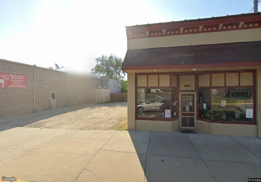
Estimated Value: $165,000 - $194,000
2
Beds
2
Baths
1,280
Sq Ft
$139/Sq Ft
Est. Value
About This Home
This home is located at 123 W Canal, Colon, MI 49040 and is currently estimated at $178,161, approximately $139 per square foot. 123 W Canal is a home located in St. Joseph County.
Ownership History
Date
Name
Owned For
Owner Type
Purchase Details
Closed on
Sep 30, 2011
Sold by
Parshall Ann and Parshall Ann L
Bought by
Parshall Ann L and Ann L Parshall Trust
Current Estimated Value
Purchase Details
Closed on
Jun 29, 2011
Sold by
Haskins Ronald A and Johnson Patricia J
Bought by
Parshall Ann
Purchase Details
Closed on
Dec 6, 2002
Sold by
Haskins Jr Lynn W and Haskins Avis M
Bought by
Haskins Avis M and Haskins Ronald A
Purchase Details
Closed on
Jun 4, 2002
Sold by
Stienbarger David H
Bought by
Haskins Ronald Johnson Patricia
Purchase Details
Closed on
Jun 1, 2002
Sold by
Stienbarger David H
Bought by
Haskins Lynn W and Haskins Avis M
Purchase Details
Closed on
Sep 5, 2000
Sold by
Ward
Bought by
Stienbarger
Purchase Details
Closed on
Feb 23, 1999
Purchase Details
Closed on
Jan 1, 1901
Create a Home Valuation Report for This Property
The Home Valuation Report is an in-depth analysis detailing your home's value as well as a comparison with similar homes in the area
Home Values in the Area
Average Home Value in this Area
Purchase History
| Date | Buyer | Sale Price | Title Company |
|---|---|---|---|
| Parshall Ann L | -- | Vt | |
| Parshall Ann | $54,900 | Patrick Abstract & Title Off | |
| Haskins Avis M | -- | -- | |
| Haskins Ronald Johnson Patricia | $74,500 | -- | |
| Haskins Lynn W | $74,500 | -- | |
| Stienbarger | $65,100 | -- | |
| -- | -- | -- | |
| -- | -- | -- |
Source: Public Records
Tax History Compared to Growth
Tax History
| Year | Tax Paid | Tax Assessment Tax Assessment Total Assessment is a certain percentage of the fair market value that is determined by local assessors to be the total taxable value of land and additions on the property. | Land | Improvement |
|---|---|---|---|---|
| 2025 | $894 | $62,300 | $3,500 | $58,800 |
| 2024 | $786 | $58,100 | $3,500 | $54,600 |
| 2023 | $856 | $53,500 | $3,500 | $50,000 |
| 2022 | $0 | $41,100 | $3,500 | $37,600 |
| 2021 | $700 | $38,300 | $3,500 | $34,800 |
| 2020 | $376 | $41,500 | $3,500 | $38,000 |
| 2019 | $288 | $34,300 | $3,500 | $30,800 |
| 2018 | $1,029 | $30,100 | $3,500 | $26,600 |
| 2017 | $1,004 | $30,700 | $30,700 | $0 |
| 2016 | -- | $30,300 | $30,300 | $0 |
| 2015 | -- | $29,200 | $0 | $0 |
| 2014 | -- | $29,800 | $29,800 | $0 |
| 2012 | -- | $24,300 | $24,300 | $0 |
Source: Public Records
Map
Nearby Homes
- 906 Bowman St
- 457 S Burr Oak Rd
- 0 N Burr Oak Rd
- 0 S Farrand Unit 25051538
- 59306 Yeatter Rd
- 31688 W Colon Rd
- 58954 Lakeshore Dr
- 59010 Lakeshore Dr
- 32205 James St
- 30725 Orla Engle Rd
- 59178 Nora Dr
- 30591 Coohon Rd
- 31908 Decker Rd
- 316 Kane Rd
- 60651 Bert Rd
- 774 Ralston Rd
- 30315 Jacksonburg Rd
- VL Heights Dr
- 30879 Michigan 60
- 31765 Michigan 60
- 207 S Street Joseph St
- 206 S St Joseph St
- 206 S Saint Joseph St
- 206 S St Joseph St
- 223 S Street Joseph St
- 211 S Blackstone Ave
- 232 S Saint Joseph St
- 224 S Saint Joseph St
- 128 W Canal
- 218 S Blackstone Ave
- 224 S Blackstone Ave
- 131 S St Joseph St
- 131 S Street Joseph St
- 207 S Saint Joseph St
- 207 S Saint Joseph St
- 207 S St Joseph St
- 223 S Saint Joseph St
- 223 S St Joseph St
- 131 S Saint Joseph St
- 212 S Blackstone Ave
