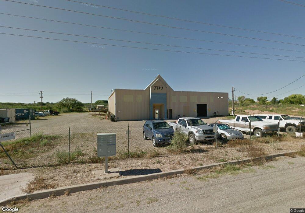
123 W Harvest Way Benson, AZ 85602
Estimated Value: $619,934
--
Bed
--
Bath
11,172
Sq Ft
$55/Sq Ft
Est. Value
About This Home
This home is located at 123 W Harvest Way, Benson, AZ 85602 and is currently estimated at $619,934, approximately $55 per square foot. 123 W Harvest Way is a home located in Cochise County with nearby schools including Benson Primary School, Benson Middle School, and Benson High School.
Ownership History
Date
Name
Owned For
Owner Type
Purchase Details
Closed on
Jun 16, 2014
Sold by
0764893 B C Ltd
Bought by
Twi Llc
Current Estimated Value
Home Financials for this Owner
Home Financials are based on the most recent Mortgage that was taken out on this home.
Original Mortgage
$250,000
Outstanding Balance
$189,365
Interest Rate
4.09%
Mortgage Type
Seller Take Back
Estimated Equity
$430,569
Purchase Details
Closed on
Sep 12, 2006
Sold by
Yakobian G Yon
Bought by
Canadian Integrated Optics Inc
Create a Home Valuation Report for This Property
The Home Valuation Report is an in-depth analysis detailing your home's value as well as a comparison with similar homes in the area
Home Values in the Area
Average Home Value in this Area
Purchase History
| Date | Buyer | Sale Price | Title Company |
|---|---|---|---|
| Twi Llc | $300,000 | Pioneer Title Agency | |
| Canadian Integrated Optics Inc | $500,000 | Pioneer Title Agency |
Source: Public Records
Mortgage History
| Date | Status | Borrower | Loan Amount |
|---|---|---|---|
| Open | Twi Llc | $250,000 |
Source: Public Records
Tax History Compared to Growth
Tax History
| Year | Tax Paid | Tax Assessment Tax Assessment Total Assessment is a certain percentage of the fair market value that is determined by local assessors to be the total taxable value of land and additions on the property. | Land | Improvement |
|---|---|---|---|---|
| 2025 | $8,629 | $58,798 | $4,208 | $54,590 |
| 2024 | $8,629 | $58,798 | $4,208 | $54,590 |
| 2023 | $8,964 | $58,798 | $4,208 | $54,590 |
| 2022 | $9,234 | $58,798 | $4,208 | $54,590 |
| 2021 | $10,129 | $58,798 | $4,208 | $54,590 |
| 2020 | $9,918 | $0 | $0 | $0 |
| 2019 | $10,348 | $0 | $0 | $0 |
| 2018 | $10,174 | $0 | $0 | $0 |
| 2017 | $10,970 | $0 | $0 | $0 |
| 2016 | $10,221 | $0 | $0 | $0 |
| 2015 | -- | $0 | $0 | $0 |
Source: Public Records
Map
Nearby Homes
- 658 E Elm St
- 560 N Adams St
- TBD E Mark St
- 1ac Lot W 4 Feathers Ln
- 176 E Flint St Unit 10 & 11
- 280 E Flint St
- 264 E Flint St Unit 11
- 0 Ocotillo & Frontage Rd Unit 22425177
- 190 W 4 Feathers Ln
- XXX N Ocotillo Rd
- 476 E 2nd St Unit 19
- 238 N Tawni Dr Unit 23
- 623 E Didianne Dr
- 162 W 5th St
- 176 S Central Ave
- 674 E Didi Anne Dr
- 674 E Didi Ann Dr
- 0000 Vacant Land
- 260 S Land St Unit 15
- 260 S Land Ave Unit 17
- 826 N Madison Ave
- 848 N Madison Ave
- 714 N Madison Ave
- 803 N Madison Ave
- 000 Madison St
- 1 Benson Ave
- 711 N Madison Ave
- 674 N Adams St
- 674 N Adams St
- 630 N Adams St
- 650 N Patagonia Ave Unit 1
- 621 N Patagonia Ave
- O Darby Ave Unit 21
- 631 N Circle Dr
- 618 N Huachuca St
- 620 N Huachuca St
- 634 N Circle Dr
- 627 N Circle Dr
- 614 N Huachuca St
- 628 N Circle Dr