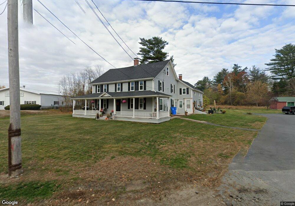
123 W Main St Merrimac, MA 01860
Estimated Value: $741,310
--
Bed
--
Bath
3,840
Sq Ft
$193/Sq Ft
Est. Value
About This Home
This home is located at 123 W Main St, Merrimac, MA 01860 and is currently estimated at $741,310, approximately $193 per square foot. 123 W Main St is a home located in Essex County with nearby schools including Pentucket Regional High School.
Ownership History
Date
Name
Owned For
Owner Type
Purchase Details
Closed on
Aug 13, 1996
Sold by
Milton H Smith Rlty Co
Bought by
123 West Main St Rt and Smith Cabot B
Current Estimated Value
Home Financials for this Owner
Home Financials are based on the most recent Mortgage that was taken out on this home.
Original Mortgage
$180,000
Interest Rate
8.24%
Mortgage Type
Commercial
Create a Home Valuation Report for This Property
The Home Valuation Report is an in-depth analysis detailing your home's value as well as a comparison with similar homes in the area
Home Values in the Area
Average Home Value in this Area
Purchase History
| Date | Buyer | Sale Price | Title Company |
|---|---|---|---|
| 123 West Main St Rt | $190,000 | -- |
Source: Public Records
Mortgage History
| Date | Status | Borrower | Loan Amount |
|---|---|---|---|
| Open | 123 West Main St Rt | $350,000 | |
| Closed | 123 West Main St Rt | $300,000 | |
| Closed | 123 West Main St Rt | $420,000 | |
| Closed | 123 West Main St Rt | $180,000 |
Source: Public Records
Tax History Compared to Growth
Tax History
| Year | Tax Paid | Tax Assessment Tax Assessment Total Assessment is a certain percentage of the fair market value that is determined by local assessors to be the total taxable value of land and additions on the property. | Land | Improvement |
|---|---|---|---|---|
| 2025 | $6,349 | $479,200 | $285,000 | $194,200 |
| 2024 | $6,369 | $471,800 | $285,000 | $186,800 |
| 2023 | $6,020 | $407,600 | $241,400 | $166,200 |
| 2022 | $6,051 | $370,300 | $208,700 | $161,600 |
| 2021 | $5,716 | $350,700 | $189,100 | $161,600 |
| 2020 | $5,218 | $350,700 | $189,100 | $161,600 |
| 2019 | $5,429 | $343,400 | $182,600 | $160,800 |
| 2018 | $5,395 | $342,300 | $181,500 | $160,800 |
| 2017 | $5,343 | $327,000 | $166,200 | $160,800 |
| 2016 | $5,284 | $327,000 | $166,200 | $160,800 |
| 2015 | $5,203 | $320,200 | $166,200 | $154,000 |
| 2014 | $5,088 | $320,200 | $166,200 | $154,000 |
Source: Public Records
Map
Nearby Homes
- 121 W Main St
- 125 W Main St
- 1 Gunnison Dr
- 3 Gunnison Dr
- 117 W Main St
- 4 Westminster Rd
- 5 Gunnison Dr
- 2 Gunnison Dr
- 6 Westminster Rd
- 1 Noyes Ln
- 19 Noyes Ln
- 108 W Main St Unit 101
- 108 W Main St Unit 301
- 108 W Main St Unit 316
- 108 W Main St Unit 103
- 108 W Main St Unit 105
- 108 W Main St Unit 201
- 108 W Main St Unit 303
- 108 W Main St Unit 310
- 108 W Main St Unit 111