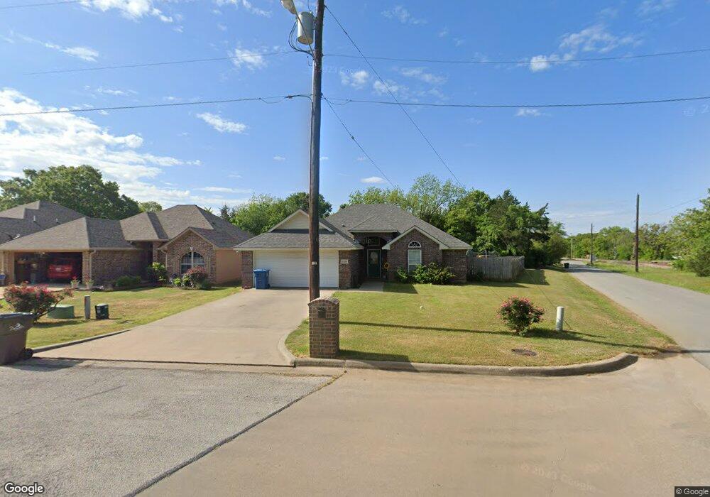
1230 Amsden Cir Denison, TX 75020
Estimated Value: $256,104 - $296,000
3
Beds
2
Baths
1,550
Sq Ft
$178/Sq Ft
Est. Value
About This Home
This home is located at 1230 Amsden Cir, Denison, TX 75020 and is currently estimated at $276,052, approximately $178 per square foot. 1230 Amsden Cir is a home located in Grayson County with nearby schools including Scott Middle School, Denison High School, and St. Luke's Parish Day School.
Ownership History
Date
Name
Owned For
Owner Type
Purchase Details
Closed on
Jun 6, 2008
Sold by
Aday Jeff
Bought by
Hancock Sasha R
Current Estimated Value
Home Financials for this Owner
Home Financials are based on the most recent Mortgage that was taken out on this home.
Original Mortgage
$133,445
Outstanding Balance
$85,719
Interest Rate
6.07%
Mortgage Type
FHA
Estimated Equity
$190,333
Purchase Details
Closed on
May 12, 2008
Sold by
Sanders Amy
Bought by
Aday Jeff
Home Financials for this Owner
Home Financials are based on the most recent Mortgage that was taken out on this home.
Original Mortgage
$133,445
Outstanding Balance
$85,719
Interest Rate
6.07%
Mortgage Type
FHA
Estimated Equity
$190,333
Purchase Details
Closed on
Aug 23, 2007
Sold by
Pettit Randy and Wood Richard
Bought by
Aday Jeff and Sanders Amy
Create a Home Valuation Report for This Property
The Home Valuation Report is an in-depth analysis detailing your home's value as well as a comparison with similar homes in the area
Home Values in the Area
Average Home Value in this Area
Purchase History
| Date | Buyer | Sale Price | Title Company |
|---|---|---|---|
| Hancock Sasha R | -- | Chapin Title Co Inc | |
| Aday Jeff | -- | Chapin Title Co Inc | |
| Aday Jeff | -- | None Available |
Source: Public Records
Mortgage History
| Date | Status | Borrower | Loan Amount |
|---|---|---|---|
| Open | Hancock Sasha R | $133,445 | |
| Closed | Aday Jeff | $133,445 |
Source: Public Records
Tax History Compared to Growth
Tax History
| Year | Tax Paid | Tax Assessment Tax Assessment Total Assessment is a certain percentage of the fair market value that is determined by local assessors to be the total taxable value of land and additions on the property. | Land | Improvement |
|---|---|---|---|---|
| 2025 | $4,440 | $273,225 | -- | -- |
| 2024 | $5,771 | $248,386 | $0 | $0 |
| 2023 | $3,799 | $225,805 | $0 | $0 |
| 2022 | $4,877 | $205,277 | $0 | $0 |
| 2021 | $4,707 | $186,615 | $33,990 | $152,625 |
| 2020 | $4,826 | $185,879 | $23,326 | $162,553 |
| 2019 | $4,577 | $184,553 | $23,326 | $161,227 |
| 2018 | $4,194 | $169,778 | $23,326 | $146,452 |
| 2017 | $3,845 | $137,453 | $19,007 | $118,446 |
| 2016 | $3,806 | $136,028 | $19,007 | $117,021 |
| 2015 | $0 | $129,128 | $19,007 | $110,121 |
| 2014 | -- | $129,128 | $19,007 | $110,121 |
Source: Public Records
Map
Nearby Homes
- 1130 Amsden Cir
- 3101 S College Blvd
- 3312 Vine Ln
- 938 Amsden St
- 923 Dubois St
- 905 Seymore Cir
- 903 Seymore Cir
- 603 W Star St
- 916 W Collins St
- 923 W Collins St
- 921 W Collins St
- 919 W Collins St
- 1901 Woodlawn Blvd
- 711 Dubois St
- 700 Dubois St
- 527 W Coffin St
- 701 W Star St
- 1803 Woodland Park Dr
- 930 W Florence St
- 904 W Florence St
- 1226 Amsden Cir
- 1222 Amsden Cir
- 000000 Amsden Cir
- 1218 Amsden Cir
- 1229 Amsden Cir
- 3110 Vine Ln
- 1214 Amsden Cir
- 1225 Amsden Cir
- 1221 Amsden Cir
- 1210 Amsden Cir
- 1109 Little Creek Dr
- 1107 Little Creek Dr
- 1217 Amsden Cir
- 1206 Amsden Cir
- 938 W Amsden St
- 1213 Amsden Cir
- 3122 Vine Ln
- 3116 Vine Ln
- 1105 Little Creek Dr
- 1202 Amsden Cir