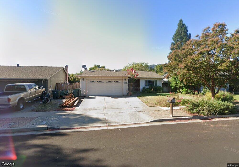
1230 Ayer Dr Gilroy, CA 95020
Estimated Value: $807,000 - $1,004,000
About This Home
This home is located at 1230 Ayer Dr, Gilroy, CA 95020 and is currently estimated at $904,766, approximately $692 per square foot. 1230 Ayer Dr is a home located in Santa Clara County with nearby schools including El Roble Elementary School, Brownell Middle School, and Solorsano Middle School.
Ownership History
We collect this data history from publicly available records. To have your information removed, we recommend requesting removal directly through your county’s website.
Purchase Details
Purchase Details
Home Financials for this Owner
Home Financials are based on the most recent Mortgage that was taken out on this home.Purchase Details
Home Financials for this Owner
Home Financials are based on the most recent Mortgage that was taken out on this home.Purchase Details
Home Financials for this Owner
Home Financials are based on the most recent Mortgage that was taken out on this home.Home Values in the Area
Average Home Value in this Area
Purchase History
We collect this data history from publicly available records. To have your information removed, we recommend requesting removal directly through your county’s website.
| Date | Buyer | Sale Price | Title Company |
|---|---|---|---|
| -- | Fidelity National Title Ins | ||
| $390,000 | Commonwealth Land Title Co | ||
| -- | Commonwealth Land Title Co | ||
| $69,000 | Commonwealth Land Title Co |
Mortgage History
We collect this data history from publicly available records. To have your information removed, we recommend requesting removal directly through your county’s website.
| Date | Status | Borrower | Loan Amount |
|---|---|---|---|
| Open | $372,500 | ||
| Previous Owner | $275,000 | ||
| Previous Owner | $160,300 |
Tax History
We collect this data history from publicly available records. To have your information removed, we recommend requesting removal directly through your county’s website.
| Year | Tax Paid | Tax Assessment Tax Assessment Total Assessment is a certain percentage of the fair market value that is determined by local assessors to be the total taxable value of land and additions on the property. | Land | Improvement |
|---|---|---|---|---|
| 2025 | $6,964 | $576,129 | $369,316 | $206,813 |
| 2024 | $6,964 | $564,833 | $362,075 | $202,758 |
| 2023 | $6,964 | $553,759 | $354,976 | $198,783 |
| 2022 | $6,806 | $542,902 | $348,016 | $194,886 |
| 2021 | $6,774 | $532,258 | $341,193 | $191,065 |
| 2020 | $6,699 | $526,801 | $337,695 | $189,106 |
| 2019 | $6,636 | $516,473 | $331,074 | $185,399 |
| 2018 | $6,195 | $506,347 | $324,583 | $181,764 |
| 2017 | $6,324 | $496,419 | $318,219 | $178,200 |
| 2016 | $6,194 | $486,686 | $311,980 | $174,706 |
| 2015 | $5,843 | $479,376 | $307,294 | $172,082 |
| 2014 | $5,805 | $469,987 | $301,275 | $168,712 |
Map
- 1150 3rd St
- 1150 3rd St Unit 3rd
- 1395 3rd St
- 7490 Santa Theresa Dr Unit 10
- 1646 Siderits Way
- 1619 Santiago Ct
- 6389 Tawhana Ln
- 7390 Miller Ave
- 759 Tennyson Dr
- 730 Tennyson Dr
- 704 Tennyson Dr
- 7969 Kipling Cir
- 60 Monte Vista Way
- 1540 Rosette Way
- 7934 Kipling Cir
- 7011 Kirigin Way
- 7922 Cinnamon Way
- 1959 Saint Andrews Cir
- 7135 Yorktown Dr
- 7466 Dunbar Ct
- 1190 Ayer Dr Unit 11
- 1180 Ayer Dr
- 1200 Ayer Dr
- 1170 Ayer Dr
- 1210 Ayer Dr Unit 11
- 1191 Hersman Dr
- 1181 Hersman Dr
- 1201 Hersman Dr
- 1171 Hersman Dr
- 1201 Ayer Dr Unit 11
- 1209 Ayer Dr Unit 11
- 1220 Ayer Dr
- 1160 Ayer Dr
- 1199 Ayer Dr
- 1219 Ayer Dr
- 1211 Hersman Dr
- 1189 Ayer Dr
- 1161 Hersman Dr
- 7549 Stewart Dr
- 1229 Ayer Dr
Ask me questions while you tour the home.