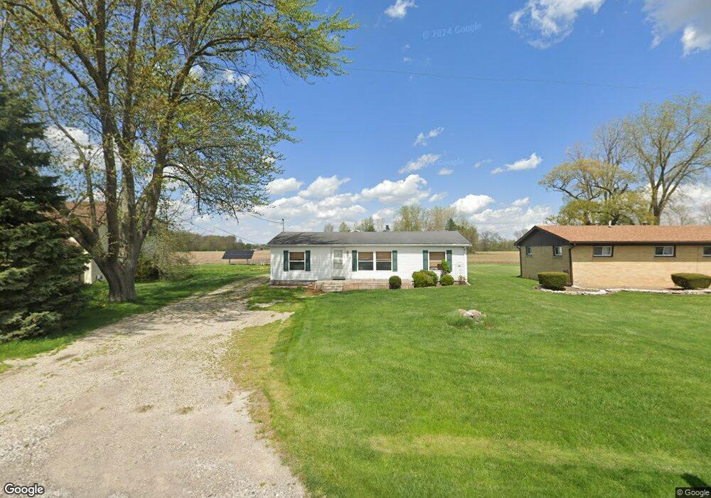
1230 Curtis Rd Birch Run, MI 48415
Estimated Value: $99,000 - $128,000
--
Bed
1
Bath
1,188
Sq Ft
$93/Sq Ft
Est. Value
About This Home
This home is located at 1230 Curtis Rd, Birch Run, MI 48415 and is currently estimated at $110,407, approximately $92 per square foot. 1230 Curtis Rd is a home located in Saginaw County with nearby schools including Thomas White School, Iuka Elementary School, and Martin G. Atkins Elementary School.
Ownership History
Date
Name
Owned For
Owner Type
Purchase Details
Closed on
Jan 24, 2025
Sold by
Zuniga Jeffrey Scott and Zuniga Sara
Bought by
Carter Makaio Payton
Current Estimated Value
Home Financials for this Owner
Home Financials are based on the most recent Mortgage that was taken out on this home.
Original Mortgage
$95,000
Outstanding Balance
$94,329
Interest Rate
6.72%
Mortgage Type
New Conventional
Estimated Equity
$16,078
Purchase Details
Closed on
Jul 28, 2004
Home Financials for this Owner
Home Financials are based on the most recent Mortgage that was taken out on this home.
Original Mortgage
$93,926
Interest Rate
6.35%
Mortgage Type
FHA
Create a Home Valuation Report for This Property
The Home Valuation Report is an in-depth analysis detailing your home's value as well as a comparison with similar homes in the area
Home Values in the Area
Average Home Value in this Area
Purchase History
| Date | Buyer | Sale Price | Title Company |
|---|---|---|---|
| Carter Makaio Payton | $100,000 | Crossroads Title | |
| -- | $95,400 | -- | |
| Zuniga Jeffrey S | $95,400 | -- |
Source: Public Records
Mortgage History
| Date | Status | Borrower | Loan Amount |
|---|---|---|---|
| Open | Carter Makaio Payton | $95,000 | |
| Previous Owner | Zuniga Jeffrey S | $93,926 |
Source: Public Records
Tax History Compared to Growth
Tax History
| Year | Tax Paid | Tax Assessment Tax Assessment Total Assessment is a certain percentage of the fair market value that is determined by local assessors to be the total taxable value of land and additions on the property. | Land | Improvement |
|---|---|---|---|---|
| 2025 | $2,445 | $58,600 | $0 | $0 |
| 2024 | $469 | $54,900 | $0 | $0 |
| 2023 | $446 | $54,200 | $0 | $0 |
| 2022 | $2,281 | $43,800 | $0 | $0 |
| 2021 | $1,871 | $47,600 | $0 | $0 |
| 2020 | $1,961 | $42,500 | $0 | $0 |
| 2019 | $1,236 | $39,700 | $1,800 | $37,900 |
| 2018 | $389 | $37,050 | $0 | $0 |
| 2017 | $1,112 | $36,450 | $0 | $0 |
| 2016 | $1,181 | $34,450 | $0 | $0 |
| 2014 | -- | $38,050 | $0 | $36,700 |
| 2013 | -- | $37,000 | $0 | $0 |
Source: Public Records
Map
Nearby Homes
- 7365 Cole Rd
- 7863 Sheridan Rd Lot #2 Rd
- 7863 Sheridan Rd Lot 4 Rd
- 7863 Sheridan Rd Lot #3 Rd
- 1750 Curtis Rd
- 1160 E Moore Rd
- 1374 E Moore Rd
- 1865 W Moore Rd
- 1891 W Moore Rd
- 1321 Ruby Ann Dr
- 1944 E Moore Rd
- 5521 Cole Rd
- 5665 East Rd
- VL E Moore Rd
- 6493 Mower Rd
- 5126 Youngstown Place
- 1261 Houlihan Rd
- 6580 Bell Rd
- 3130 E Moore Rd
- 2000 Sloan Rd
- 1210 W Curtis Rd
- 1180 W Curtis Rd
- 1350 W Curtis Rd
- 1118 W Curtis Rd
- 1072 W Curtis Rd
- 6930 Sheridan Rd
- 6920 Sheridan Rd
- 6900 Sheridan Rd
- 6888 Sheridan Rd
- 6880 Sheridan Rd
- 7090 Sheridan Rd
- 6835 Cole Rd
- 6776 Sheridan Rd
- 7125 Sheridan Rd
- 7180 Sheridan Rd
- 2745 W Curtis Rd
- 7214 Cole Rd
- 7310 Sheridan Rd
- 7280 Cole Rd
- 7298 Cole Rd