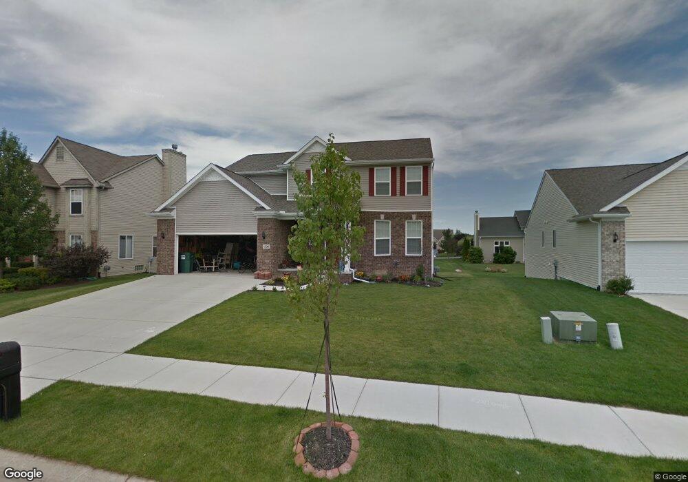
1230 Douglas Fir Dr Unit FIR Howell, MI 48843
Estimated Value: $425,359 - $467,000
4
Beds
3
Baths
2,405
Sq Ft
$186/Sq Ft
Est. Value
About This Home
This home is located at 1230 Douglas Fir Dr Unit FIR, Howell, MI 48843 and is currently estimated at $447,090, approximately $185 per square foot. 1230 Douglas Fir Dr Unit FIR is a home located in Livingston County with nearby schools including Northwest Elementary School, Highlander Way Middle School, and Howell High School.
Ownership History
Date
Name
Owned For
Owner Type
Purchase Details
Closed on
Apr 7, 2016
Sold by
Capital Construction Group Llc
Bought by
Hubbard Ryan and Hubbard Tonya
Current Estimated Value
Home Financials for this Owner
Home Financials are based on the most recent Mortgage that was taken out on this home.
Original Mortgage
$263,150
Outstanding Balance
$209,057
Interest Rate
3.68%
Mortgage Type
New Conventional
Estimated Equity
$238,033
Create a Home Valuation Report for This Property
The Home Valuation Report is an in-depth analysis detailing your home's value as well as a comparison with similar homes in the area
Home Values in the Area
Average Home Value in this Area
Purchase History
| Date | Buyer | Sale Price | Title Company |
|---|---|---|---|
| Hubbard Ryan | $277,000 | Select Title Company |
Source: Public Records
Mortgage History
| Date | Status | Borrower | Loan Amount |
|---|---|---|---|
| Open | Hubbard Ryan | $263,150 |
Source: Public Records
Tax History Compared to Growth
Tax History
| Year | Tax Paid | Tax Assessment Tax Assessment Total Assessment is a certain percentage of the fair market value that is determined by local assessors to be the total taxable value of land and additions on the property. | Land | Improvement |
|---|---|---|---|---|
| 2025 | $2,746 | $217,600 | $0 | $0 |
| 2024 | $2,667 | $220,200 | $0 | $0 |
| 2023 | $2,548 | $201,300 | $0 | $0 |
| 2022 | $2,600 | $161,100 | $0 | $0 |
| 2021 | $5,153 | $171,300 | $0 | $0 |
| 2020 | $5,128 | $161,100 | $0 | $0 |
| 2019 | $5,142 | $153,300 | $0 | $0 |
| 2018 | $5,164 | $145,100 | $0 | $0 |
| 2017 | $5,183 | $142,000 | $0 | $0 |
| 2016 | $4,540 | $112,300 | $0 | $0 |
| 2014 | $1,487 | $0 | $0 | $0 |
| 2012 | $1,487 | $10,000 | $0 | $0 |
Source: Public Records
Map
Nearby Homes
- 3040 Bogues View Dr
- 3224 Waverly Woods Ln
- 3227 Waverly Woods Ln
- 571 Cannonade Loop
- 523 Cannonade Loop
- 583 Cannonade Loop
- 1633 Frech Ln
- 475 Cannonade Loop
- 1400 Oakcrest Rd
- 559 Cannonade Loop
- The Austin Plan at Broadmoor
- The Charlotte Plan at Broadmoor
- The Harrison Plan at Broadmoor
- The Bloomington Plan at Broadmoor
- The Columbia Plan at Broadmoor
- 2653 Ravine Side N
- 1570 Princewood Blvd
- 3020 Brookline
- 2700 Court Ln N
- 2511 Kerria Dr Unit 42
- 1230 Douglas Fir Dr
- 1216 Douglas Fir Dr
- 1216 Douglas Fir Dr Unit FIR
- 1244 Douglas Fir Dr
- 1243 Douglas Fir Dr
- 1243 Douglas Fir Dr Unit FIR
- 1191 Stonebrooke Dr
- 1208 Douglas Fir Dr
- 1229 Douglas Fir Dr
- 1213 Douglas Fir Dr
- 1213 Douglas Fir Dr Unit FIR
- 1231 Stonebrooke Dr
- 1201 Stonebrooke Dr
- 1260 Douglas Fir Dr
- 1245 Stonebrooke Dr
- 1201 Douglas Fir Dr
- TBD Douglas Fir (Homesite 57)
- 1259 Stonebrooke Dr
- 1187 Douglas Fir Dr
- 1272 Douglas Fir Dr