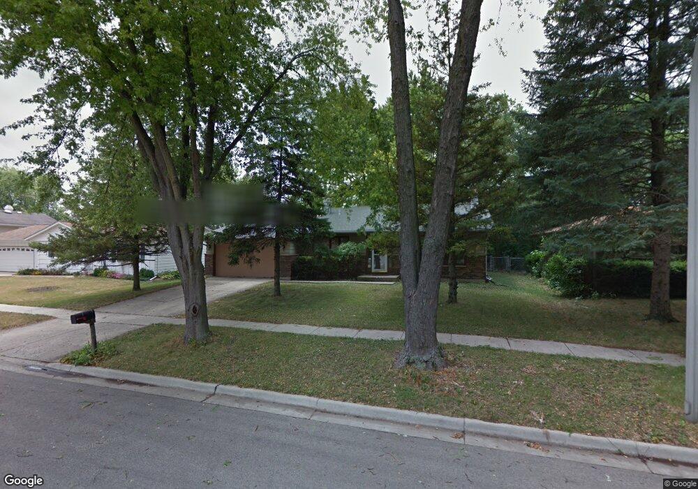
1230 Mallard Dr Elgin, IL 60123
Century Oaks NeighborhoodEstimated Value: $338,000 - $372,000
3
Beds
2
Baths
1,900
Sq Ft
$189/Sq Ft
Est. Value
About This Home
This home is located at 1230 Mallard Dr, Elgin, IL 60123 and is currently estimated at $359,780, approximately $189 per square foot. 1230 Mallard Dr is a home located in Kane County with nearby schools including Century Oaks Elementary School, Kimball Middle School, and Larkin High School.
Ownership History
Date
Name
Owned For
Owner Type
Purchase Details
Closed on
Sep 30, 2002
Sold by
Deibert Grace and Deibert Grace A
Bought by
Good William
Current Estimated Value
Home Financials for this Owner
Home Financials are based on the most recent Mortgage that was taken out on this home.
Original Mortgage
$186,079
Interest Rate
6.1%
Mortgage Type
FHA
Create a Home Valuation Report for This Property
The Home Valuation Report is an in-depth analysis detailing your home's value as well as a comparison with similar homes in the area
Home Values in the Area
Average Home Value in this Area
Purchase History
| Date | Buyer | Sale Price | Title Company |
|---|---|---|---|
| Good William | $189,000 | Nlt Title Llc |
Source: Public Records
Mortgage History
| Date | Status | Borrower | Loan Amount |
|---|---|---|---|
| Previous Owner | Good William | $186,079 |
Source: Public Records
Tax History
| Year | Tax Paid | Tax Assessment Tax Assessment Total Assessment is a certain percentage of the fair market value that is determined by local assessors to be the total taxable value of land and additions on the property. | Land | Improvement |
|---|---|---|---|---|
| 2024 | $7,182 | $97,737 | $24,998 | $72,739 |
| 2023 | $6,845 | $88,298 | $22,584 | $65,714 |
| 2022 | $6,461 | $80,513 | $20,593 | $59,920 |
| 2021 | $6,180 | $75,274 | $19,253 | $56,021 |
| 2020 | $6,007 | $71,861 | $18,380 | $53,481 |
| 2019 | $5,833 | $68,452 | $17,508 | $50,944 |
| 2018 | $5,493 | $61,559 | $16,494 | $45,065 |
| 2017 | $5,369 | $58,196 | $15,593 | $42,603 |
| 2016 | $5,118 | $53,990 | $14,466 | $39,524 |
| 2015 | -- | $49,486 | $13,259 | $36,227 |
| 2014 | -- | $48,875 | $13,095 | $35,780 |
| 2013 | -- | $50,164 | $13,440 | $36,724 |
Source: Public Records
Map
Nearby Homes
- 1212 Century Oaks Dr
- 1345 S Madlock Ct
- 1790 Devonshire Ct
- 938 Hillcrest Rd
- 2013 Jeffrey Ln Unit 2013
- 801 N Mclean Blvd Unit 324
- 801 N Mclean Blvd Unit 320
- 764 Scott Dr
- 1104 Florimond Dr
- 1419 Harlan Ave
- LOT 17 Teal Ave
- LOTS 14 & 15 Teal Ave
- 10 Chateau Dr
- 1367 Wauchope Dr
- 527 N Lyle Ave
- 1101 Richard Rd
- 1045 Richard Rd Unit 207
- 682 Alice Place
- 1052 Bayside Rd Unit 213
- 308 N Clifton Ave
- 1220 Mallard Dr
- 1240 Mallard Dr
- 1229 Robinwood Dr
- 1237 Robinwood Dr Unit 39
- 1219 Robinwood Dr
- 1210 Mallard Dr
- 1250 Mallard Dr
- 1229 Mallard Dr
- 1247 Robinwood Dr
- 1209 Robinwood Dr
- 1237 Mallard Dr
- 1219 Mallard Dr
- 1260 Mallard Dr
- 1472 Todd Farm Dr
- 1470 Todd Farm Dr
- 1245 Mallard Dr
- 1259 Robinwood Dr
- 1209 Mallard Dr
- 1484 Todd Farm Dr
- 1261 Robinwood Dr
Your Personal Tour Guide
Ask me questions while you tour the home.