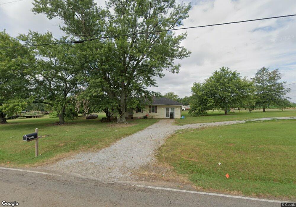
1230 Riverton Rd Huntsville, AL 35811
Moores Mill NeighborhoodEstimated Value: $80,000 - $159,000
--
Bed
--
Bath
1,076
Sq Ft
$119/Sq Ft
Est. Value
About This Home
This home is located at 1230 Riverton Rd, Huntsville, AL 35811 and is currently estimated at $127,852, approximately $118 per square foot. 1230 Riverton Rd is a home with nearby schools including Riverton Elementary School, Riverton Intermediate School, and Buckhorn Middle School.
Ownership History
Date
Name
Owned For
Owner Type
Purchase Details
Closed on
Aug 26, 2021
Sold by
Huskey Kristi Nicole Davis
Bought by
Lones Daniel Dean
Current Estimated Value
Purchase Details
Closed on
Aug 23, 2021
Sold by
Lones Wesley Daniel and Lones Chloe Marie
Bought by
Lones Daniel Dean
Purchase Details
Closed on
Sep 4, 2019
Sold by
Lones Chloe Marie and Lones Wesley Daniel
Bought by
Lones Daniel Dean
Purchase Details
Closed on
Apr 15, 2009
Sold by
Segura Martinez J Dolores and Garcia Velinda Coria
Bought by
Bogle Ronnie
Create a Home Valuation Report for This Property
The Home Valuation Report is an in-depth analysis detailing your home's value as well as a comparison with similar homes in the area
Home Values in the Area
Average Home Value in this Area
Purchase History
| Date | Buyer | Sale Price | Title Company |
|---|---|---|---|
| Lones Daniel Dean | -- | None Available | |
| Lones Daniel Dean | $62,000 | None Available | |
| Lones Daniel Dean | $5,000 | None Available | |
| Bogle Ronnie | -- | -- |
Source: Public Records
Tax History Compared to Growth
Tax History
| Year | Tax Paid | Tax Assessment Tax Assessment Total Assessment is a certain percentage of the fair market value that is determined by local assessors to be the total taxable value of land and additions on the property. | Land | Improvement |
|---|---|---|---|---|
| 2024 | $571 | $16,000 | $4,200 | $11,800 |
| 2023 | $551 | $15,440 | $4,200 | $11,240 |
| 2022 | $453 | $12,600 | $2,440 | $10,160 |
| 2021 | $164 | $5,900 | $1,220 | $4,680 |
| 2020 | $409 | $11,160 | $2,440 | $8,720 |
| 2019 | $443 | $6,230 | $2,030 | $4,200 |
| 2018 | $410 | $11,520 | $0 | $0 |
| 2017 | $410 | $11,520 | $0 | $0 |
| 2016 | $157 | $5,760 | $0 | $0 |
| 2015 | $157 | $5,760 | $0 | $0 |
| 2014 | $155 | $5,720 | $0 | $0 |
Source: Public Records
Map
Nearby Homes
- 188 Rube Robinson Rd
- 109 Morning Dove Dr
- 271 Rube Robinson Rd
- 7521A Moores Mill Rd
- 7521 Moores Mill Rd
- 104 A Smith Rd
- 215 Riverside Dr
- 205 Applewood Ct
- 207 Applewood Ct
- 332 Merrydale Dr
- 215 Applewood Ct
- Lots 2 & 3 Riverside Dr
- 210 Applewood Ct
- 121 Southern Oaks Dr
- Aldridge Plan at Kensington
- Kerry Plan at Kensington
- Freeport Plan at Kensington
- Lakeside Plan at Kensington
- 221 Applewood Ct
- 104 Saw Palmetto Dr
- 514 Darwin Rd
- 1196 Riverton Rd
- 126 Macon Ln
- 1180 Riverton Rd
- 1172 Riverton Rd
- 156 Macon Ln
- 1146 Riverton Rd
- 140 Rube Robinson Rd
- 123 Rube Robinson Rd
- 129 Rube Robinson Rd
- 165 Rube Robinson Rd
- 177 Rube Robinson Rd
- 183 Rube Robinson Rd
- 195 Rube Robinson Rd
- 1094 Riverton Rd
- 100 Morning Dove Dr
- 102 Morning Dove Dr
- 104 Morning Dove Dr
- 209 Macon Ln
- 101 Morning Dove Dr