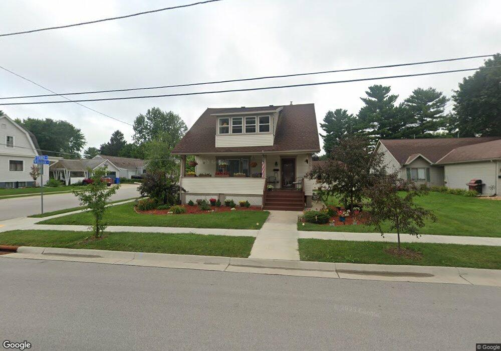
1230 S 3rd St Watertown, WI 53094
Estimated Value: $219,000 - $267,000
3
Beds
1
Bath
1,322
Sq Ft
$184/Sq Ft
Est. Value
About This Home
This home is located at 1230 S 3rd St, Watertown, WI 53094 and is currently estimated at $242,629, approximately $183 per square foot. 1230 S 3rd St is a home located in Jefferson County with nearby schools including Watertown High School, eCampus Academy Charter School, and Trinity-St. Luke's Lutheran Elementary School.
Ownership History
Date
Name
Owned For
Owner Type
Purchase Details
Closed on
Sep 14, 2020
Sold by
Ward Cheryl A
Bought by
Perry Douglas M and Russo Catherine J
Current Estimated Value
Home Financials for this Owner
Home Financials are based on the most recent Mortgage that was taken out on this home.
Original Mortgage
$154,850
Outstanding Balance
$137,419
Interest Rate
2.9%
Mortgage Type
New Conventional
Estimated Equity
$105,210
Purchase Details
Closed on
Jun 27, 2019
Sold by
Yenser Jeremy S
Bought by
Ward Cheryl A
Home Financials for this Owner
Home Financials are based on the most recent Mortgage that was taken out on this home.
Original Mortgage
$114,400
Interest Rate
3.9%
Mortgage Type
New Conventional
Purchase Details
Closed on
Jul 27, 2009
Sold by
Affeld Mary and Estate Of Clemens W Stoll
Bought by
Carew Mark R and Carew Autumn A
Create a Home Valuation Report for This Property
The Home Valuation Report is an in-depth analysis detailing your home's value as well as a comparison with similar homes in the area
Home Values in the Area
Average Home Value in this Area
Purchase History
| Date | Buyer | Sale Price | Title Company |
|---|---|---|---|
| Perry Douglas M | $170,000 | None Available | |
| Ward Cheryl A | $143,000 | None Available | |
| Carew Mark R | $55,000 | None Available |
Source: Public Records
Mortgage History
| Date | Status | Borrower | Loan Amount |
|---|---|---|---|
| Open | Perry Douglas M | $154,850 | |
| Previous Owner | Ward Cheryl A | $114,400 |
Source: Public Records
Tax History Compared to Growth
Tax History
| Year | Tax Paid | Tax Assessment Tax Assessment Total Assessment is a certain percentage of the fair market value that is determined by local assessors to be the total taxable value of land and additions on the property. | Land | Improvement |
|---|---|---|---|---|
| 2024 | $2,731 | $184,500 | $38,800 | $145,700 |
| 2023 | $2,403 | $148,800 | $32,800 | $116,000 |
| 2022 | $2,424 | $148,800 | $32,800 | $116,000 |
| 2021 | $2,410 | $104,400 | $21,000 | $83,400 |
| 2020 | $2,461 | $104,400 | $21,000 | $83,400 |
| 2019 | $2,379 | $104,400 | $21,000 | $83,400 |
| 2018 | $2,334 | $104,400 | $21,000 | $83,400 |
| 2017 | $2,255 | $104,400 | $21,000 | $83,400 |
| 2016 | $2,218 | $104,400 | $21,000 | $83,400 |
| 2015 | $2,304 | $104,400 | $21,000 | $83,400 |
| 2014 | $2,335 | $104,400 | $21,000 | $83,400 |
| 2013 | $2,379 | $104,400 | $21,000 | $83,400 |
Source: Public Records
Map
Nearby Homes
- 1301 Utah St
- 1215 Utah St
- 1313 Utah St
- 1418 S 9th St
- 913 S 3rd St
- 1330 S 10th St
- 1314 Waldron St
- 901 S 8th St
- 908 Franklin St
- 1507 S 10th St
- 601 S 6th St
- 131 Cedar Ct
- 709 S 10th St
- 623 S 12th St
- The Saybrook Plan at Rock River Ridge
- The Atwater Plan at Rock River Ridge
- The Hudson Plan at Rock River Ridge
- The Coral Plan at Rock River Ridge
- The Drake Plan at Rock River Ridge
- The Addison Plan at Rock River Ridge