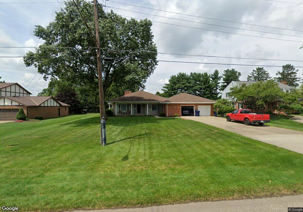
1230 Springbrook Dr Mansfield, OH 44906
Estimated Value: $333,489 - $363,000
3
Beds
3
Baths
2,228
Sq Ft
$156/Sq Ft
Est. Value
About This Home
This home is located at 1230 Springbrook Dr, Mansfield, OH 44906 and is currently estimated at $348,372, approximately $156 per square foot. 1230 Springbrook Dr is a home located in Richland County with nearby schools including Mansfield Christian School, Discovery School, and Mansfield Seventh-day Adventist School.
Ownership History
Date
Name
Owned For
Owner Type
Purchase Details
Closed on
Mar 8, 2018
Sold by
Brickman Homer W and Brickman Joanne E
Bought by
Knowlton Robert and Knowlton Mary
Current Estimated Value
Purchase Details
Closed on
Dec 2, 1997
Sold by
Study Bernard L
Bought by
Brickman Homer W
Home Financials for this Owner
Home Financials are based on the most recent Mortgage that was taken out on this home.
Original Mortgage
$128,000
Interest Rate
6.25%
Mortgage Type
New Conventional
Purchase Details
Closed on
Apr 1, 1985
Create a Home Valuation Report for This Property
The Home Valuation Report is an in-depth analysis detailing your home's value as well as a comparison with similar homes in the area
Home Values in the Area
Average Home Value in this Area
Purchase History
| Date | Buyer | Sale Price | Title Company |
|---|---|---|---|
| Knowlton Robert | $182,500 | Barrister Title Group | |
| Brickman Homer W | $160,000 | -- | |
| -- | $95,000 | -- |
Source: Public Records
Mortgage History
| Date | Status | Borrower | Loan Amount |
|---|---|---|---|
| Previous Owner | Brickman Homer W | $128,000 |
Source: Public Records
Tax History
| Year | Tax Paid | Tax Assessment Tax Assessment Total Assessment is a certain percentage of the fair market value that is determined by local assessors to be the total taxable value of land and additions on the property. | Land | Improvement |
|---|---|---|---|---|
| 2024 | $4,104 | $89,660 | $12,110 | $77,550 |
| 2023 | $4,198 | $89,660 | $12,110 | $77,550 |
| 2022 | $4,162 | $74,490 | $10,730 | $63,760 |
| 2021 | $4,191 | $74,490 | $10,730 | $63,760 |
| 2020 | $4,286 | $74,490 | $10,730 | $63,760 |
| 2019 | $4,026 | $63,140 | $9,100 | $54,040 |
| 2018 | $3,420 | $63,140 | $9,100 | $54,040 |
| 2017 | $3,328 | $63,140 | $9,100 | $54,040 |
| 2016 | $3,490 | $64,060 | $8,820 | $55,240 |
| 2015 | $3,334 | $64,060 | $8,820 | $55,240 |
| 2014 | $3,291 | $64,060 | $8,820 | $55,240 |
| 2012 | $2,598 | $66,050 | $9,100 | $56,950 |
Source: Public Records
Map
Nearby Homes
- 1326 Rosedale Dr
- 1314 Bridgewater Way N
- 1560 Bridgewater Way N
- 1485 Overdale Dr
- 1480 Overdale Dr
- 1476 Overdale Dr
- 1516 Bridgewater Way S Unit 1516
- 1520 Bridgewater Way S Unit 1518
- 1490 Hess Cir
- 0 Lot #23132 Hess Cir
- 0 Lot #23127 Hess Cir
- 0 Lot #23139 Hess Cir
- 0 Lot #23121 Hess Cir
- 0 Lot #23133 Hess Cir
- 1576 Bridgewater Way S
- 1515 Oak Run Ct
- 755 Locust Ln
- 1490 Royalwood Ct Lot 23097
- 1500 Royalwood Ct Lot 23096
- 1510 Royalwood Ct Lot 23095
- 1222 Springbrook Dr
- 1385 Brookpark Dr
- 1365 Brookpark Dr
- 1250 Springbrook Dr
- 1212 Springbrook Dr
- 1395 Brookpark Dr
- 1227 Springbrook Dr
- 1233 Springbrook Dr
- 1355 Brookpark Dr
- 1217 Springbrook Dr
- 1260 Springbrook Dr
- 1245 Springbrook Dr
- 1405 Brookpark Dr
- 1345 Brookpark Dr
- 1378 Brookpark Dr
- 1202 Springbrook Dr
- 1388 Brookpark Dr
- 1368 Brookpark Dr
- 1257 Springbrook Dr
- 1191 Springbrook Dr
Your Personal Tour Guide
Ask me questions while you tour the home.