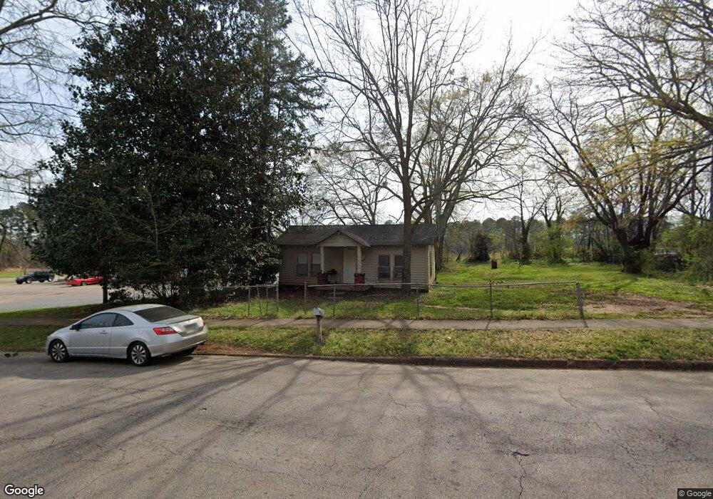
1230 Troup St Lagrange, GA 30240
Estimated Value: $54,896 - $116,000
2
Beds
1
Bath
800
Sq Ft
$100/Sq Ft
Est. Value
About This Home
This home is located at 1230 Troup St, Lagrange, GA 30240 and is currently estimated at $80,224, approximately $100 per square foot. 1230 Troup St is a home located in Troup County with nearby schools including Ethel W. Kight Elementary School, Hollis Hand Elementary School, and Franklin Forest Elementary School.
Ownership History
Date
Name
Owned For
Owner Type
Purchase Details
Closed on
Apr 18, 1994
Sold by
Richard Gary Johns
Bought by
Mallory Realty Co Inc
Current Estimated Value
Purchase Details
Closed on
Sep 26, 1991
Sold by
Charter Federal Savings & Loan
Bought by
Richard Gary Johns
Purchase Details
Closed on
Apr 2, 1991
Sold by
Wynne Norman L/First Federal S
Bought by
Charter Federal Savings & Loan
Purchase Details
Closed on
Jul 6, 1988
Sold by
Thompson E Lavaughn
Bought by
Wynne Norman L/First Federal S
Purchase Details
Closed on
Mar 1, 1988
Sold by
Jacks Dad Francis
Bought by
Thompson E Lavaughn
Purchase Details
Closed on
Apr 26, 1983
Sold by
Jacks Charlie B
Bought by
Jacks Dad Francis
Purchase Details
Closed on
Jul 1, 1966
Sold by
Hale C L
Bought by
Jacks Charlie B
Create a Home Valuation Report for This Property
The Home Valuation Report is an in-depth analysis detailing your home's value as well as a comparison with similar homes in the area
Home Values in the Area
Average Home Value in this Area
Purchase History
| Date | Buyer | Sale Price | Title Company |
|---|---|---|---|
| Mallory Realty Co Inc | $23,500 | -- | |
| Richard Gary Johns | $10,000 | -- | |
| Charter Federal Savings & Loan | $10,000 | -- | |
| Wynne Norman L/First Federal S | $27,500 | -- | |
| Thompson E Lavaughn | $20,000 | -- | |
| Jacks Dad Francis | -- | -- | |
| Jacks Charlie B | -- | -- |
Source: Public Records
Tax History Compared to Growth
Tax History
| Year | Tax Paid | Tax Assessment Tax Assessment Total Assessment is a certain percentage of the fair market value that is determined by local assessors to be the total taxable value of land and additions on the property. | Land | Improvement |
|---|---|---|---|---|
| 2024 | $260 | $9,520 | $3,760 | $5,760 |
| 2023 | $251 | $9,200 | $3,760 | $5,440 |
| 2022 | $249 | $8,920 | $3,760 | $5,160 |
| 2021 | $234 | $7,760 | $3,760 | $4,000 |
| 2020 | $323 | $8,600 | $3,760 | $4,840 |
| 2019 | $171 | $5,680 | $2,560 | $3,120 |
| 2018 | $166 | $5,492 | $2,372 | $3,120 |
| 2017 | $166 | $5,492 | $2,372 | $3,120 |
| 2016 | $166 | $5,501 | $2,372 | $3,130 |
| 2015 | $167 | $5,541 | $2,412 | $3,130 |
| 2014 | $168 | $5,541 | $2,412 | $3,130 |
| 2013 | -- | $8,668 | $3,215 | $5,453 |
Source: Public Records
Map
Nearby Homes
- 119 Jones St
- 900 B N Pkwy
- 1402 Forrest Ave
- 205 Grady St
- 1311 Juniper St
- 1205 Park Ave
- 1300 Murphy Ave
- 701 Jefferson St
- 167 S Kight Dr
- 109 Garfield St
- The Rhodes Plan at Crown Street Cottages
- The Truitt Plan at Crown Street Cottages
- The Callaway Plan at Crown Street Cottages
- 612 S Lee St
- 102 Crown St Unit LOT 1
- 101 Crown St Unit LOT 5
- 1301 Polk St
- 802 Monroe St
- 812 Elm St
- 606 Poplar St
- 1228 Troup St
- 1226 Troup St
- 1229 Troup St
- 1231 Troup St
- 1227 Troup St
- 1225 Troup St
- 1224 Troup St
- 1424 Forrest Ave
- 1424 Forrest Ave Unit 1
- 6.45 Acres On Lukken Industrial Drive Extension
- 1.23 ACRES On Lukken Industrial Drive Extension
- 1223 Troup St
- 1222 Troup St
- 1221 Troup St
- 1220 Troup St
- 1219 Troup St
- 1419 Forrest Ave
- 1218 Troup St
- 1417 Forrest Ave
- 1217 Troup St