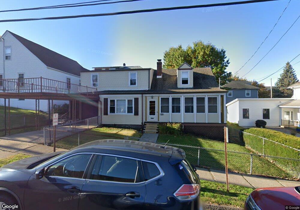
1230 University Ave Scranton, PA 18509
Greenridge NeighborhoodEstimated Value: $81,819 - $317,000
--
Bed
--
Bath
--
Sq Ft
4,879
Sq Ft Lot
About This Home
This home is located at 1230 University Ave, Scranton, PA 18509 and is currently estimated at $215,955. 1230 University Ave is a home located in Lackawanna County with nearby schools including Robert Morris #27, Northeast Scranton Intermediate School, and Scranton High School.
Ownership History
Date
Name
Owned For
Owner Type
Purchase Details
Closed on
Jan 22, 2007
Sold by
Neary Helen R and Neary Michael X
Bought by
Neary Michael S and Neary Michele M
Current Estimated Value
Purchase Details
Closed on
Jan 12, 2007
Sold by
Neary Patrick Brendan
Bought by
Neary Helen R
Purchase Details
Closed on
May 18, 1989
Sold by
Neary Michael X and Neary Beverly E
Bought by
Neary Michael J and Neary Helen R
Create a Home Valuation Report for This Property
The Home Valuation Report is an in-depth analysis detailing your home's value as well as a comparison with similar homes in the area
Home Values in the Area
Average Home Value in this Area
Purchase History
| Date | Buyer | Sale Price | Title Company |
|---|---|---|---|
| Neary Michael S | $70,000 | None Available | |
| Neary Helen R | -- | None Available | |
| Neary Michael J | -- | None Available |
Source: Public Records
Tax History Compared to Growth
Tax History
| Year | Tax Paid | Tax Assessment Tax Assessment Total Assessment is a certain percentage of the fair market value that is determined by local assessors to be the total taxable value of land and additions on the property. | Land | Improvement |
|---|---|---|---|---|
| 2025 | $4,744 | $14,000 | $3,450 | $10,550 |
| 2024 | $4,352 | $14,000 | $3,450 | $10,550 |
| 2023 | $4,352 | $14,000 | $3,450 | $10,550 |
| 2022 | $4,257 | $14,000 | $3,450 | $10,550 |
| 2021 | $4,257 | $14,000 | $3,450 | $10,550 |
| 2020 | $4,181 | $14,000 | $3,450 | $10,550 |
| 2019 | $3,938 | $14,000 | $3,450 | $10,550 |
| 2018 | $3,938 | $14,000 | $3,450 | $10,550 |
| 2017 | $3,872 | $14,000 | $3,450 | $10,550 |
| 2016 | $1,336 | $14,000 | $3,450 | $10,550 |
| 2015 | $2,949 | $14,000 | $3,450 | $10,550 |
| 2014 | -- | $14,000 | $3,450 | $10,550 |
Source: Public Records
Map
Nearby Homes
- 1008 Fisk St
- 2510 Boulevard Ave
- 831 Raines St
- 829 Raines St Unit 829-831
- 829 Raines St Unit 831
- 2237 Boulevard Ave
- 816 Woodlawn St
- 2106 Boulevard Ave
- 2129 Comegys Ave Unit L11
- 1599 Electric St
- 2446 Heermans Ave
- 1012 Sunset St
- 1008 Sunset St
- 1820 Sanderson Ave
- 722 Electric St
- 35 Dean St
- 1732 Capouse Ave
- 802 Sunset St
- 121 Throop St
- 1747 Monsey Ave
- 2450 Dimmick Ave
- 2343 Adams Ave Unit 45
- 2343-2345 Adams Ave
- 2343 45 Adams Ave
- 2343 2345 Adams Ave
- 2448 Dimmick Ave
- 2339 Adams Ave Unit 2341
- 2335 Adams Ave
- 2446 Dimmick Ave
- 2333 Adams Ave
- 1212 University Ave
- 2329 Adams Ave Unit 2331
- 2329 2331 Adams Ave
- 2329 2331 Adams Ave
- 2450 N Washington Ave
- 2448 N Washington Ave
- 2454 Wash & College
- 2436 Dimmick Ave
- 2446 N Washington Ave
- 2327 Adams Ave