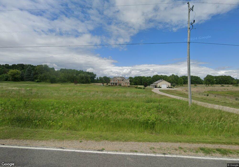
1230 W Garrison Rd Owosso, MI 48867
Estimated Value: $315,000 - $629,000
--
Bed
--
Bath
--
Sq Ft
39.3
Acres
About This Home
This home is located at 1230 W Garrison Rd, Owosso, MI 48867 and is currently estimated at $472,000. 1230 W Garrison Rd is a home with nearby schools including Morrice Area Elementary School and Morrice Area High School.
Ownership History
Date
Name
Owned For
Owner Type
Purchase Details
Closed on
Mar 23, 2018
Sold by
Zacharda T Robert D T and Zacharda Robert D
Bought by
Zacharda Michael R and Zacharda Jennifer K
Current Estimated Value
Purchase Details
Closed on
May 1, 2013
Sold by
Katz Kimberly and Katz Roger E
Bought by
Zacharda Robert Duane and Zachard Trust Robert Duane
Purchase Details
Closed on
Mar 15, 2013
Sold by
Katz Kimberly and Zacharda Rolene R
Bought by
Zacharda Robert D and Zacharda Mark A
Purchase Details
Closed on
Aug 9, 2005
Sold by
Zacharda Rolene R and Zacharda Robert L
Bought by
Bailey Christopher D and Bailey Elizabeth A
Home Financials for this Owner
Home Financials are based on the most recent Mortgage that was taken out on this home.
Original Mortgage
$1,000
Interest Rate
6%
Mortgage Type
Seller Take Back
Create a Home Valuation Report for This Property
The Home Valuation Report is an in-depth analysis detailing your home's value as well as a comparison with similar homes in the area
Home Values in the Area
Average Home Value in this Area
Purchase History
| Date | Buyer | Sale Price | Title Company |
|---|---|---|---|
| Zacharda Michael R | $88,215 | -- | |
| Zacharda Robert Duane | -- | -- | |
| Zacharda Robert D | -- | -- | |
| Bailey Christopher D | $148,000 | -- | |
| Bailey Christopher D | $2,000 | -- |
Source: Public Records
Mortgage History
| Date | Status | Borrower | Loan Amount |
|---|---|---|---|
| Previous Owner | Bailey Christopher D | $1,000 | |
| Previous Owner | Bailey Christopher D | $119,000 |
Source: Public Records
Tax History Compared to Growth
Tax History
| Year | Tax Paid | Tax Assessment Tax Assessment Total Assessment is a certain percentage of the fair market value that is determined by local assessors to be the total taxable value of land and additions on the property. | Land | Improvement |
|---|---|---|---|---|
| 2024 | -- | $0 | $0 | $0 |
| 2023 | $6,708 | $0 | $0 | $0 |
| 2022 | $2,565 | $272,400 | $0 | $0 |
| 2021 | $6,259 | $258,300 | $0 | $0 |
| 2020 | $6,165 | $257,100 | $0 | $0 |
| 2019 | $6,097 | $51,700 | $0 | $0 |
| 2018 | $815 | $47,900 | $0 | $0 |
| 2017 | $819 | $47,900 | $0 | $0 |
| 2016 | -- | $47,900 | $0 | $0 |
| 2015 | -- | $40,400 | $0 | $0 |
| 2014 | $3 | $40,400 | $0 | $0 |
Source: Public Records
Map
Nearby Homes
- 4650 Waugh Rd
- 8 Bennington Greens Dr
- V/L Morrice Rd Rd
- 0 Gale Rd Unit 50124635
- 2628 W Brewer Rd
- 4458 S M 52
- 2973 W Brewer Rd
- 2560 S Morrice Rd
- 2419 S Morrice Rd
- 7697 Riverview St
- 849 Hite Rd
- 3110 Innsbrook Dr
- 25 Bennington Greens Dr
- 26 Bennington Greens Dr Unit 26
- 20 Bennington Greens Dr
- 24 Bennington Greens Dr
- 38 Bennington Greens Dr
- 14 Bennington Greens Dr
- 54 Bennington Greens Dr
- 3062 Innsbrook Dr
- 4730 S Morrice Rd
- 4730 S Morrice Rd
- 1378 W Garrison Rd
- 1394 W Garrison Rd
- 1450 W Garrison Rd
- 1041 W Garrison Rd
- 5120 S Morrice Rd
- 4779 S Morrice Rd
- 5015 S Morrice Rd
- 4658 S Morrice Rd
- 4825 S Morrice Rd
- 4735 S Morrice Rd
- 4735 S Morrice Rd
- 1970 E Ashbrook Dr
- 4665 S Morrice Rd
- 4665 S Morrice Rd
- 0 E Ashbrook Dr
- 4578 S Morrice Rd
- 1505 W Garrison Rd
- 4643 S Morrice Rd