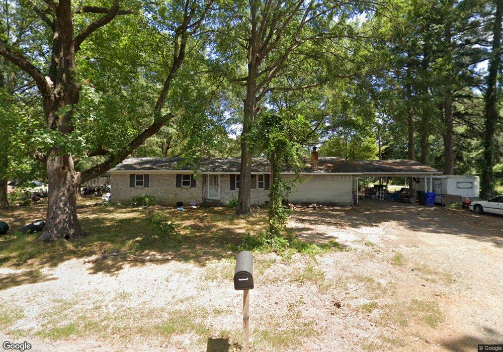
1230 Woodside Dr Conway, AR 72032
Estimated Value: $213,000 - $238,000
--
Bed
3
Baths
1,700
Sq Ft
$135/Sq Ft
Est. Value
About This Home
This home is located at 1230 Woodside Dr, Conway, AR 72032 and is currently estimated at $230,294, approximately $135 per square foot. 1230 Woodside Dr is a home located in Faulkner County with nearby schools including Theodore Jones Elementary School, Conway Junior High School, and Conway High School.
Ownership History
Date
Name
Owned For
Owner Type
Purchase Details
Closed on
Jul 16, 2018
Sold by
Looper Danny and Looper Cheryl
Bought by
Curtis Carrie L
Current Estimated Value
Purchase Details
Closed on
Jul 31, 2009
Bought by
Curtis
Home Financials for this Owner
Home Financials are based on the most recent Mortgage that was taken out on this home.
Original Mortgage
$95,000
Interest Rate
5.41%
Mortgage Type
New Conventional
Purchase Details
Closed on
Aug 28, 1996
Bought by
James and James Judy
Create a Home Valuation Report for This Property
The Home Valuation Report is an in-depth analysis detailing your home's value as well as a comparison with similar homes in the area
Home Values in the Area
Average Home Value in this Area
Purchase History
| Date | Buyer | Sale Price | Title Company |
|---|---|---|---|
| Curtis Carrie L | $21,500 | None Available | |
| Curtis | $100,000 | -- | |
| Curtis Carrie L | $100,000 | Conway Title Svcs & Escrow I | |
| James | -- | -- |
Source: Public Records
Mortgage History
| Date | Status | Borrower | Loan Amount |
|---|---|---|---|
| Previous Owner | Curtis Carrie L | $95,000 |
Source: Public Records
Tax History Compared to Growth
Tax History
| Year | Tax Paid | Tax Assessment Tax Assessment Total Assessment is a certain percentage of the fair market value that is determined by local assessors to be the total taxable value of land and additions on the property. | Land | Improvement |
|---|---|---|---|---|
| 2024 | $1,312 | $41,420 | $4,000 | $37,420 |
| 2023 | $1,249 | $24,690 | $4,000 | $20,690 |
| 2022 | $865 | $24,690 | $4,000 | $20,690 |
| 2021 | $809 | $24,690 | $4,000 | $20,690 |
| 2020 | $752 | $22,280 | $4,000 | $18,280 |
| 2019 | $752 | $22,280 | $4,000 | $18,280 |
| 2018 | $777 | $22,280 | $4,000 | $18,280 |
| 2017 | $777 | $22,280 | $4,000 | $18,280 |
| 2016 | $777 | $22,280 | $4,000 | $18,280 |
| 2015 | $1,181 | $23,340 | $3,920 | $19,420 |
| 2014 | $831 | $23,340 | $3,920 | $19,420 |
Source: Public Records
Map
Nearby Homes
- The Laurel Oak Plan at Woodside Crossing
- The Sanibel Plan at Woodside Crossing
- The Live Oak II Plan at Woodside Crossing
- The Oak II Plan at Woodside Crossing
- The Cayman Plan at Woodside Crossing
- The Hatteras Plan at Woodside Crossing
- The Sewee Plan at Woodside Crossing
- The Kokomo Plan at Woodside Crossing
- The Beaufort Plan at Woodside Crossing
- The Abaco Plan at Woodside Crossing
- The Key Largo Plan at Woodside Crossing
- The Abaco II Plan at Woodside Crossing
- The Busbee Plan at Woodside Crossing
- 1810 Angeline Dr
- 1660 Sweetspire Dr
- 1600 Beautyberry Dr
- 2365 E Oak St
- 18 Hazelwood Rd
- 1735 Rohan Cir
- 2415 E Oak St
- 1260 Woodside Dr
- 0 Woodside and Keathley
- 1285 Woodside Dr
- 1225 Woodside C2
- 1280 Woodside Dr
- 2110 Keathley Dr
- 1225 Woodside Dr Unit E2
- 1225 Woodside Dr Unit B4
- 1270 Woodside Dr
- 0 Woodside Dr
- 2075 Edith Cir
- 1225 Woodside D2
- 1235 Brookfield Dr
- 1300 Woodside Dr
- 1225 Brookfield Dr
- 2070 Keathley Dr
- 000 Keathley
- 2045 Edith Cir
- 1215 Brookfield Dr
- 2050 Keathley Dr