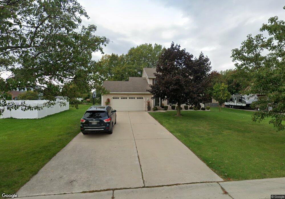
12300 36th Ave Pleasant Prairie, WI 53158
Village of Pleasant Prairie NeighborhoodEstimated Value: $427,000 - $504,000
4
Beds
3
Baths
2,105
Sq Ft
$216/Sq Ft
Est. Value
About This Home
This home is located at 12300 36th Ave, Pleasant Prairie, WI 53158 and is currently estimated at $454,755, approximately $216 per square foot. 12300 36th Ave is a home located in Kenosha County with nearby schools including Prairie Lane Elementary School, Lance Middle School, and Tremper High School.
Ownership History
Date
Name
Owned For
Owner Type
Purchase Details
Closed on
Aug 26, 2009
Sold by
Deutsche Bank National Trust Company As
Bought by
Idrizi Fadil and Idrizi Fatime
Current Estimated Value
Purchase Details
Closed on
Apr 28, 2009
Sold by
Losey Mary A
Bought by
Deutsche Bank National Trust Company As
Purchase Details
Closed on
Aug 30, 2005
Sold by
Losey Mary A
Bought by
Losey Mary A and Kechmy El Mostafa
Create a Home Valuation Report for This Property
The Home Valuation Report is an in-depth analysis detailing your home's value as well as a comparison with similar homes in the area
Home Values in the Area
Average Home Value in this Area
Purchase History
| Date | Buyer | Sale Price | Title Company |
|---|---|---|---|
| Idrizi Fadil | $185,000 | -- | |
| Deutsche Bank National Trust Company As | $178,700 | -- | |
| Losey Mary A | -- | None Available |
Source: Public Records
Tax History Compared to Growth
Tax History
| Year | Tax Paid | Tax Assessment Tax Assessment Total Assessment is a certain percentage of the fair market value that is determined by local assessors to be the total taxable value of land and additions on the property. | Land | Improvement |
|---|---|---|---|---|
| 2024 | $4,506 | $397,100 | $107,200 | $289,900 |
| 2023 | $4,443 | $342,700 | $98,400 | $244,300 |
| 2022 | $4,527 | $342,700 | $98,400 | $244,300 |
| 2021 | $4,956 | $266,600 | $80,800 | $185,800 |
| 2020 | $4,956 | $266,600 | $80,800 | $185,800 |
| 2019 | $4,542 | $266,600 | $80,800 | $185,800 |
| 2018 | $5,245 | $266,600 | $80,800 | $185,800 |
| 2017 | $4,546 | $237,300 | $73,800 | $163,500 |
| 2016 | $5,056 | $237,300 | $73,800 | $163,500 |
| 2015 | $5,846 | $224,400 | $66,800 | $157,600 |
| 2014 | -- | $224,400 | $66,800 | $157,600 |
Source: Public Records
Map
Nearby Homes
- Lt0 39th Ave
- 12122 28th Ave
- 11279 W Russell Rd
- 12111 28th Ave
- Lt0 128th St
- 43100 N Lewis Ave
- 210 Oak Ln
- 432 Megan Place
- 429 Megan Place
- 436 Megan Place
- 42908 N Lewis Ave
- 242 Thompson Ave
- Deerfield Plan at Cedar Ridge
- Essex Plan at Cedar Ridge
- Geneva Plan at Cedar Ridge
- Ellington Plan at Cedar Ridge
- Summerhill Plan at Cedar Ridge
- Harlow Plan at Cedar Ridge
- Norwood Plan at Cedar Ridge
- Andover Plan at Cedar Ridge