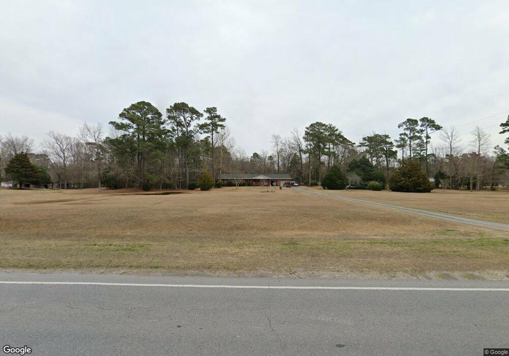
12300 Nc Highway 50 E Hampstead, NC 28443
Estimated Value: $306,000 - $496,937
3
Beds
2
Baths
1,848
Sq Ft
$240/Sq Ft
Est. Value
About This Home
This home is located at 12300 Nc Highway 50 E, Hampstead, NC 28443 and is currently estimated at $443,734, approximately $240 per square foot. 12300 Nc Highway 50 E is a home located in Pender County with nearby schools including North Topsail Elementary School, Topsail Middle School, and Topsail High School.
Ownership History
Date
Name
Owned For
Owner Type
Purchase Details
Closed on
Apr 4, 2011
Sold by
Batts Harold and Batts Martha
Bought by
Batts Gregory T
Current Estimated Value
Purchase Details
Closed on
Jan 22, 2009
Sold by
Batts Harold B and Batts Martha G
Bought by
Batts Harold B and Batts Martha G
Create a Home Valuation Report for This Property
The Home Valuation Report is an in-depth analysis detailing your home's value as well as a comparison with similar homes in the area
Home Values in the Area
Average Home Value in this Area
Purchase History
| Date | Buyer | Sale Price | Title Company |
|---|---|---|---|
| Batts Gregory T | -- | -- | |
| Batts Harold B | -- | -- |
Source: Public Records
Tax History
| Year | Tax Paid | Tax Assessment Tax Assessment Total Assessment is a certain percentage of the fair market value that is determined by local assessors to be the total taxable value of land and additions on the property. | Land | Improvement |
|---|---|---|---|---|
| 2025 | $2,523 | $518,780 | $260,500 | $258,280 |
| 2024 | $2,523 | $249,812 | $97,830 | $151,982 |
| 2023 | $2,523 | $249,812 | $97,830 | $151,982 |
| 2022 | $2,312 | $249,812 | $97,830 | $151,982 |
| 2021 | $2,312 | $249,812 | $97,830 | $151,982 |
| 2020 | $2,257 | $243,222 | $97,830 | $145,392 |
| 2019 | $2,257 | $243,222 | $97,830 | $145,392 |
| 2018 | $1,547 | $155,892 | $38,332 | $117,560 |
| 2017 | $1,547 | $155,892 | $38,332 | $117,560 |
| 2016 | $1,531 | $155,892 | $38,332 | $117,560 |
| 2015 | -- | $155,892 | $38,332 | $117,560 |
| 2014 | $1,198 | $155,892 | $38,332 | $117,560 |
| 2013 | -- | $155,892 | $38,332 | $117,560 |
| 2012 | -- | $155,892 | $38,332 | $117,560 |
Source: Public Records
Map
Nearby Homes
- 121 Poplar Branch Way
- 156 Poplar Branch Way
- 110 Belvedere Dr
- 305 Rose Bud Ln
- 8 Hwy 50
- 229 Red Carnation Dr
- 236 Red Carnation Dr
- 206 Holden Rd
- 215 Chalet Rd
- 142 N Grassland Rd Unit 4
- 140 N Grassland Rd Unit 5
- 138 N Grassland Rd Unit Lot 6
- 138 N Grassland Rd Unit 6
- 114 Edgewater Way
- Norman Plan at Waterside Townhomes
- Pearson Plan at Waterside Townhomes
- 136 N Grassland Rd Unit 7
- 136 N Grassland Rd Unit 7
- 134 N Grassland Rd Unit 8
- 124 N Grassland Rd Unit 13
- 75 Mill Creek Rd
- 12234 Nc Highway 50 E
- 12188 Nc Highway 50 E
- 71 Mill Creek Rd
- 235 Mill Creek Rd
- 12395 Nc Highway 50 E
- 12395 N Carolina 50
- 41 Mill Creek Rd
- 221 Mill Creek Rd
- 1144 Shepards Rd
- 12124 N Carolina 50
- 16 Carriage Ln
- 143 Belt Rd
- 12100 Nc Highway 50 E
- 455 Mill Creek Rd Tracks 2 & 3
- Track 2a&3 Mill Creek Rd Tracks 2 & 3
- 1035 Shepards Rd
- 1050 Shepards Rd
- 103 Poplar Branch Way
- 105 Poplar Branch Way
Your Personal Tour Guide
Ask me questions while you tour the home.