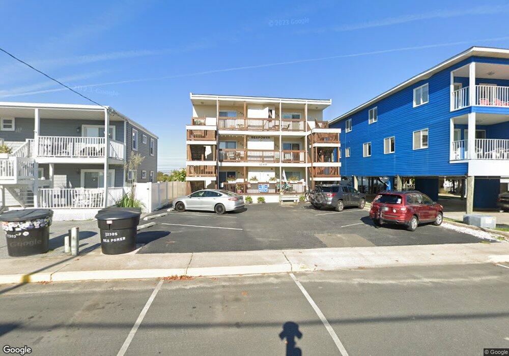
12305 Assawoman Dr Ocean City, MD 21842
Estimated Value: $307,000 - $337,000
--
Bed
2
Baths
800
Sq Ft
$403/Sq Ft
Est. Value
About This Home
This home is located at 12305 Assawoman Dr, Ocean City, MD 21842 and is currently estimated at $322,075, approximately $402 per square foot. 12305 Assawoman Dr is a home located in Worcester County with nearby schools including Ocean City Elementary School, Stephen Decatur Middle School, and Berlin Intermediate School.
Ownership History
Date
Name
Owned For
Owner Type
Purchase Details
Closed on
Aug 31, 1998
Sold by
Whitsel James L and Whitsel Sabrina L
Bought by
Foley Robert T and Foley Carole S
Current Estimated Value
Purchase Details
Closed on
Nov 3, 1994
Sold by
George Kathleen S
Bought by
Whitsel James L and Whitsel Sabrina L
Purchase Details
Closed on
Jun 29, 1994
Sold by
George Kathleen S
Bought by
George Kathleen S
Create a Home Valuation Report for This Property
The Home Valuation Report is an in-depth analysis detailing your home's value as well as a comparison with similar homes in the area
Home Values in the Area
Average Home Value in this Area
Purchase History
| Date | Buyer | Sale Price | Title Company |
|---|---|---|---|
| Foley Robert T | $64,900 | -- | |
| Whitsel James L | $60,000 | -- | |
| George Kathleen S | -- | -- | |
| George Kathleen S | -- | -- |
Source: Public Records
Mortgage History
| Date | Status | Borrower | Loan Amount |
|---|---|---|---|
| Closed | Foley Robert T | -- |
Source: Public Records
Tax History Compared to Growth
Tax History
| Year | Tax Paid | Tax Assessment Tax Assessment Total Assessment is a certain percentage of the fair market value that is determined by local assessors to be the total taxable value of land and additions on the property. | Land | Improvement |
|---|---|---|---|---|
| 2025 | $3,299 | $241,600 | $0 | $0 |
| 2024 | $2,947 | $211,200 | $0 | $0 |
| 2023 | $2,541 | $180,800 | $90,400 | $90,400 |
| 2022 | $2,541 | $180,800 | $90,400 | $90,400 |
| 2021 | $2,555 | $180,800 | $90,400 | $90,400 |
| 2020 | $2,555 | $180,800 | $90,400 | $90,400 |
| 2019 | $2,572 | $180,800 | $90,400 | $90,400 |
| 2018 | $2,546 | $180,800 | $90,400 | $90,400 |
| 2017 | $2,610 | $184,800 | $0 | $0 |
| 2016 | -- | $179,200 | $0 | $0 |
| 2015 | $2,496 | $173,600 | $0 | $0 |
| 2014 | $2,496 | $168,000 | $0 | $0 |
Source: Public Records
Map
Nearby Homes
- 4 123rd St
- 12 122nd St Unit 3I
- 12 122nd St Unit 3B
- 12305 Wight St Unit 310
- 12201 Wight St Unit 301
- 12300 Jamaica Ave Unit 103
- 12108 Coastal Hwy Unit 301
- 12108 Coastal Hwy Unit 404
- 103 123rd St
- 103 123rd St
- 101 123rd St Unit 235C3
- 101 123rd St Unit 374C
- 101 123rd St Unit 383C
- 105 123rd St
- 105 123rd St
- 12101 Assawoman Dr Unit 203
- 104 125th St Unit 202
- 104 125th St Unit 106
- 104 125th St Unit 405
- 6 126th St Unit 204S
- 12305 Assawoman Dr
- 12305 Assawoman Dr
- 12305 Assawoman Dr
- 12305 Assawoman Dr
- 12305 Assawoman Dr
- 12307 Assawoman Dr
- 12307 Assawoman Dr
- 12304 Coastal Hwy
- 14 123rd St Unit 11
- 14 123rd St Unit 5
- 14 123rd St Unit 13
- 14 123rd St Unit 3
- 14 123rd St Unit 12
- 14 123rd St
- 14 123rd St Unit 1
- 14 123rd St Unit 6
- 14 123rd St Unit 16
- 14 123rd St Unit 10
- 14 123rd St Unit 15
- 14 123rd St Unit 8