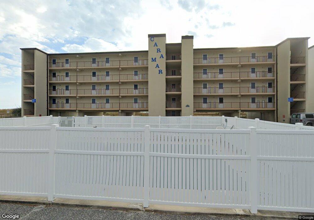
12305 Wight St Unit 107 Ocean City, MD 21842
Estimated Value: $245,308 - $300,000
--
Bed
1
Bath
392
Sq Ft
$702/Sq Ft
Est. Value
About This Home
This home is located at 12305 Wight St Unit 107, Ocean City, MD 21842 and is currently estimated at $275,077, approximately $701 per square foot. 12305 Wight St Unit 107 is a home located in Worcester County with nearby schools including Ocean City Elementary School, Stephen Decatur Middle School, and Berlin Intermediate School.
Ownership History
Date
Name
Owned For
Owner Type
Purchase Details
Closed on
Jun 9, 2020
Sold by
Pritchard Barbara Jean and Estate Of Cecilia Marie Franz
Bought by
Robbins Carolyn Franz
Current Estimated Value
Purchase Details
Closed on
Aug 17, 2010
Sold by
Us Bank National Assoc
Bought by
Franz Cecelia Marie
Purchase Details
Closed on
Apr 15, 2010
Sold by
Nolan Christine
Bought by
Us Bank National Assoc
Purchase Details
Closed on
Jun 1, 2005
Sold by
Leola Taylor
Bought by
Christine Nolan
Home Financials for this Owner
Home Financials are based on the most recent Mortgage that was taken out on this home.
Original Mortgage
$25,500
Interest Rate
5.78%
Mortgage Type
Stand Alone Second
Create a Home Valuation Report for This Property
The Home Valuation Report is an in-depth analysis detailing your home's value as well as a comparison with similar homes in the area
Home Values in the Area
Average Home Value in this Area
Purchase History
| Date | Buyer | Sale Price | Title Company |
|---|---|---|---|
| Robbins Carolyn Franz | -- | Ocean Investments Title Corp | |
| Franz Cecelia Marie | $150,000 | -- | |
| Us Bank National Assoc | $153,000 | -- | |
| Christine Nolan | $255,000 | -- |
Source: Public Records
Mortgage History
| Date | Status | Borrower | Loan Amount |
|---|---|---|---|
| Previous Owner | Christine Nolan | $25,500 |
Source: Public Records
Tax History Compared to Growth
Tax History
| Year | Tax Paid | Tax Assessment Tax Assessment Total Assessment is a certain percentage of the fair market value that is determined by local assessors to be the total taxable value of land and additions on the property. | Land | Improvement |
|---|---|---|---|---|
| 2025 | $2,916 | $213,567 | $0 | $0 |
| 2024 | $2,597 | $186,133 | $0 | $0 |
| 2023 | $2,230 | $158,700 | $111,000 | $47,700 |
| 2022 | $2,230 | $158,700 | $111,000 | $47,700 |
| 2021 | $2,243 | $158,700 | $111,000 | $47,700 |
| 2020 | $2,242 | $158,700 | $111,000 | $47,700 |
| 2019 | $2,249 | $158,067 | $0 | $0 |
| 2018 | $2,217 | $157,433 | $0 | $0 |
| 2017 | $2,226 | $156,800 | $0 | $0 |
| 2016 | -- | $156,800 | $0 | $0 |
| 2015 | $2,361 | $156,800 | $0 | $0 |
| 2014 | $2,361 | $156,800 | $0 | $0 |
Source: Public Records
Map
Nearby Homes
- 12305 Wight St Unit 102
- 12305 Wight St Unit 310
- 4 123rd St
- 12201 Wight St Unit 301
- 12 122nd St Unit 3I
- 12 122nd St Unit 3B
- 12102 Assawoman Dr Unit 207B SEA LOFT
- 12108 Coastal Hwy Unit 301
- 12108 Coastal Hwy Unit 404
- 12108 Coastal Hwy Unit 303
- 12108 Coastal Hwy Unit 204
- 8 121st St Unit 202
- 103 125th St
- 103 125th St Unit 208
- 12101 Assawoman Dr Unit 203
- 6 126th St Unit 204S
- 114 Georgia Ave
- 12302 Jamaica Ave Unit 205
- 12300 Jamaica Ave Unit 205
- 12300 Jamaica Ave Unit 209
- 12305 Wight St Unit 303
- 12305 Wight St Unit 200
- 12305 Wight St Unit 302
- 12305 Wight St Unit 400
- 12305 Wight St Unit 410
- 12305 Wight St Unit 405
- 12305 Wight St Unit 408
- 12305 Wight St Unit 104
- 12305 Wight St Unit 304
- 12305 Wight St Unit 210
- 12305 Wight St Unit 101
- 12305 Wight St Unit 404
- 12305 Wight St Unit 305
- 12305 Wight St Unit 202
- 12305 Wight St Unit 407
- 12305 Wight St Unit 110
- 12305 Wight St Unit 206
- 12305 Wight St Unit 201
- 12305 Wight St Unit 307
- 12305 Wight St Unit 401