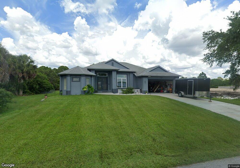
12306 Lackawanna Ln Port Charlotte, FL 33953
Northwest Port Charlotte NeighborhoodEstimated Value: $406,082 - $583,000
3
Beds
2
Baths
2,329
Sq Ft
$217/Sq Ft
Est. Value
About This Home
This home is located at 12306 Lackawanna Ln, Port Charlotte, FL 33953 and is currently estimated at $506,021, approximately $217 per square foot. 12306 Lackawanna Ln is a home located in Charlotte County with nearby schools including Liberty Elementary School, Murdock Middle School, and Port Charlotte High School.
Ownership History
Date
Name
Owned For
Owner Type
Purchase Details
Closed on
Dec 2, 2023
Sold by
Rossetti Michael and Rossetti Darlene
Bought by
Rossetti Kacey and Rossetti Michael
Current Estimated Value
Purchase Details
Closed on
Dec 2, 2005
Sold by
Rossetti Mary Lou and Rossetti George
Bought by
Rossetti Michael and Rossetti Darlene
Purchase Details
Closed on
Dec 15, 1994
Sold by
Rhines Richard L and Rhines Jean I
Bought by
Rossetti Mary Lou and Rossetti George
Create a Home Valuation Report for This Property
The Home Valuation Report is an in-depth analysis detailing your home's value as well as a comparison with similar homes in the area
Home Values in the Area
Average Home Value in this Area
Purchase History
| Date | Buyer | Sale Price | Title Company |
|---|---|---|---|
| Rossetti Kacey | $100 | None Listed On Document | |
| Rossetti Michael | -- | -- | |
| Rossetti Mary Lou | $13,000 | -- |
Source: Public Records
Tax History Compared to Growth
Tax History
| Year | Tax Paid | Tax Assessment Tax Assessment Total Assessment is a certain percentage of the fair market value that is determined by local assessors to be the total taxable value of land and additions on the property. | Land | Improvement |
|---|---|---|---|---|
| 2024 | $2,276 | $361,537 | $16,150 | $345,387 |
| 2023 | $2,276 | $134,509 | $0 | $0 |
| 2022 | $2,183 | $130,591 | $0 | $0 |
| 2021 | $2,170 | $126,787 | $0 | $0 |
| 2020 | $2,120 | $125,036 | $0 | $0 |
| 2019 | $2,030 | $122,225 | $0 | $0 |
| 2018 | $1,867 | $119,946 | $0 | $0 |
| 2017 | $1,845 | $117,479 | $0 | $0 |
| 2016 | $1,830 | $115,063 | $0 | $0 |
| 2015 | $1,819 | $114,263 | $0 | $0 |
| 2014 | $1,700 | $113,356 | $0 | $0 |
Source: Public Records
Map
Nearby Homes
- 12301 Endicott Ln Unit 10
- 12444 Eisenhower Dr
- 12518 Eisenhower Dr
- 12308 Eisenhower Dr
- 13495 Eisenhower Dr
- 13487 Eisenhower Dr
- 1288 Wheatley St
- 1343 Underhill Cir
- 12253 Endicott Ln
- 12262 Toynbee Ln
- 12345 Greenleaf Ln
- 12360 Greenleaf Ln
- 12281 Greenleaf Ln
- 12373 Toynbee Ln
- 12349 Toynbee Ln
- 12477 Eisenhower Dr Unit 6
- 12477 Eisenhower Dr
- 12266 Defender Dr
- 12280 Greenleaf Ln
- 1221 Underhill Cir
- 12298 Lackawanna Ln
- 12314 Lackawanna Ln
- 12331 Eisenhower Dr
- 12339 Eisenhower Dr
- 12290 Lackawanna Ln
- 12322 Lackawanna Ln
- 12323 Lackawanna Ln
- 12315 Eisenhower Dr
- 12330 Lackawanna Ln
- 12307 Eisenhower Dr
- 12338 Lackawanna Ln
- 12274 Lackawanna Ln
- 12332 Eisenhower Dr
- 12339 Lackawanna Ln
- 12340 Eisenhower Dr
- 12498 Eisenhower Dr
- 12308/12316 Eisenhower Dr
- 12308 & 12316 Eisenhower Dr
- 12356 Eisenhower Dr
- 12291 Eisenhower Dr