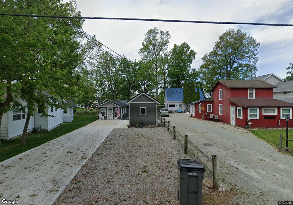
12307 N Kings Dr Unit Peir 689-A050-33 Syracuse, IN 46567
Estimated Value: $239,000 - $290,638
3
Beds
1
Bath
782
Sq Ft
$336/Sq Ft
Est. Value
About This Home
This home is located at 12307 N Kings Dr Unit Peir 689-A050-33, Syracuse, IN 46567 and is currently estimated at $262,660, approximately $335 per square foot. 12307 N Kings Dr Unit Peir 689-A050-33 is a home located in Kosciusko County with nearby schools including Wawasee High School.
Ownership History
Date
Name
Owned For
Owner Type
Purchase Details
Closed on
Oct 16, 2018
Sold by
Wenstrup Brian M and Wenstrup Valerie K
Bought by
Gerger John J and Gerger Dodie M
Current Estimated Value
Home Financials for this Owner
Home Financials are based on the most recent Mortgage that was taken out on this home.
Original Mortgage
$132,750
Outstanding Balance
$115,766
Interest Rate
4.5%
Mortgage Type
New Conventional
Estimated Equity
$146,894
Purchase Details
Closed on
Jul 26, 2002
Sold by
Lisa Zillman
Bought by
Laird David and Laird Brenda
Purchase Details
Closed on
Jun 21, 1999
Sold by
Drogemuller Pearl J and Drogemuller Carl E
Bought by
Zillman Jim C and Zillman Lisa M
Create a Home Valuation Report for This Property
The Home Valuation Report is an in-depth analysis detailing your home's value as well as a comparison with similar homes in the area
Home Values in the Area
Average Home Value in this Area
Purchase History
| Date | Buyer | Sale Price | Title Company |
|---|---|---|---|
| Gerger John J | -- | Hamilton Title | |
| Laird David | $148,000 | -- | |
| Zillman Jim C | $95,000 | -- |
Source: Public Records
Mortgage History
| Date | Status | Borrower | Loan Amount |
|---|---|---|---|
| Open | Gerger John J | $132,750 |
Source: Public Records
Tax History Compared to Growth
Tax History
| Year | Tax Paid | Tax Assessment Tax Assessment Total Assessment is a certain percentage of the fair market value that is determined by local assessors to be the total taxable value of land and additions on the property. | Land | Improvement |
|---|---|---|---|---|
| 2024 | $1,651 | $185,200 | $91,800 | $93,400 |
| 2023 | $1,616 | $177,600 | $88,200 | $89,400 |
| 2022 | $1,417 | $154,800 | $79,000 | $75,800 |
| 2021 | $1,116 | $120,800 | $66,900 | $53,900 |
| 2020 | $976 | $114,900 | $63,800 | $51,100 |
| 2019 | $1,078 | $112,800 | $63,800 | $49,000 |
| 2018 | $1,002 | $109,800 | $63,800 | $46,000 |
| 2017 | $915 | $98,100 | $59,200 | $38,900 |
| 2016 | $799 | $98,100 | $59,200 | $38,900 |
| 2014 | $817 | $91,200 | $56,200 | $35,000 |
| 2013 | $817 | $94,300 | $57,800 | $36,500 |
Source: Public Records
Map
Nearby Homes
- 6071 E Island Ave
- 822 S Lakeside Dr
- 919 S Haug St
- 700 S Lakeside Dr Unit 8
- 531 E Lake View Rd
- 12967 N Eastshore Dr
- 407 E Cable Ln
- 6793 E Eli Lilly Rd
- tbd Huntington
- 500 E Medusa St
- 6458 E Waco Dr
- 6592 E Waco Dr
- 300 E Medusa St Unit 5D
- 1135 E Northshore Dr
- 13495 N Hillside Dr
- 6660 Beck Ave
- 12018 N Woodland Acres Dr
- 205 W Washington St
- 4392 E Fox Run Dr
- 0 TBD N Huntington St
- 12307 N Kings Dr Unit Pier 689-A050-33
- 12307 N Kings Dr
- 6046 E Island Ave
- 12313 N Kings Dr
- 12323 N Kings Dr
- 12321 N Kings Dr
- 12329 N Kings Dr
- 6062 E Island Ave
- 6045 E Island Ave
- 12337 N Kings Dr
- 6049 E Island Ave
- 6041 E Island Ave
- 6055 E Island Ave
- 6033 E Island Ave
- 6070 E Island Ave
- 6037 E Island Ave
- 6061 E Island Ave
- 6010 E Island Ave
- 6027 E Island Ave
- 6065 E Island Ave