Estimated Value: $504,000 - $535,000
4
Beds
4
Baths
3,282
Sq Ft
$158/Sq Ft
Est. Value
About This Home
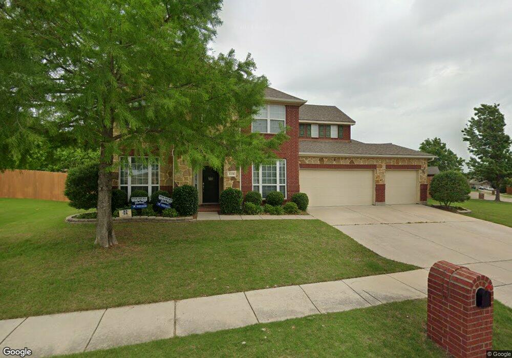
This home is located at 1231 Cedar Branch Dr, Wylie, TX 75098 and is currently estimated at $519,381, approximately $158 per square foot. 1231 Cedar Branch Dr is a home located in Collin County with nearby schools including Wally Watkins Elementary School, AB Harrison Intermediate School, and Grady Burnett J High School.
Ownership History
Date
Name
Owned For
Owner Type
Purchase Details
Closed on
Mar 3, 2009
Sold by
Rh Of Texas Limited Partnership
Bought by
Roper Benjamin R and Roper Holly D
Current Estimated Value
Home Financials for this Owner
Home Financials are based on the most recent Mortgage that was taken out on this home.
Original Mortgage
$199,080
Outstanding Balance
$126,117
Interest Rate
5.06%
Estimated Equity
$393,264
Purchase Details
Closed on
Aug 17, 2006
Sold by
Bozman Farm Development Ltd
Bought by
Rh Of Texas Lp
Create a Home Valuation Report for This Property
The Home Valuation Report is an in-depth analysis detailing your home's value as well as a comparison with similar homes in the area
Home Values in the Area
Average Home Value in this Area
Purchase History
| Date | Buyer | Sale Price | Title Company |
|---|---|---|---|
| Roper Benjamin R | -- | None Available | |
| Rh Of Texas Lp | -- | Fatco |
Source: Public Records
Mortgage History
| Date | Status | Borrower | Loan Amount |
|---|---|---|---|
| Open | Roper Benjamin R | $199,080 |
Source: Public Records
Tax History Compared to Growth
Tax History
| Year | Tax Paid | Tax Assessment Tax Assessment Total Assessment is a certain percentage of the fair market value that is determined by local assessors to be the total taxable value of land and additions on the property. | Land | Improvement |
|---|---|---|---|---|
| 2025 | $7,472 | $490,474 | $126,000 | $405,640 |
| 2024 | $7,472 | $445,885 | $126,000 | $398,985 |
| 2023 | $7,472 | $405,350 | $114,000 | $396,610 |
| 2022 | $8,085 | $368,500 | $96,000 | $348,274 |
| 2021 | $7,882 | $335,000 | $84,000 | $251,000 |
| 2020 | $8,194 | $330,000 | $60,000 | $270,000 |
| 2019 | $8,701 | $331,100 | $60,000 | $274,000 |
| 2018 | $8,106 | $301,000 | $55,000 | $246,000 |
| 2017 | $7,886 | $303,543 | $45,000 | $258,543 |
| 2016 | $7,396 | $267,000 | $40,000 | $227,000 |
| 2015 | $5,976 | $242,000 | $40,000 | $202,000 |
Source: Public Records
Map
Nearby Homes
- 1318 Chestnut Hill Dr
- 1320 Cedar Branch Dr
- 1321 Iron Horse St
- 1210 Iron Horse St
- 1201 E Stone Rd
- 1323 Canyon Creek Rd
- 1316 Taren Trail
- 1318 Taren Trail
- 407 Sparrow Dr
- 1330 Canyon Creek Rd
- 306 Foxwood Ct
- 312 Maltese Cir
- 1503 E Collins Blvd
- 1210 Troy Rd
- 1115 Nighthawk Dr
- 1209 Surrey Cir
- 1613 Saddle Ridge Dr
- 825 Forest Edge Ln
- 1605 Roberts Ravine Rd
- 409 Cedar Ridge Dr
- 1303 Clear Creek Dr
- 1229 Cedar Branch Dr
- 1305 Clear Creek Dr
- 1226 Cedar Branch Dr
- 1227 Cedar Branch Dr
- 1224 Cedar Branch Dr
- 1228 Cedar Branch Dr
- 1307 Clear Creek Dr
- 1222 Cedar Branch Dr
- 1300 Cedar Branch Dr
- 1300 Clear Creek Dr
- 1220 Cedar Branch Dr
- 1309 Clear Creek Dr
- 1225 Cedar Branch Dr
- 1302 Cedar Branch Dr
- 1302 Clear Creek Dr
- 1218 Cedar Branch Dr
- 1303 Chestnut Hill Dr
- 1305 Chestnut Hill Dr
- 1311 Clear Creek Dr