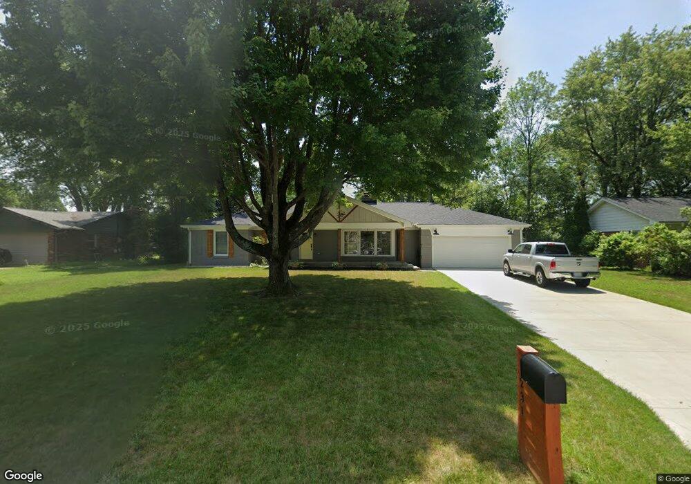
1231 E Adams Dr Franklin, IN 46131
Estimated Value: $343,029 - $382,000
3
Beds
2
Baths
2,158
Sq Ft
$170/Sq Ft
Est. Value
About This Home
This home is located at 1231 E Adams Dr, Franklin, IN 46131 and is currently estimated at $366,257, approximately $169 per square foot. 1231 E Adams Dr is a home located in Johnson County with nearby schools including Webb Elementary School, Franklin Community Middle School, and Custer Baker Intermediate School.
Ownership History
Date
Name
Owned For
Owner Type
Purchase Details
Closed on
Aug 1, 2025
Sold by
Naumovich Grace Emily and Paszek Grace Emily
Bought by
Hagan Donald P and Hagan Michele M
Current Estimated Value
Home Financials for this Owner
Home Financials are based on the most recent Mortgage that was taken out on this home.
Original Mortgage
$292,000
Outstanding Balance
$290,986
Interest Rate
5.89%
Mortgage Type
New Conventional
Estimated Equity
$75,271
Purchase Details
Closed on
Apr 28, 2023
Sold by
Paszek Joseph R and Paszek Amy D
Bought by
Paszek Grace Emily and Naumovich Andrew
Purchase Details
Closed on
Aug 19, 2022
Sold by
Goodman Douglas S
Bought by
Paszek Joseph R and Paszek Amy D
Purchase Details
Closed on
Mar 13, 2019
Sold by
Goodman David L
Bought by
Goodman Douglas S
Purchase Details
Closed on
Apr 24, 2007
Sold by
Goodman Barbara J and Loomis Susan M
Bought by
Goodman Barbara J
Create a Home Valuation Report for This Property
The Home Valuation Report is an in-depth analysis detailing your home's value as well as a comparison with similar homes in the area
Home Values in the Area
Average Home Value in this Area
Purchase History
| Date | Buyer | Sale Price | Title Company |
|---|---|---|---|
| Hagan Donald P | -- | None Listed On Document | |
| Paszek Grace Emily | -- | None Listed On Document | |
| Paszek Joseph R | -- | Huddleston & Huddleston | |
| Goodman Douglas S | -- | None Available | |
| Goodman Barbara J | -- | None Available |
Source: Public Records
Mortgage History
| Date | Status | Borrower | Loan Amount |
|---|---|---|---|
| Open | Hagan Donald P | $292,000 |
Source: Public Records
Tax History Compared to Growth
Tax History
| Year | Tax Paid | Tax Assessment Tax Assessment Total Assessment is a certain percentage of the fair market value that is determined by local assessors to be the total taxable value of land and additions on the property. | Land | Improvement |
|---|---|---|---|---|
| 2025 | $3,092 | $357,800 | $39,100 | $318,700 |
| 2024 | $3,092 | $278,600 | $39,100 | $239,500 |
| 2023 | $3,035 | $272,300 | $39,100 | $233,200 |
| 2022 | $2,174 | $195,600 | $28,500 | $167,100 |
| 2021 | $2,121 | $191,000 | $28,500 | $162,500 |
| 2020 | $2,031 | $182,500 | $28,500 | $154,000 |
| 2019 | $1,866 | $168,200 | $28,500 | $139,700 |
| 2018 | $3,244 | $162,200 | $28,500 | $133,700 |
| 2017 | $1,536 | $152,600 | $28,500 | $124,100 |
| 2016 | $1,658 | $162,100 | $28,500 | $133,600 |
| 2014 | $1,492 | $149,200 | $28,500 | $120,700 |
| 2013 | $1,492 | $139,700 | $28,500 | $111,200 |
Source: Public Records
Map
Nearby Homes
- 1130 E Adams Dr
- 1121 E Adams Dr
- 1110 Hillview Dr
- 1532 Williamsburg Ln
- 1083 Beechtree Ln
- 750 Hurricane St
- 651 Hamilton Ave
- 1850 Longest Dr
- 1185 Beechtree Ln
- 348 Ohio St
- 698 Yandes St
- 1682 Millpond Ln
- 1669 Millpond Ln
- 1646 Millpond Ln
- 1636 Millpond Ln
- 1679 Millpond Ln
- 1690 Millpond Ln
- 1642 Millpond Ln
- 1663 Millpond Ln
- 1640 Millpond Ln
- 1221 E Adams Dr
- 1241 E Adams Dr
- 1230 E King St
- 1251 E Adams Dr
- 1215 E Adams Dr
- 1240 E King St
- 1220 E King St
- 1230 E Adams Dr
- 1250 E King St
- 1220 E Adams Dr
- 1240 E Adams Dr
- 1210 E King St
- 1201 E Adams Dr
- 1250 E Adams Dr
- 1260 E King St
- 1200 E Adams Dr
- 1260 E Adams Dr
- 1271 E Adams Dr
- 1270 E King St
- 1231 Hillview Dr