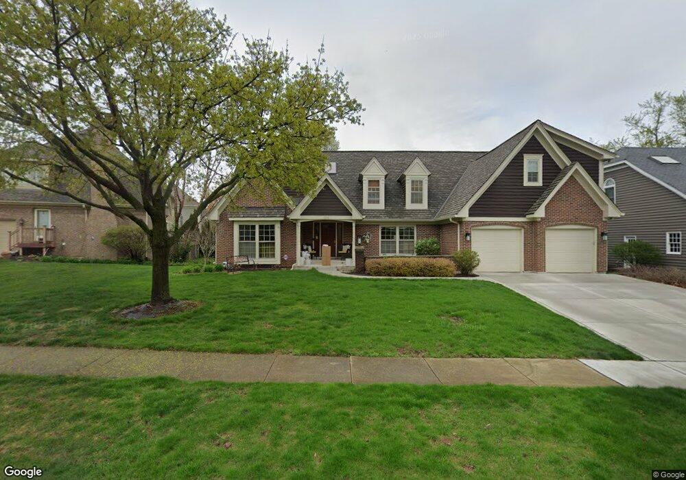
1231 Midwest Ln Wheaton, IL 60189
West Wheaton NeighborhoodEstimated Value: $906,924 - $1,006,000
4
Beds
4
Baths
3,509
Sq Ft
$275/Sq Ft
Est. Value
About This Home
This home is located at 1231 Midwest Ln, Wheaton, IL 60189 and is currently estimated at $963,481, approximately $274 per square foot. 1231 Midwest Ln is a home located in DuPage County with nearby schools including Madison Elementary School, Edison Middle School, and Wheaton Warrenville South High School.
Ownership History
Date
Name
Owned For
Owner Type
Purchase Details
Closed on
Apr 13, 1995
Sold by
Anderson Bruce R and Anderson Kenna L
Bought by
Anderson Bruce R and Anderson Kenna L
Current Estimated Value
Create a Home Valuation Report for This Property
The Home Valuation Report is an in-depth analysis detailing your home's value as well as a comparison with similar homes in the area
Home Values in the Area
Average Home Value in this Area
Purchase History
| Date | Buyer | Sale Price | Title Company |
|---|---|---|---|
| Anderson Bruce R | -- | -- |
Source: Public Records
Tax History Compared to Growth
Tax History
| Year | Tax Paid | Tax Assessment Tax Assessment Total Assessment is a certain percentage of the fair market value that is determined by local assessors to be the total taxable value of land and additions on the property. | Land | Improvement |
|---|---|---|---|---|
| 2024 | $16,810 | $268,808 | $36,970 | $231,838 |
| 2023 | $16,181 | $247,430 | $34,030 | $213,400 |
| 2022 | $15,778 | $233,830 | $32,160 | $201,670 |
| 2021 | $15,733 | $228,290 | $31,400 | $196,890 |
| 2020 | $15,687 | $226,170 | $31,110 | $195,060 |
| 2019 | $15,335 | $220,200 | $30,290 | $189,910 |
| 2018 | $17,433 | $246,690 | $28,540 | $218,150 |
| 2017 | $17,188 | $237,590 | $27,490 | $210,100 |
| 2016 | $16,976 | $228,100 | $26,390 | $201,710 |
| 2015 | $16,866 | $217,610 | $25,180 | $192,430 |
| 2014 | $17,283 | $219,880 | $50,760 | $169,120 |
| 2013 | $16,838 | $220,540 | $50,910 | $169,630 |
Source: Public Records
Map
Nearby Homes
- Lot 1 Foothill Dr
- 1519 Foothill Dr
- 1028 Lodalia Ct
- 1110 S Gables Blvd
- 1601 W Wiesbrook Rd
- 1021 Greenwood Dr
- 1219 Golf Ln
- 1961 Wexford Cir Unit 116
- 1907 Gresham Cir Unit D
- 1785 Grosvenor Cir Unit A
- 620 Crest St
- 1420 Stonebridge Trail Unit 1-3
- 615 Polo Dr
- 141 Loretto Ct
- 536 W Evergreen St
- 325 W Park Ave
- 1460 Stonebridge Cir Unit G9
- 1477 S County Farm Rd Unit 23F
- 2059 W Roosevelt Rd
- 24 Winners Cup Cir Unit 3
- 1561 Promenade Ln
- 1541 Promenade Ln
- 1230 Midwest Ln
- 1220 Midwest Ln
- 1234 Midwest Ln
- 1210 Midwest Ln
- 1510 Cadet Ct
- 1170 Midwest Ln
- 1521 Promenade Ln
- 1506 Cadet Ct
- 1560 Promenade Ln
- 1238 Midwest Ln
- 1507 Cadet Ct
- 1160 Midwest Ln
- 1200 Midwest Ln
- 1540 Promenade Ln
- 1511 Promenade Ln
- 1242 Midwest Ln
- 1247 Midwest Ln
- 1150 Midwest Ln