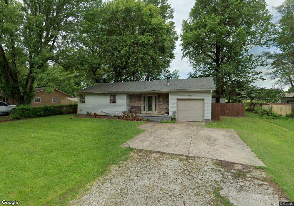
1231 N Fender Ave Springfield, MO 65803
Estimated Value: $147,000 - $169,000
3
Beds
1
Bath
1,012
Sq Ft
$158/Sq Ft
Est. Value
About This Home
This home is located at 1231 N Fender Ave, Springfield, MO 65803 and is currently estimated at $159,428, approximately $157 per square foot. 1231 N Fender Ave is a home located in Greene County with nearby schools including Willard Intermediate-South, Willard High School, and St. Joseph Elementary School.
Ownership History
Date
Name
Owned For
Owner Type
Purchase Details
Closed on
Feb 13, 2009
Sold by
Killingsworth Donnita A and Killingsworth David
Bought by
Gill Elizabeth A
Current Estimated Value
Home Financials for this Owner
Home Financials are based on the most recent Mortgage that was taken out on this home.
Original Mortgage
$69,714
Outstanding Balance
$43,973
Interest Rate
5.06%
Mortgage Type
FHA
Estimated Equity
$115,455
Create a Home Valuation Report for This Property
The Home Valuation Report is an in-depth analysis detailing your home's value as well as a comparison with similar homes in the area
Home Values in the Area
Average Home Value in this Area
Purchase History
| Date | Buyer | Sale Price | Title Company |
|---|---|---|---|
| Gill Elizabeth A | -- | None Available |
Source: Public Records
Mortgage History
| Date | Status | Borrower | Loan Amount |
|---|---|---|---|
| Open | Gill Elizabeth A | $69,714 |
Source: Public Records
Tax History Compared to Growth
Tax History
| Year | Tax Paid | Tax Assessment Tax Assessment Total Assessment is a certain percentage of the fair market value that is determined by local assessors to be the total taxable value of land and additions on the property. | Land | Improvement |
|---|---|---|---|---|
| 2025 | $853 | $16,990 | $3,230 | $13,760 |
| 2024 | $853 | $15,500 | $2,850 | $12,650 |
| 2023 | $850 | $15,500 | $2,850 | $12,650 |
| 2022 | $792 | $14,360 | $2,850 | $11,510 |
| 2021 | $792 | $14,360 | $2,850 | $11,510 |
| 2020 | $689 | $12,370 | $2,850 | $9,520 |
| 2019 | $686 | $12,370 | $2,850 | $9,520 |
| 2018 | $636 | $11,420 | $2,850 | $8,570 |
| 2017 | $631 | $11,420 | $2,850 | $8,570 |
| 2016 | $627 | $11,420 | $2,850 | $8,570 |
| 2015 | $623 | $11,420 | $2,850 | $8,570 |
| 2014 | $627 | $11,420 | $2,850 | $8,570 |
Source: Public Records
Map
Nearby Homes
- 3952 W Collings St
- 1523 N Western Ave
- 3921 W Young St
- 1128 N Ohara Ave
- 3518 W Waddill St
- 3251 W Scott St
- 3200 W Lynn St
- 4001 W Chestnut Expy
- 1017 N Golden Ave
- 220 N Duke Ave
- 3660 W Dover St
- 1537 N Colgate Ave
- 207 S Dexter Ave
- 2956 W Lynn St
- 2944 W Lynn St
- 3022 W Brower St
- 306 S Dexter Ave
- 303 S Suburban Ave
- 316 S Monterey Ave
- 928 N Glenn Ave
- 1239 N Fender Ave
- 1223 N Fender Ave
- 1247 N Fender Ave
- 1232 N Fender Ave
- 1224 N Fender Ave
- 1242 N Fender Ave
- 1248 N Fender Ave
- 1303 N Fender Ave
- 1304 N Fender Ave
- 1231 N Dawn Ave
- 1311 N Fender Ave
- 1223 N Dawn Ave
- 1239 N Dawn Ave
- 1247 N Dawn Ave
- 1310 N Fender Ave
- 1303 N Dawn Ave
- 1319 N Fender Ave
- 1311 N Dawn Ave
- 1327 N Fender Ave
- 1326 N Fender Ave