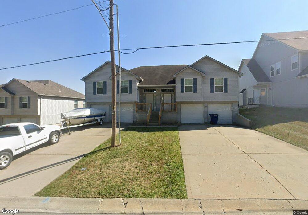
1231 R D Mize Rd Grain Valley, MO 64029
Estimated Value: $350,000 - $432,982
6
Beds
4
Baths
2,018
Sq Ft
$193/Sq Ft
Est. Value
About This Home
This home is located at 1231 R D Mize Rd, Grain Valley, MO 64029 and is currently estimated at $389,496, approximately $193 per square foot. 1231 R D Mize Rd is a home located in Jackson County with nearby schools including Grain Valley High School and St John Lalande School.
Ownership History
Date
Name
Owned For
Owner Type
Purchase Details
Closed on
May 22, 2007
Sold by
Aegis Mortgage Corp
Bought by
Petiryan Armine
Current Estimated Value
Home Financials for this Owner
Home Financials are based on the most recent Mortgage that was taken out on this home.
Original Mortgage
$136,850
Outstanding Balance
$83,196
Interest Rate
6.16%
Mortgage Type
Purchase Money Mortgage
Estimated Equity
$306,300
Purchase Details
Closed on
Dec 4, 2006
Sold by
Withrow Michael
Bought by
Aegis Mortgage Corp
Purchase Details
Closed on
Jul 28, 2005
Sold by
Ancona Construction Inc
Bought by
Withrow Michael
Home Financials for this Owner
Home Financials are based on the most recent Mortgage that was taken out on this home.
Original Mortgage
$52,000
Interest Rate
5.65%
Mortgage Type
Stand Alone Second
Create a Home Valuation Report for This Property
The Home Valuation Report is an in-depth analysis detailing your home's value as well as a comparison with similar homes in the area
Home Values in the Area
Average Home Value in this Area
Purchase History
| Date | Buyer | Sale Price | Title Company |
|---|---|---|---|
| Petiryan Armine | -- | Continental Title Company | |
| Aegis Mortgage Corp | $237,331 | None Available | |
| Withrow Michael | -- | -- |
Source: Public Records
Mortgage History
| Date | Status | Borrower | Loan Amount |
|---|---|---|---|
| Open | Petiryan Armine | $136,850 | |
| Previous Owner | Withrow Michael | $52,000 |
Source: Public Records
Tax History Compared to Growth
Tax History
| Year | Tax Paid | Tax Assessment Tax Assessment Total Assessment is a certain percentage of the fair market value that is determined by local assessors to be the total taxable value of land and additions on the property. | Land | Improvement |
|---|---|---|---|---|
| 2025 | $6,875 | $70,859 | $6,673 | $64,186 |
| 2024 | $6,618 | $83,465 | $8,451 | $75,014 |
| 2023 | $6,618 | $83,465 | $7,953 | $75,512 |
| 2022 | $4,857 | $53,580 | $3,420 | $50,160 |
| 2021 | $4,743 | $53,580 | $3,420 | $50,160 |
| 2020 | $4,215 | $46,965 | $3,420 | $43,545 |
| 2019 | $4,129 | $46,965 | $3,420 | $43,545 |
| 2018 | $3,814 | $40,536 | $5,138 | $35,398 |
| 2017 | $3,814 | $40,536 | $5,138 | $35,398 |
| 2016 | $3,717 | $39,520 | $6,783 | $32,737 |
| 2014 | $3,707 | $39,114 | $6,787 | $32,327 |
Source: Public Records
Map
Nearby Homes
- 1211 NW Scenic Dr
- 1208 NW Golfview Dr
- 1206 NW Baytree Dr
- 605 NW Silverstone Cir
- 1007 NW Long Dr
- 1229 NW Ashley Dr
- 1235 NW Ashley Ln
- 708 Pavillion Dr
- 2609 NE Amanda Ln
- 2613 NE Amanda Ln
- 1400 NW Burr Oak Ct
- 2701 NE Crestview St
- 2700 NE Crestview St
- 2605 NE Crestview St
- 2601 NE Crestview St
- 2601 NE Wheatley Dr
- 2513 NE Wheatley Dr
- 2512 NE Wheatley Dr
- 2704 NE Amanda Ln
- 1403 NW Burr Oak Ct
- 1235 R D Mize Rd
- 1237 R D Mize Rd
- 1227 R D Mize Rd
- 809 NW Meadow Rd
- 1222 R D Mize Rd
- 1118 NW Scenic Dr
- 1220 R D Mize Rd
- 1116 NW Scenic Dr
- 1223 R D Mize Rd
- 1225 R D Mize Rd
- 807 NW Meadow Rd
- 1218 R D Mize Rd
- 1221 R D Mize Rd
- 1114 NW Scenic Dr
- 812 NW Meadow Rd
- 1216 R D Mize Rd
- 1300 R D Mize Rd
- 1219 R D Mize Rd
- 1112 NW Scenic Dr
- 1117 NW Scenic Dr