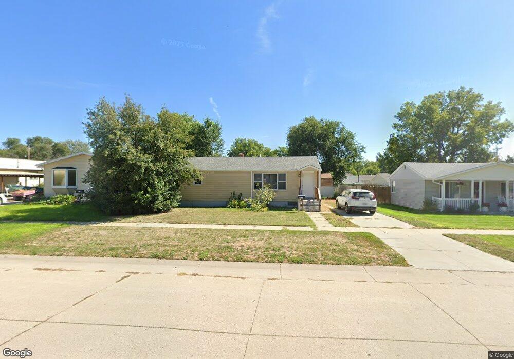
1231 Toluca Ave Alliance, NE 69301
Estimated Value: $86,700 - $114,000
2
Beds
1
Bath
921
Sq Ft
$106/Sq Ft
Est. Value
About This Home
This home is located at 1231 Toluca Ave, Alliance, NE 69301 and is currently estimated at $97,925, approximately $106 per square foot. 1231 Toluca Ave is a home located in Box Butte County with nearby schools including Alliance High School, St. Agnes Academy, and Immanuel Evangelical Lutheran School.
Ownership History
Date
Name
Owned For
Owner Type
Purchase Details
Closed on
Sep 8, 2022
Sold by
Walls and Kaitlyn
Bought by
Breen Brittany A
Current Estimated Value
Home Financials for this Owner
Home Financials are based on the most recent Mortgage that was taken out on this home.
Original Mortgage
$65,656
Outstanding Balance
$62,711
Interest Rate
5.22%
Mortgage Type
New Conventional
Estimated Equity
$35,214
Purchase Details
Closed on
Aug 6, 2013
Sold by
Long Melissa Jo and Dexter Melissa Jo
Bought by
Walls Preston
Home Financials for this Owner
Home Financials are based on the most recent Mortgage that was taken out on this home.
Original Mortgage
$57,142
Interest Rate
4.53%
Mortgage Type
Future Advance Clause Open End Mortgage
Create a Home Valuation Report for This Property
The Home Valuation Report is an in-depth analysis detailing your home's value as well as a comparison with similar homes in the area
Home Values in the Area
Average Home Value in this Area
Purchase History
| Date | Buyer | Sale Price | Title Company |
|---|---|---|---|
| Breen Brittany A | -- | Kunzman Title Company | |
| Walls Preston | -- | Kunzman Title |
Source: Public Records
Mortgage History
| Date | Status | Borrower | Loan Amount |
|---|---|---|---|
| Open | Breen Brittany A | $65,656 | |
| Previous Owner | Walls Preston | $57,142 |
Source: Public Records
Tax History Compared to Growth
Tax History
| Year | Tax Paid | Tax Assessment Tax Assessment Total Assessment is a certain percentage of the fair market value that is determined by local assessors to be the total taxable value of land and additions on the property. | Land | Improvement |
|---|---|---|---|---|
| 2024 | $787 | $62,875 | $8,400 | $54,475 |
| 2023 | $1,081 | $62,875 | $8,400 | $54,475 |
| 2022 | $1,180 | $64,785 | $7,560 | $57,225 |
| 2021 | $1,194 | $64,785 | $7,560 | $57,225 |
| 2020 | $1,191 | $64,785 | $7,560 | $57,225 |
| 2019 | $1,163 | $64,785 | $7,560 | $57,225 |
| 2018 | $1,185 | $66,350 | $7,560 | $58,790 |
| 2017 | $1,086 | $58,521 | $5,460 | $53,061 |
| 2016 | $1,074 | $58,521 | $5,460 | $53,061 |
| 2015 | $1,007 | $55,585 | $5,460 | $50,125 |
| 2014 | $1,007 | $55,470 | $5,460 | $50,010 |
Source: Public Records
Map
Nearby Homes
- 1239 Toluca Ave
- 1232 Cheyenne Ave
- 924 Big Horn Ave
- 1019 Laramie Ave
- 936 Platte Ave
- 911 Emerson Ave
- 907 Toluca Ave
- 904 Laramie Ave
- 1021 Dakota Ave
- 819 Black Hills Ave
- 20th St Emerson Ave To Colorado Ave
- 719 Toluca Ave
- 672 W 20th St
- 621 Emerson Ave
- 2039 Niobrara Ave
- 1004 Missouri Ave
- 917 Missouri Ave
- 420 Laramie Ave
- 615 Sweetwater Ave
- 316 Big Horn Ave
- 1235 Toluca Ave
- 1227 Toluca Ave
- 1221 Toluca Ave
- 1236 Big Horn Ave
- 1243 Toluca Ave
- 1228 Big Horn Ave
- 1240 Big Horn Ave
- 1211 Toluca Ave
- 1224 Big Horn Ave
- 1306 Toluca Ave
- 1244 Big Horn Ave
- 1316 Toluca Ave
- 1220 Big Horn Ave
- 1207 Toluca Ave
- 1220 Toluca Ave
- 1403 Toluca Ave
- 504 W 14th St
- 1212 Big Horn Ave
- 1404 Big Horn Ave
- 1407 Toluca Ave