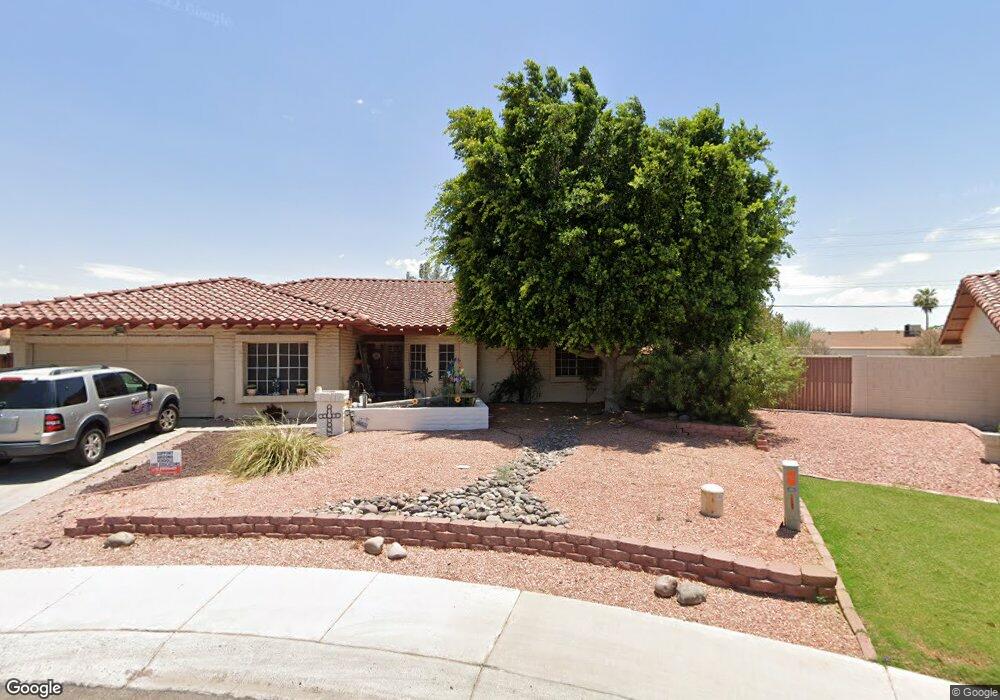
12313 N 71st Dr Peoria, AZ 85381
Estimated Value: $634,808 - $745,000
5
Beds
3
Baths
4,011
Sq Ft
$172/Sq Ft
Est. Value
About This Home
This home is located at 12313 N 71st Dr, Peoria, AZ 85381 and is currently estimated at $691,202, approximately $172 per square foot. 12313 N 71st Dr is a home located in Maricopa County with nearby schools including Oakwood Elementary School, Cactus High School, and Legacy Traditional School - Glendale.
Ownership History
Date
Name
Owned For
Owner Type
Purchase Details
Closed on
Apr 28, 2003
Sold by
Harris Raymond and Harris Vivian
Bought by
Kattau Timothy G and Kattau Karen L
Current Estimated Value
Home Financials for this Owner
Home Financials are based on the most recent Mortgage that was taken out on this home.
Original Mortgage
$193,500
Outstanding Balance
$83,854
Interest Rate
5.75%
Mortgage Type
Purchase Money Mortgage
Estimated Equity
$607,348
Purchase Details
Closed on
Jan 12, 1999
Sold by
Harris Raymond E and Harris Vivian M
Bought by
Harris Raymond and Harris Vivian
Home Financials for this Owner
Home Financials are based on the most recent Mortgage that was taken out on this home.
Original Mortgage
$188,000
Interest Rate
6.63%
Purchase Details
Closed on
Dec 28, 1998
Sold by
Harris Raymond and Harris Vivian
Bought by
Harris Raymond E and Harris Vivian M
Home Financials for this Owner
Home Financials are based on the most recent Mortgage that was taken out on this home.
Original Mortgage
$188,000
Interest Rate
6.63%
Create a Home Valuation Report for This Property
The Home Valuation Report is an in-depth analysis detailing your home's value as well as a comparison with similar homes in the area
Home Values in the Area
Average Home Value in this Area
Purchase History
| Date | Buyer | Sale Price | Title Company |
|---|---|---|---|
| Kattau Timothy G | $261,000 | Westland Title Agency Of Az | |
| Harris Raymond | -- | Transnation Title Insurance | |
| Harris Raymond E | -- | Transnation Title Ins Co |
Source: Public Records
Mortgage History
| Date | Status | Borrower | Loan Amount |
|---|---|---|---|
| Open | Kattau Timothy G | $193,500 | |
| Previous Owner | Harris Raymond E | $188,000 |
Source: Public Records
Tax History Compared to Growth
Tax History
| Year | Tax Paid | Tax Assessment Tax Assessment Total Assessment is a certain percentage of the fair market value that is determined by local assessors to be the total taxable value of land and additions on the property. | Land | Improvement |
|---|---|---|---|---|
| 2025 | $2,703 | $35,708 | -- | -- |
| 2024 | $2,738 | $34,008 | -- | -- |
| 2023 | $2,738 | $50,630 | $10,120 | $40,510 |
| 2022 | $2,681 | $38,700 | $7,740 | $30,960 |
| 2021 | $2,870 | $34,270 | $6,850 | $27,420 |
| 2020 | $2,897 | $33,730 | $6,740 | $26,990 |
| 2019 | $2,803 | $32,530 | $6,500 | $26,030 |
| 2018 | $2,711 | $32,350 | $6,470 | $25,880 |
| 2017 | $2,712 | $27,560 | $5,510 | $22,050 |
| 2016 | $2,685 | $27,350 | $5,470 | $21,880 |
| 2015 | $2,505 | $26,170 | $5,230 | $20,940 |
Source: Public Records
Map
Nearby Homes
- 7126 W Columbine Dr
- 7214 W Columbine Dr
- 7157 W Cherry Hills Dr
- 7113 W Sunnyside Dr
- 7220 W Larkspur Dr
- 7266 W Cherry Hills Dr
- 7126 W Jenan Dr
- 7233 W Corrine Dr
- 6914 W Sunnyside Dr Unit 3
- 6938 W Jenan Dr
- 6849 W Wethersfield Rd
- 12709 N 72nd Ave
- 6845 W Charter Oak Rd
- 7225 W Canterbury Dr
- 6821 W Cherry Hills Dr
- 6763 W Wethersfield Rd
- 6746 W Wethersfield Rd
- 6749 W Charter Oak Rd
- 7418 W Corrine Dr
- 6739 W Cactus Rd
- 12319 N 71st Dr
- 12307 N 71st Dr
- 7051 W Wethersfield Rd
- 12329 N 71st Dr
- 12301 N 71st Dr
- 7110 W Shaw Butte Dr
- 7050 W Wethersfield Rd
- 7120 W Shaw Butte Dr
- 12320 N 71st Dr
- 7045 W Wethersfield Rd
- 12330 N 71st Dr
- 12339 N 71st Dr
- 7130 W Shaw Butte Dr
- 7142 W Wethersfield Rd
- 7044 W Wethersfield Rd
- 7051 W Charter Oak Rd
- 7143 W Wethersfield Rd
- 12340 N 71st Dr
- 7140 W Shaw Butte Dr
- 12349 N 71st Dr