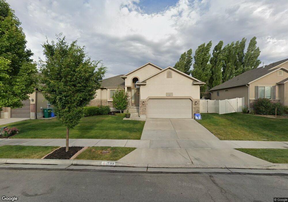
12314 Black Canyon Rd Riverton, UT 84096
Estimated Value: $563,242 - $600,000
3
Beds
2
Baths
1,369
Sq Ft
$424/Sq Ft
Est. Value
About This Home
This home is located at 12314 Black Canyon Rd, Riverton, UT 84096 and is currently estimated at $579,811, approximately $423 per square foot. 12314 Black Canyon Rd is a home located in Salt Lake County with nearby schools including Midas Creek Elementary School, Oquirrh Hills Middle School, and Riverton High School.
Ownership History
Date
Name
Owned For
Owner Type
Purchase Details
Closed on
Jun 3, 2019
Sold by
Ramsay Carol
Bought by
Ramsay Carol and Ramsay Jacob B
Current Estimated Value
Purchase Details
Closed on
Jun 24, 2016
Sold by
Salt Lake County
Bought by
Ramsay Carol
Home Financials for this Owner
Home Financials are based on the most recent Mortgage that was taken out on this home.
Original Mortgage
$206,200
Outstanding Balance
$164,166
Interest Rate
3.58%
Mortgage Type
New Conventional
Estimated Equity
$415,645
Purchase Details
Closed on
Jun 25, 2009
Sold by
Bach Homes Llc
Bought by
Ramsay Carol A
Home Financials for this Owner
Home Financials are based on the most recent Mortgage that was taken out on this home.
Original Mortgage
$217,950
Interest Rate
4.83%
Mortgage Type
Purchase Money Mortgage
Create a Home Valuation Report for This Property
The Home Valuation Report is an in-depth analysis detailing your home's value as well as a comparison with similar homes in the area
Home Values in the Area
Average Home Value in this Area
Purchase History
| Date | Buyer | Sale Price | Title Company |
|---|---|---|---|
| Ramsay Carol | -- | Accommodation | |
| Ramsay Carol | -- | Title Guarantee S Jordan | |
| Ramsay Carol A | -- | Meridian Title |
Source: Public Records
Mortgage History
| Date | Status | Borrower | Loan Amount |
|---|---|---|---|
| Open | Ramsay Carol | $206,200 | |
| Closed | Ramsay Carol A | $217,950 |
Source: Public Records
Tax History Compared to Growth
Tax History
| Year | Tax Paid | Tax Assessment Tax Assessment Total Assessment is a certain percentage of the fair market value that is determined by local assessors to be the total taxable value of land and additions on the property. | Land | Improvement |
|---|---|---|---|---|
| 2025 | $3,025 | $540,300 | $145,800 | $394,500 |
| 2024 | $3,025 | $523,600 | $141,300 | $382,300 |
| 2023 | $3,025 | $502,400 | $101,000 | $401,400 |
| 2022 | $3,187 | $510,100 | $99,000 | $411,100 |
| 2021 | $2,660 | $379,100 | $80,470 | $298,630 |
| 2020 | $2,511 | $333,600 | $78,800 | $254,800 |
| 2019 | $2,551 | $333,200 | $78,800 | $254,400 |
| 2018 | $2,410 | $309,900 | $76,400 | $233,500 |
| 2017 | $2,315 | $290,200 | $76,400 | $213,800 |
| 2016 | $2,244 | $269,900 | $76,400 | $193,500 |
| 2015 | $2,106 | $245,500 | $77,900 | $167,600 |
| 2014 | $2,024 | $231,400 | $74,200 | $157,200 |
Source: Public Records
Map
Nearby Homes
- 4587 W Flintlock Way
- 4494 W Osage Rd
- 12284 S Flintlock Way
- 12693 S Lincoln Peak Ln
- 12694 S Lincoln Peak Ln Unit 116
- 12694 S Lincoln Peak Ln
- 12687 S Lincoln Peak Ln Unit 126
- 12687 S Lincoln Peak Ln
- 12688 S Lincoln Peak Ln Unit 115
- 12688 S Lincoln Peak Ln
- 12686 Lincoln Peak Ln
- 12682 S Lincoln Peak Ln
- 12682 S Lincoln Peak Ln Unit 113
- 12676 S Lincoln Peak Ln
- 12676 S Lincoln Peak Ln Unit 112
- 12671 S Lincoln Peak Ln Unit 131
- 12671 S Lincoln Peak Ln
- 12674 S Lincoln Peak Ln
- 12674 S Lincoln Peak Ln Unit 111
- 12672 S Lincoln Peak Ln Unit 110
- 12324 Black Canyon Rd
- 12324 S Black Canyon Rd
- 12304 S Black Canyon Rd Unit LOT441
- 12304 Black Canyon Rd
- 12319 Black Powder Dr
- 12319 S Black Powder Dr
- 12327 S Black Powder Dr
- 12327 Black Powder Dr
- 12309 Black Powder Dr
- 12309 S Black Powder Dr
- 12296 S Black Canyon Rd
- 12334 Black Canyon Rd
- 12334 S Black Canyon Rd
- 12296 Black Canyon Rd
- 12313 Black Canyon Rd
- 12337 S Black Powder Dr
- 12323 S Black Canyon Rd
- 12337 Black Powder Dr
- 12323 Black Canyon Rd
- 12299 Black Powder Dr