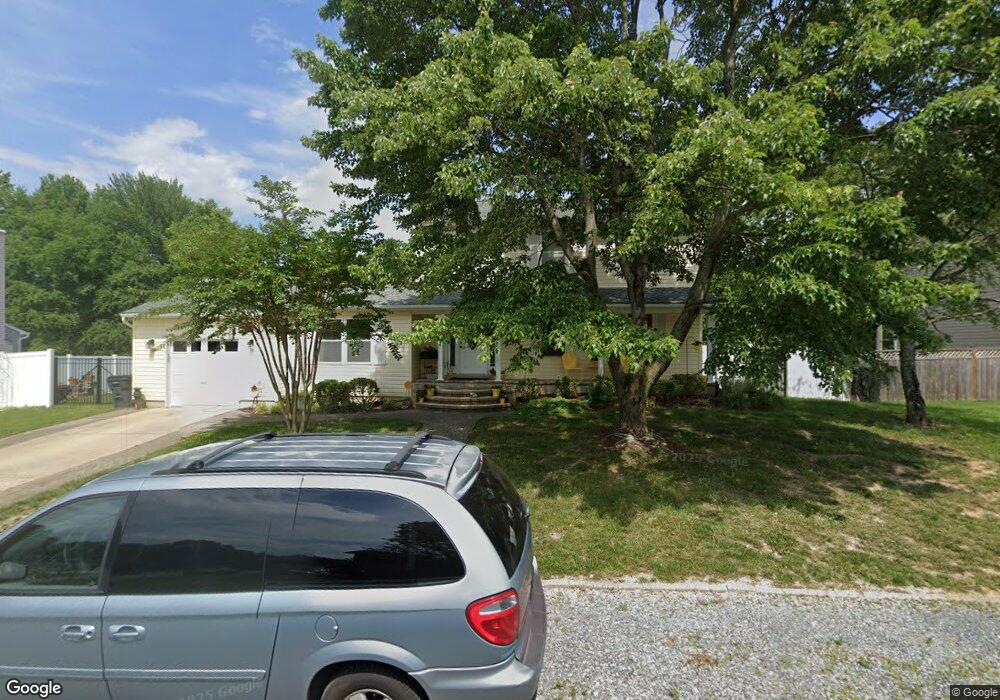
12315 Burning Oak Ct Waldorf, MD 20601
Estimated Value: $439,610 - $509,000
Studio
4
Baths
2,016
Sq Ft
$236/Sq Ft
Est. Value
About This Home
This home is located at 12315 Burning Oak Ct, Waldorf, MD 20601 and is currently estimated at $474,903, approximately $235 per square foot. 12315 Burning Oak Ct is a home located in Charles County with nearby schools including J.P. Ryon Elementary School, John Hanson Middle School, and Thomas Stone High School.
Ownership History
Date
Name
Owned For
Owner Type
Purchase Details
Closed on
Aug 3, 1994
Sold by
Fundamentl Holdg Inc
Bought by
Rice Howard M
Current Estimated Value
Home Financials for this Owner
Home Financials are based on the most recent Mortgage that was taken out on this home.
Original Mortgage
$135,950
Interest Rate
8.4%
Purchase Details
Closed on
May 13, 1994
Sold by
Nationsbanc Mtge Cp
Bought by
Fundamental Holdings
Purchase Details
Closed on
Nov 18, 1993
Sold by
Collins
Bought by
Nationsbanc Mtge Cp
Create a Home Valuation Report for This Property
The Home Valuation Report is an in-depth analysis detailing your home's value as well as a comparison with similar homes in the area
Home Values in the Area
Average Home Value in this Area
Purchase History
| Date | Buyer | Sale Price | Title Company |
|---|---|---|---|
| Rice Howard M | $137,000 | -- | |
| Fundamental Holdings | $135,575 | -- | |
| Nationsbanc Mtge Cp | $135,575 | -- |
Source: Public Records
Mortgage History
| Date | Status | Borrower | Loan Amount |
|---|---|---|---|
| Closed | Nationsbanc Mtge Cp | $135,950 |
Source: Public Records
Tax History
| Year | Tax Paid | Tax Assessment Tax Assessment Total Assessment is a certain percentage of the fair market value that is determined by local assessors to be the total taxable value of land and additions on the property. | Land | Improvement |
|---|---|---|---|---|
| 2025 | $5,354 | $379,567 | -- | -- |
| 2024 | $4,918 | $349,000 | $125,100 | $223,900 |
| 2023 | $4,757 | $332,900 | $0 | $0 |
| 2022 | $4,439 | $316,800 | $0 | $0 |
| 2021 | $4,128 | $300,700 | $95,100 | $205,600 |
| 2020 | $4,128 | $297,067 | $0 | $0 |
| 2019 | $4,062 | $293,433 | $0 | $0 |
| 2018 | $3,979 | $289,800 | $90,100 | $199,700 |
| 2017 | $3,818 | $278,033 | $0 | $0 |
| 2016 | -- | $266,267 | $0 | $0 |
| 2015 | $3,712 | $254,500 | $0 | $0 |
| 2014 | $3,712 | $254,500 | $0 | $0 |
Source: Public Records
Map
Nearby Homes
- 2414 Shade Oak Ct
- 2212 Holly Oak Ct
- 2454 Sagewood Ct
- 2204 Holly Oak Ct
- 2012 English Oak Ct
- 1764 Red Oak Ln
- 1914 Black Oak Ct
- 12820 Twin Oak Dr
- 12577 Sub-Station Rd
- 2450 Indian Ct
- 12613 Indian Ln
- 12081 Pierce Rd
- 11902 Calico Woods Place
- 2290 Mattawoman Beantown Rd
- 3319 Westdale Ct
- 2650 Pinewood Dr
- 2545 Enterprise Place
- 2511 Lisa Dr
- 12276 Wendy Ln
- 2069 Tanglewood Dr
- 12317 Burning Oak Ct
- 12313 Burning Oak Ct
- 2757 Scarlett Oak Ct
- 12312 Burning Oak Ct
- 12319 Burning Oak Ct
- 12311 Burning Oak Ct
- 2754 Scarlett Oak Ct
- 2755 Scarlett Oak Ct
- 12310 Burning Oak Ct
- 2653 Oakland Ct
- 12321 Burning Oak Ct
- 12309 Burning Oak Ct
- 2752 Scarlett Oak Ct
- 2724 Burning Oak Dr
- 2541 Charter Oak Dr
- 12588 Council Oak Dr
- 2753 Scarlett Oak Ct
- 12323 Burning Oak Ct
- 12590 Council Oak Dr
- 12307 Burning Oak Ct
Your Personal Tour Guide
Ask me questions while you tour the home.