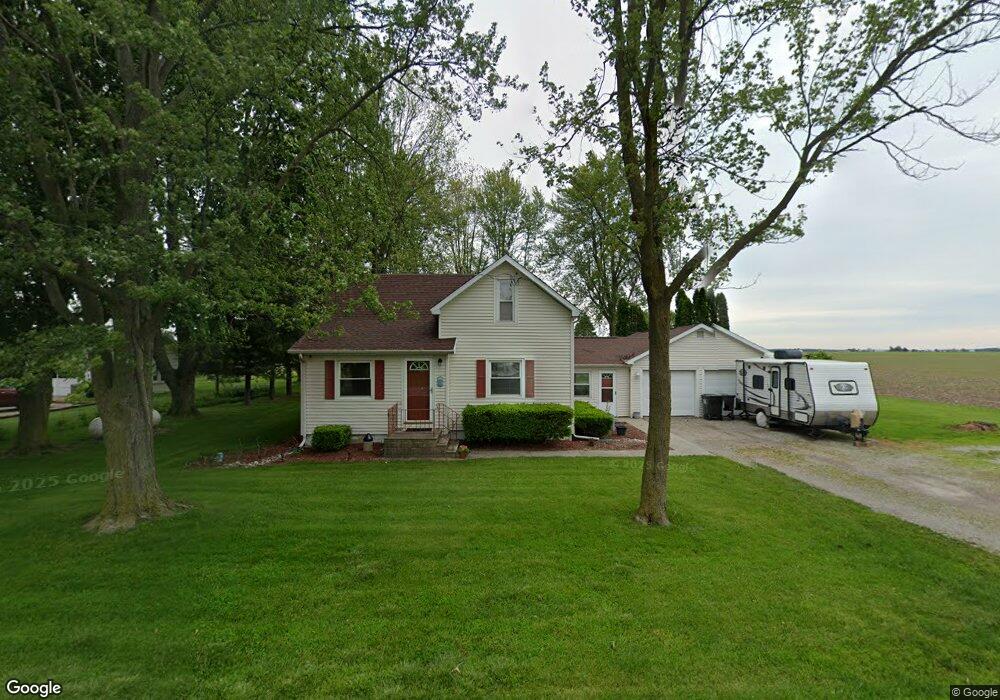
12315 State Route 613 Paulding, OH 45879
Estimated Value: $117,244 - $203,000
2
Beds
1
Bath
1,304
Sq Ft
$116/Sq Ft
Est. Value
About This Home
This home is located at 12315 State Route 613, Paulding, OH 45879 and is currently estimated at $151,811, approximately $116 per square foot. 12315 State Route 613 is a home located in Paulding County with nearby schools including Wayne Trace High School.
Ownership History
Date
Name
Owned For
Owner Type
Purchase Details
Closed on
Nov 9, 2018
Sold by
Miller Richard F and Miller Patricia J
Bought by
Zartman Rob L and Zartman Kathy S
Current Estimated Value
Home Financials for this Owner
Home Financials are based on the most recent Mortgage that was taken out on this home.
Original Mortgage
$79,700
Outstanding Balance
$69,937
Interest Rate
4.7%
Mortgage Type
New Conventional
Estimated Equity
$81,874
Purchase Details
Closed on
May 24, 2006
Sold by
Scholfield Michael P and Scholfield Lynn
Bought by
Miller Richard F and Miller Patricia J
Home Financials for this Owner
Home Financials are based on the most recent Mortgage that was taken out on this home.
Original Mortgage
$82,741
Interest Rate
6.66%
Mortgage Type
VA
Purchase Details
Closed on
Jun 30, 1995
Bought by
Miller Richard F Miller Patricia J
Create a Home Valuation Report for This Property
The Home Valuation Report is an in-depth analysis detailing your home's value as well as a comparison with similar homes in the area
Home Values in the Area
Average Home Value in this Area
Purchase History
| Date | Buyer | Sale Price | Title Company |
|---|---|---|---|
| Zartman Rob L | $87,500 | None Available | |
| Miller Richard F | $81,000 | None Available | |
| Miller Richard F Miller Patricia J | $55,000 | -- |
Source: Public Records
Mortgage History
| Date | Status | Borrower | Loan Amount |
|---|---|---|---|
| Open | Zartman Rob L | $79,700 | |
| Previous Owner | Miller Richard F | $82,741 |
Source: Public Records
Tax History Compared to Growth
Tax History
| Year | Tax Paid | Tax Assessment Tax Assessment Total Assessment is a certain percentage of the fair market value that is determined by local assessors to be the total taxable value of land and additions on the property. | Land | Improvement |
|---|---|---|---|---|
| 2024 | $581 | $33,880 | $7,000 | $26,880 |
| 2023 | $1,124 | $33,880 | $7,000 | $26,880 |
| 2022 | $1,119 | $33,880 | $7,000 | $26,880 |
| 2021 | $1,004 | $27,830 | $7,000 | $20,830 |
| 2020 | $1,039 | $27,830 | $7,000 | $20,830 |
| 2019 | $1,044 | $25,940 | $7,000 | $18,940 |
| 2018 | $892 | $25,940 | $7,000 | $18,940 |
| 2017 | $894 | $25,940 | $7,000 | $18,940 |
| 2016 | $893 | $25,940 | $7,000 | $18,940 |
| 2015 | $837 | $24,780 | $7,000 | $17,780 |
| 2014 | $848 | $24,780 | $7,000 | $17,780 |
| 2013 | $936 | $24,780 | $7,000 | $17,780 |
Source: Public Records
Map
Nearby Homes
- 225 2nd St
- 14255 Road 126
- 300 S Williams St
- 714 W Wayne St
- 720 W Wayne St
- 717 W Harrison St
- 120 S Grant St
- 720 W Perry St
- 215 N Dewitt St
- 301 N Main St
- 0 Road 72
- 516 N Williams St
- 11051 Road 93
- 726 N Main St
- 829 Greenbriar Ave
- Tract 2 - 0000 Ohio 111
- 0000 Ohio 111
- 741 Tom Tim Dr
- 907 Country View Dr
- 1045 Emerald Rd