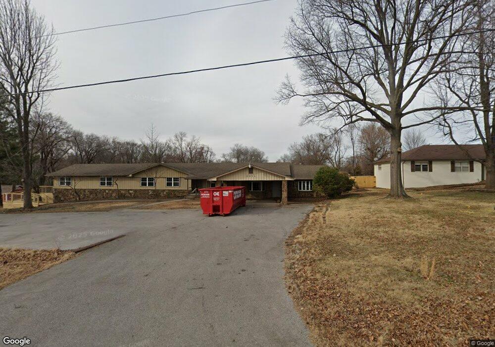
1232 & 1308 W Stultz Rd Springdale, AR 72764
Estimated Value: $908,131
--
Bed
--
Bath
4,206
Sq Ft
$216/Sq Ft
Est. Value
About This Home
This home is located at 1232 & 1308 W Stultz Rd, Springdale, AR 72764 and is currently priced at $908,131, approximately $215 per square foot. 1232 & 1308 W Stultz Rd is a home located in Benton County with nearby schools including Hunt Elementary School, Central Junior High School, and Hellstern Middle School.
Ownership History
Date
Name
Owned For
Owner Type
Purchase Details
Closed on
Sep 8, 2022
Sold by
Montage Llc
Bought by
Bonnie-Coat Llc
Current Estimated Value
Purchase Details
Closed on
Aug 31, 2011
Sold by
Davis Zada Dianne
Bought by
Montage Llc
Home Financials for this Owner
Home Financials are based on the most recent Mortgage that was taken out on this home.
Original Mortgage
$235,000
Interest Rate
4.43%
Purchase Details
Closed on
Aug 22, 1996
Bought by
Davis
Purchase Details
Closed on
Apr 12, 1996
Bought by
Davis
Purchase Details
Closed on
Jan 15, 1988
Bought by
Davis
Purchase Details
Closed on
Mar 5, 1986
Bought by
Davis
Create a Home Valuation Report for This Property
The Home Valuation Report is an in-depth analysis detailing your home's value as well as a comparison with similar homes in the area
Home Values in the Area
Average Home Value in this Area
Purchase History
| Date | Buyer | Sale Price | Title Company |
|---|---|---|---|
| Bonnie-Coat Llc | $850,000 | None Listed On Document | |
| Montage Llc | $195,000 | Waco Title Company | |
| Davis | -- | -- | |
| Davis | -- | -- | |
| Davis | -- | -- | |
| Davis | $76,000 | -- |
Source: Public Records
Mortgage History
| Date | Status | Borrower | Loan Amount |
|---|---|---|---|
| Previous Owner | Montage Llc | $235,000 |
Source: Public Records
Tax History Compared to Growth
Tax History
| Year | Tax Paid | Tax Assessment Tax Assessment Total Assessment is a certain percentage of the fair market value that is determined by local assessors to be the total taxable value of land and additions on the property. | Land | Improvement |
|---|---|---|---|---|
| 2025 | $7,666 | $147,121 | $51,649 | $95,472 |
| 2024 | $3,552 | $147,121 | $51,649 | $95,472 |
| 2023 | $3,253 | $61,034 | $8,954 | $52,080 |
| 2022 | $3,259 | $62,000 | $9,920 | $52,080 |
| 2021 | $3,284 | $62,000 | $9,920 | $52,080 |
| 2020 | $2,992 | $56,130 | $6,700 | $49,430 |
| 2019 | $2,992 | $56,130 | $6,700 | $49,430 |
| 2018 | $2,992 | $56,130 | $6,700 | $49,430 |
| 2017 | $3,536 | $56,130 | $6,700 | $49,430 |
| 2016 | $3,536 | $151,420 | $6,700 | $144,720 |
| 2015 | $3,215 | $60,320 | $13,830 | $46,490 |
| 2014 | $3,215 | $60,320 | $13,830 | $46,490 |
Source: Public Records
Map
Nearby Homes
- 1308 W Stultz Rd
- 3450 Pasofino Loop
- 1376 Lexington Cir
- 1072 Lexington Cir
- 4465 Warwick Cove
- 3800 Tanglewood Dr
- 0 Graham Rd
- 413 W Highway 264
- 1483 Leesburg Ave
- 4661 Carriage Ln
- 4654 Carriage Ln
- 7.25 AC Thompson
- 2122 Wagon Wheel Rd
- 3751 Alliance Dr
- 5315 Walden St
- 235 Glory Ln
- 3986 Saulsbury St
- 3498 Alliance Dr
- 3557 Alliance Dr
- 5335 Callahan Mountain Rd
- 1232 W Stultz Rd
- 1232 W Stultz Rd
- 1308 W Stultz Rd
- 1210 W Stultz Rd
- 3427 Pasofino Loop
- 3426 Pasofino Loop
- 1308 & 1232 W Stultz Rd
- 3451 Pasofino Loop
- 1176 W Stultz Rd
- 4074 Pasofino Loop
- 3473 Pasofino Loop
- 3472 Pasofino Loop
- 4052 Pasofino Loop
- 1323 W Stultz Rd
- 3497 Pasofino Loop
- 1200 Wagon Wheel Rd
- 4030 Pasofino Loop
- 4075 Pasofino Loop
- 4008 Pasofino Loop
- 3515 Pasofino Loop