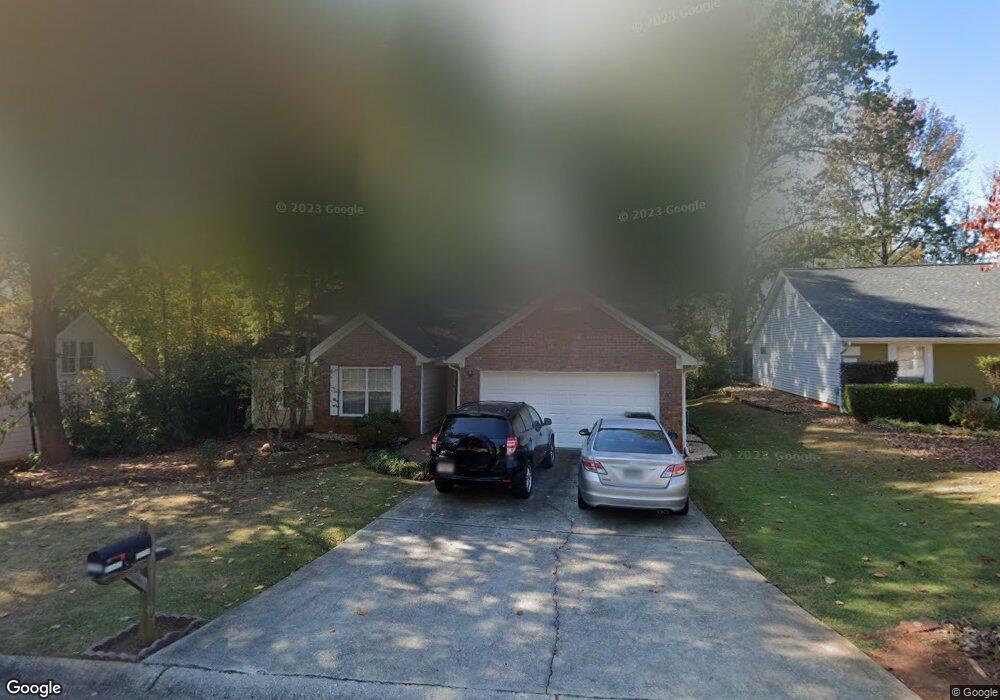
1232 Bailing Dr Unit 1 Lawrenceville, GA 30043
Estimated Value: $349,975 - $358,000
3
Beds
2
Baths
1,635
Sq Ft
$217/Sq Ft
Est. Value
About This Home
This home is located at 1232 Bailing Dr Unit 1, Lawrenceville, GA 30043 and is currently estimated at $354,494, approximately $216 per square foot. 1232 Bailing Dr Unit 1 is a home located in Gwinnett County with nearby schools including McKendree Elementary School, Creekland Middle School, and Collins Hill High School.
Ownership History
Date
Name
Owned For
Owner Type
Purchase Details
Closed on
Apr 25, 2005
Sold by
Brown Elsy M
Bought by
Brown Lawrence C and Brown Elsy
Current Estimated Value
Purchase Details
Closed on
May 26, 1999
Sold by
Barrett Linda J
Bought by
Freeman Elsy M
Home Financials for this Owner
Home Financials are based on the most recent Mortgage that was taken out on this home.
Original Mortgage
$110,250
Interest Rate
6.9%
Mortgage Type
New Conventional
Purchase Details
Closed on
Jul 25, 1996
Sold by
Rodgers Deborah L James L
Bought by
Barrett Linda J
Create a Home Valuation Report for This Property
The Home Valuation Report is an in-depth analysis detailing your home's value as well as a comparison with similar homes in the area
Home Values in the Area
Average Home Value in this Area
Purchase History
| Date | Buyer | Sale Price | Title Company |
|---|---|---|---|
| Brown Lawrence C | -- | -- | |
| Freeman Elsy M | $122,500 | -- | |
| Barrett Linda J | $97,500 | -- |
Source: Public Records
Mortgage History
| Date | Status | Borrower | Loan Amount |
|---|---|---|---|
| Previous Owner | Freeman Elsy M | $110,250 | |
| Closed | Barrett Linda J | $0 |
Source: Public Records
Tax History Compared to Growth
Tax History
| Year | Tax Paid | Tax Assessment Tax Assessment Total Assessment is a certain percentage of the fair market value that is determined by local assessors to be the total taxable value of land and additions on the property. | Land | Improvement |
|---|---|---|---|---|
| 2024 | $3,508 | $135,520 | $28,000 | $107,520 |
| 2023 | $3,508 | $135,520 | $28,000 | $107,520 |
| 2022 | $3,058 | $115,600 | $22,000 | $93,600 |
| 2021 | $2,524 | $87,880 | $19,200 | $68,680 |
| 2020 | $2,379 | $80,280 | $16,080 | $64,200 |
| 2019 | $2,335 | $80,280 | $16,080 | $64,200 |
| 2018 | $2,050 | $67,120 | $12,880 | $54,240 |
| 2016 | $1,738 | $51,680 | $10,800 | $40,880 |
| 2015 | $1,750 | $51,680 | $10,800 | $40,880 |
| 2014 | -- | $42,280 | $7,200 | $35,080 |
Source: Public Records
Map
Nearby Homes
- 1182 Bailing Dr
- 1131 Bailing Dr
- 1006 Bass Ct
- 1181 Colony Bend Dr
- 1460 Walnut Hill Cir
- 1312 Yorktown Cir Unit 3
- 1398 Field Creek Terrace
- 1425 Wheatfield Dr
- 830 Meadowsong Cir
- 1346 Lucan Ln Unit WC2.27
- 1356 Lucan Ln Unit WC2.26
- 1165 Luther Way
- 1416 Lucan Ln Unit WC2.20
- 1368 Christiana Dr
- 585 Station View Run
- 1216 Lucan Ln Unit WC2.32
- 1226 Lucan Ln Unit WC2.31
- 1236 Lucan Ln Unit WC2.30
- 1246 Lucan Ln Unit WC2.29
- 1112 Hopedale Ln
- 1242 Bailing Dr
- 1222 Bailing Dr
- 1275 Sugar Land Ct Unit 8
- 1275 Sugar Land Ct
- 1212 Bailing Dr
- 1265 Sugar Land Ct
- 1285 Sugar Land Ct Unit 2
- 1252 Bailing Dr Unit 1
- 1231 Bailing Dr
- 1241 Bailing Dr
- 1202 Bailing Dr
- 0 Bailing Dr Unit 7496519
- 0 Bailing Dr Unit 7465253
- 0 Bailing Dr Unit 7205797
- 0 Bailing Dr Unit 7154618
- 0 Bailing Dr Unit 7118852
- 0 Bailing Dr Unit 8766801
- 0 Bailing Dr Unit 8608493
- 0 Bailing Dr Unit 8361251
- 0 Bailing Dr Unit 8157152