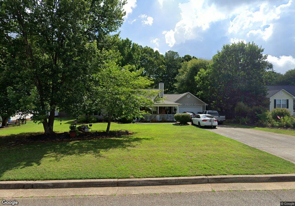
1232 Dale Dr Monroe, GA 30656
Estimated Value: $309,000 - $367,000
3
Beds
2
Baths
1,434
Sq Ft
$227/Sq Ft
Est. Value
About This Home
This home is located at 1232 Dale Dr, Monroe, GA 30656 and is currently estimated at $325,455, approximately $226 per square foot. 1232 Dale Dr is a home located in Barrow County with nearby schools including Bethlehem Elementary School, Haymon-Morris Middle School, and Apalachee High School.
Ownership History
Date
Name
Owned For
Owner Type
Purchase Details
Closed on
Nov 17, 2023
Sold by
Byrd Bryan M
Bought by
Byrd Amanda C
Current Estimated Value
Purchase Details
Closed on
Oct 19, 2005
Sold by
Byrd Bryan M
Bought by
Byrd Amanda C and Byrd Bryan M
Home Financials for this Owner
Home Financials are based on the most recent Mortgage that was taken out on this home.
Original Mortgage
$122,400
Interest Rate
5.88%
Mortgage Type
New Conventional
Purchase Details
Closed on
May 31, 2000
Sold by
White Oak Homes
Bought by
Byrd Bryan M
Home Financials for this Owner
Home Financials are based on the most recent Mortgage that was taken out on this home.
Original Mortgage
$102,600
Interest Rate
8.14%
Mortgage Type
New Conventional
Purchase Details
Closed on
Nov 4, 1999
Sold by
Ado Inc
Bought by
White Oak Homes Inc
Purchase Details
Closed on
Feb 19, 1998
Bought by
Ado Inc
Create a Home Valuation Report for This Property
The Home Valuation Report is an in-depth analysis detailing your home's value as well as a comparison with similar homes in the area
Home Values in the Area
Average Home Value in this Area
Purchase History
| Date | Buyer | Sale Price | Title Company |
|---|---|---|---|
| Byrd Amanda C | -- | -- | |
| Byrd Amanda C | -- | -- | |
| Byrd Bryan M | $108,100 | -- | |
| White Oak Homes Inc | $304,000 | -- | |
| Ado Inc | -- | -- |
Source: Public Records
Mortgage History
| Date | Status | Borrower | Loan Amount |
|---|---|---|---|
| Previous Owner | Byrd Amanda C | $122,400 | |
| Previous Owner | Byrd Bryan M | $102,600 |
Source: Public Records
Tax History Compared to Growth
Tax History
| Year | Tax Paid | Tax Assessment Tax Assessment Total Assessment is a certain percentage of the fair market value that is determined by local assessors to be the total taxable value of land and additions on the property. | Land | Improvement |
|---|---|---|---|---|
| 2024 | $1,857 | $83,232 | $20,000 | $63,232 |
| 2023 | $1,330 | $77,632 | $14,000 | $63,632 |
| 2022 | $1,837 | $70,850 | $14,000 | $56,850 |
| 2021 | $1,738 | $63,324 | $14,000 | $49,324 |
| 2020 | $1,731 | $63,324 | $14,000 | $49,324 |
| 2019 | $1,756 | $63,324 | $14,000 | $49,324 |
| 2018 | $1,587 | $57,324 | $8,000 | $49,324 |
| 2017 | $1,172 | $40,261 | $8,000 | $32,261 |
| 2016 | $1,081 | $37,702 | $8,000 | $29,702 |
| 2015 | $1,096 | $38,038 | $8,000 | $30,038 |
| 2014 | $1,046 | $36,212 | $6,174 | $30,038 |
| 2013 | -- | $34,764 | $6,174 | $28,590 |
Source: Public Records
Map
Nearby Homes
- 1235 Dale Dr
- 3300 Jack Glass Rd
- 303 Carly Ct
- 1224 Palmer Dr
- 164 Manning Gin Rd
- 1050 Bethlehem Church Rd
- 633 Skyland Dr
- 1210 Austin Rd
- 1216 Austin Rd
- 797 Ode Peppers Rd
- 865 Ode Peppers Ct
- 1408 Wyndham Way
- 259 Dunagan Ct
- 378 Dunagan Ct
- 2112 Perry Place Ln
- 784 Manger Ave
- 0 McElhannon Rd SW Unit 10581793
- 1221 Casper Ln