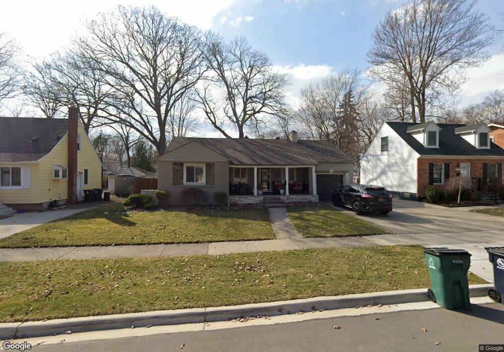
1232 Etowah Ave Royal Oak, MI 48067
Estimated Value: $387,046 - $453,000
3
Beds
1
Bath
1,450
Sq Ft
$290/Sq Ft
Est. Value
About This Home
This home is located at 1232 Etowah Ave, Royal Oak, MI 48067 and is currently estimated at $420,012, approximately $289 per square foot. 1232 Etowah Ave is a home located in Oakland County with nearby schools including Oakland Elementary School, Royal Oak Middle School, and Royal Oak High School.
Ownership History
Date
Name
Owned For
Owner Type
Purchase Details
Closed on
Aug 31, 2022
Sold by
David Capoferi
Bought by
David Cameron Capoferi Living Trust
Current Estimated Value
Purchase Details
Closed on
Dec 23, 2004
Sold by
Anchor Capital Group Ltd and Bernier Susan
Bought by
Capoferi David
Purchase Details
Closed on
Aug 3, 2004
Sold by
Youngblood James Edward and Youngblood Sandra S
Bought by
Anchor Capital Group Ltd
Purchase Details
Closed on
Nov 7, 1997
Sold by
Youngblood James Edward
Bought by
Youngblood James Edward
Home Financials for this Owner
Home Financials are based on the most recent Mortgage that was taken out on this home.
Original Mortgage
$60,000
Interest Rate
7.26%
Create a Home Valuation Report for This Property
The Home Valuation Report is an in-depth analysis detailing your home's value as well as a comparison with similar homes in the area
Home Values in the Area
Average Home Value in this Area
Purchase History
| Date | Buyer | Sale Price | Title Company |
|---|---|---|---|
| David Cameron Capoferi Living Trust | -- | -- | |
| Capoferi David | $192,500 | Summit Title | |
| Anchor Capital Group Ltd | $158,000 | Capital Title | |
| Youngblood James Edward | -- | -- |
Source: Public Records
Mortgage History
| Date | Status | Borrower | Loan Amount |
|---|---|---|---|
| Previous Owner | Youngblood James Edward | $60,000 |
Source: Public Records
Tax History Compared to Growth
Tax History
| Year | Tax Paid | Tax Assessment Tax Assessment Total Assessment is a certain percentage of the fair market value that is determined by local assessors to be the total taxable value of land and additions on the property. | Land | Improvement |
|---|---|---|---|---|
| 2024 | $3,238 | $173,580 | $0 | $0 |
| 2022 | $3,826 | $155,770 | $0 | $0 |
| 2020 | $3,147 | $135,680 | $0 | $0 |
| 2018 | $3,826 | $119,970 | $0 | $0 |
| 2017 | $3,678 | $119,970 | $0 | $0 |
| 2015 | -- | $104,030 | $0 | $0 |
| 2014 | -- | $95,800 | $0 | $0 |
| 2011 | -- | $87,050 | $0 | $0 |
Source: Public Records
Map
Nearby Homes
- 1307 Etowah Ave
- 1412 Etowah Ave
- 1402 Owana Ave
- 1212 Wyandotte Ave
- 1515 Etowah Ave
- 1533 Owana Ave
- 1410 Mclean Ave
- 1602 Hoffman Ave
- 1007 Mohawk Ave
- 1102 S Wilson Ave
- 1118 Longfellow Ave
- 1222 E Lincoln Ave Unit 4
- 823 Mclean Ave
- 722 E Parent Ave
- 1007 Irving Ave
- 1036 Irving Ave
- 1213 Batavia Ave
- 1418 E 10 Mile Rd
- 1538 S Campbell Rd
- 622 MacWilliams Ln Unit 1
- 1304 Etowah Ave
- 1230 Etowah Ave
- 1226 Etowah Ave
- 1308 Etowah Ave
- 1303 Cherokee Ave
- 1220 Etowah Ave
- 1231 Cherokee Ave
- 1229 Cherokee Ave
- 1307 Cherokee Ave
- 1225 Cherokee Ave
- 1318 Etowah Ave
- 1313 Cherokee Ave
- 1216 Etowah Ave
- 1221 Cherokee Ave
- 1320 Etowah Ave
- 1317 Cherokee Ave
- 1227 Etowah Ave Unit Bldg-Unit
- 1227 Etowah Ave
- 1217 Cherokee Ave
- 1212 Etowah Ave