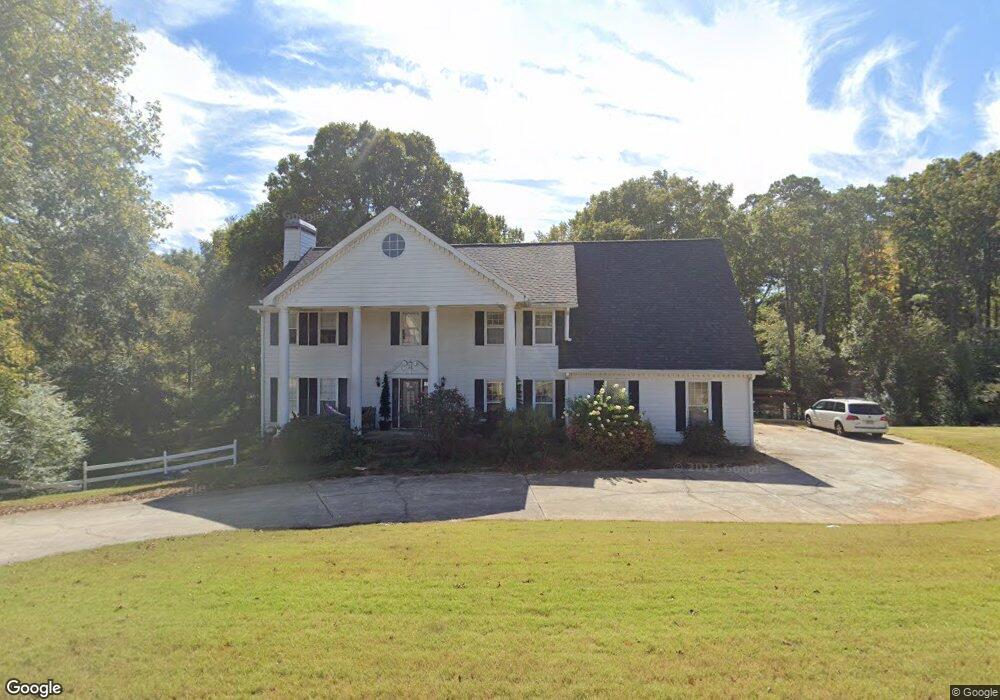
1232 Jimson Cir SE Conyers, GA 30013
Estimated Value: $411,000 - $587,000
6
Beds
4
Baths
2,923
Sq Ft
$163/Sq Ft
Est. Value
About This Home
This home is located at 1232 Jimson Cir SE, Conyers, GA 30013 and is currently estimated at $477,056, approximately $163 per square foot. 1232 Jimson Cir SE is a home located in Rockdale County with nearby schools including Flat Shoals Elementary School, Memorial Middle School, and Rockdale County High School.
Ownership History
Date
Name
Owned For
Owner Type
Purchase Details
Closed on
May 30, 2008
Sold by
Lange Neal B and Lange Terri
Bought by
Fitzgerald Matthew A and Fitzgerald Michelle K
Current Estimated Value
Home Financials for this Owner
Home Financials are based on the most recent Mortgage that was taken out on this home.
Original Mortgage
$284,555
Outstanding Balance
$182,131
Interest Rate
6%
Mortgage Type
FHA
Estimated Equity
$294,925
Create a Home Valuation Report for This Property
The Home Valuation Report is an in-depth analysis detailing your home's value as well as a comparison with similar homes in the area
Home Values in the Area
Average Home Value in this Area
Purchase History
| Date | Buyer | Sale Price | Title Company |
|---|---|---|---|
| Fitzgerald Matthew A | $286,804 | -- |
Source: Public Records
Mortgage History
| Date | Status | Borrower | Loan Amount |
|---|---|---|---|
| Open | Fitzgerald Matthew A | $284,555 |
Source: Public Records
Tax History Compared to Growth
Tax History
| Year | Tax Paid | Tax Assessment Tax Assessment Total Assessment is a certain percentage of the fair market value that is determined by local assessors to be the total taxable value of land and additions on the property. | Land | Improvement |
|---|---|---|---|---|
| 2024 | $4,211 | $167,760 | $39,400 | $128,360 |
| 2023 | $3,709 | $153,600 | $35,240 | $118,360 |
| 2022 | $3,625 | $150,320 | $35,240 | $115,080 |
| 2021 | $3,036 | $119,480 | $25,200 | $94,280 |
| 2020 | $2,842 | $108,480 | $24,560 | $83,920 |
| 2019 | $2,495 | $94,920 | $15,000 | $79,920 |
| 2018 | $2,511 | $94,920 | $15,000 | $79,920 |
| 2017 | $2,245 | $85,360 | $15,000 | $70,360 |
| 2016 | $1,794 | $75,680 | $15,880 | $59,800 |
| 2015 | $1,798 | $75,680 | $15,880 | $59,800 |
| 2014 | $1,545 | $73,200 | $13,400 | $59,800 |
| 2013 | -- | $93,800 | $21,600 | $72,200 |
Source: Public Records
Map
Nearby Homes
- 1180 Azalea Cir SE
- 2405 Old Salem Rd SE Unit 1
- 2561 Old Salem Cir SE
- 2259 Old Salem Rd SE
- 1135 Vineyard Dr SE
- 1613 Brentwood Crossing SE Unit 3
- 2474 Harvest Dr SE
- 1260 Sweet Shrub Ln SE
- 2235 Kings Forest Dr SE
- 1820 Lancaster Dr SE
- 2225 Kings Forest Dr SE
- 2215 Kings Forest Dr SE
- 2165 Old Salem Rd SE
- 2193 Kings Forest Dr SE
- 2791 Wellington Way SE Unit 1
- 2303 Deerfield Chase SE Unit 5
- 2365 Brentmoore Point Unit 3
- 2684 Harvest Dr SE
- 1234 Jimson Cir SE Unit 23
- 1234 Jimson Cir SE
- 1222 Jimson Cir SE Unit 6
- 1203 Jimson Cir SE
- 1252 Jimson Cir SE
- 1233 Jimson Cir SE Unit 6
- 1193 Jimson Cir SE Unit 6
- 1212 Jimson Cir SE
- 1243 Jimson Cir SE
- 1262 Jimson Cir SE
- 0 Jimson Cir SE Unit 8696788
- 0 Jimson Cir SE Unit 8654993
- 0 Jimson Cir SE Unit 8582704
- 0 Jimson Cir SE Unit 8531285
- 0 Jimson Cir SE Unit 8646600
- 0 Jimson Cir SE Unit 7546923
- 0 Jimson Cir SE Unit 8783755
- 0 Jimson Cir SE Unit 8849952
- 0 Jimson Cir SE Unit 8850901
- 0 Jimson Cir SE Unit 8858077