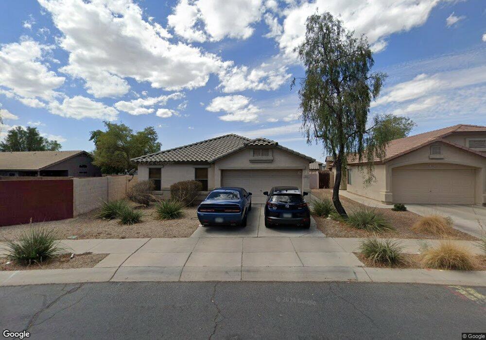
1232 N 161st Ave Unit 2 Goodyear, AZ 85338
Canyon Trails NeighborhoodEstimated Value: $316,884 - $354,000
--
Bed
2
Baths
1,119
Sq Ft
$301/Sq Ft
Est. Value
About This Home
This home is located at 1232 N 161st Ave Unit 2, Goodyear, AZ 85338 and is currently estimated at $336,971, approximately $301 per square foot. 1232 N 161st Ave Unit 2 is a home located in Maricopa County with nearby schools including Desert Thunder Elementary School, Desert Edge High School, and Incito Schools.
Ownership History
Date
Name
Owned For
Owner Type
Purchase Details
Closed on
Aug 1, 2017
Sold by
Smith Maurice M
Bought by
Smith Maurice Manwell and Manwell Living Trust
Current Estimated Value
Purchase Details
Closed on
Apr 12, 2004
Sold by
Continental Homes Inc
Bought by
Smith Maurice M
Home Financials for this Owner
Home Financials are based on the most recent Mortgage that was taken out on this home.
Original Mortgage
$127,632
Outstanding Balance
$58,929
Interest Rate
5.39%
Mortgage Type
FHA
Estimated Equity
$278,042
Create a Home Valuation Report for This Property
The Home Valuation Report is an in-depth analysis detailing your home's value as well as a comparison with similar homes in the area
Home Values in the Area
Average Home Value in this Area
Purchase History
| Date | Buyer | Sale Price | Title Company |
|---|---|---|---|
| Smith Maurice Manwell | -- | None Available | |
| Smith Maurice M | $129,636 | Century Title Agency Inc | |
| Continental Homes Inc | -- | Century Title Agency Inc |
Source: Public Records
Mortgage History
| Date | Status | Borrower | Loan Amount |
|---|---|---|---|
| Open | Smith Maurice M | $127,632 |
Source: Public Records
Tax History Compared to Growth
Tax History
| Year | Tax Paid | Tax Assessment Tax Assessment Total Assessment is a certain percentage of the fair market value that is determined by local assessors to be the total taxable value of land and additions on the property. | Land | Improvement |
|---|---|---|---|---|
| 2025 | $973 | $10,573 | -- | -- |
| 2024 | $963 | $10,070 | -- | -- |
| 2023 | $963 | $25,680 | $5,130 | $20,550 |
| 2022 | $916 | $18,850 | $3,770 | $15,080 |
| 2021 | $996 | $16,680 | $3,330 | $13,350 |
| 2020 | $961 | $15,700 | $3,140 | $12,560 |
| 2019 | $938 | $13,820 | $2,760 | $11,060 |
| 2018 | $935 | $12,850 | $2,570 | $10,280 |
| 2017 | $923 | $11,270 | $2,250 | $9,020 |
| 2016 | $953 | $10,720 | $2,140 | $8,580 |
| 2015 | $882 | $9,020 | $1,800 | $7,220 |
Source: Public Records
Map
Nearby Homes
- 16236 W La Ventilla Way
- 16230 W Latham St
- 16019 W Moreland St Unit 2
- 16256 W Culver St
- 1178 N 163rd Ln
- 1176 N 163rd Ln
- 16368 W Moreland St
- 16425 W Latham St
- 16140 W Ameria Rd
- 15910 W Fillmore St
- 1291 N 166th Ave
- 16396 W Fillmore St
- 16158 W Coronado Rd
- 16229 W Berkeley Rd
- 16192 W Berkeley Rd
- 16445 W Berkeley Rd
- 16693 W Moreland St
- 15960 W Bonitos Dr
- 16178 W Granada Rd
- 399 N 157th Ln
- 1240 N 161st Ave
- 16211 W La Ventilla Way
- 16124 W Moreland St Unit 2
- 16110 W Moreland St
- 16136 W Moreland St
- 16209 W La Ventilla Way
- 1248 N 161st Ave Unit 127
- 16213 W La Ventilla Way
- 16144 W Moreland St
- 16207 W La Ventilla Way
- 1235 N 161st Ave
- 1265 N 162nd Ave
- 1256 N 161st Ave
- 1221 N 161st Ave
- 16152 W Moreland St
- 1263 N 162nd Ave
- 1249 N 161st Ave
- 16215 W La Ventilla Way
- 16205 W La Ventilla Way
- 1264 N 161st Ave