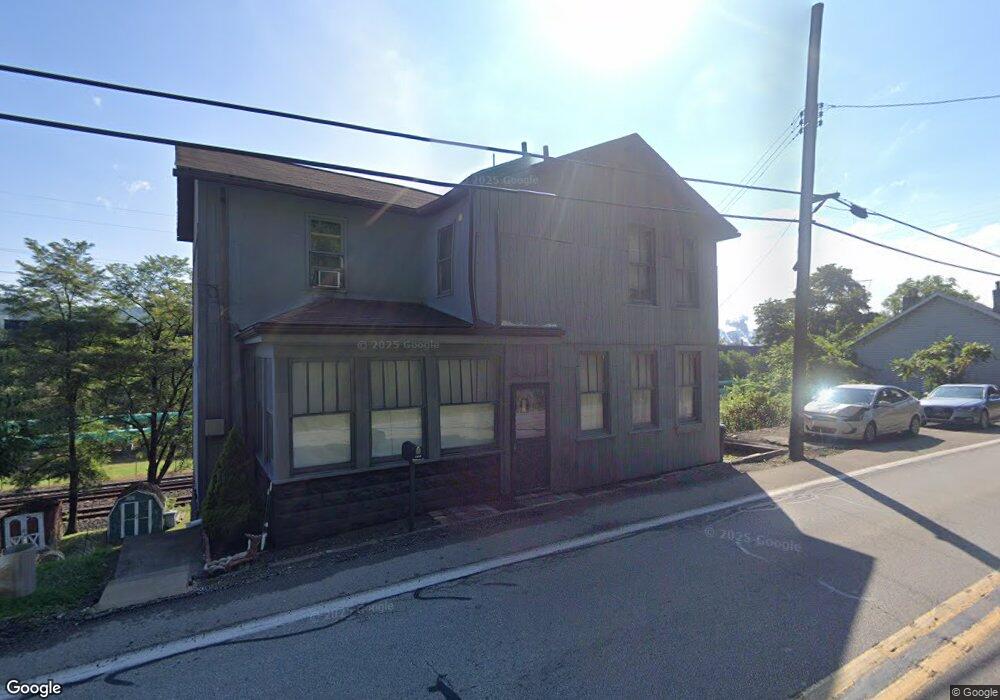
1232 N State St Clairton, PA 15025
Estimated Value: $74,572 - $251,000
2
Beds
1
Bath
1,786
Sq Ft
$82/Sq Ft
Est. Value
About This Home
This home is located at 1232 N State St, Clairton, PA 15025 and is currently estimated at $146,643, approximately $82 per square foot. 1232 N State St is a home located in Allegheny County with nearby schools including Clairton Elementary School, Clairton Middle School/High School, and Walnut Grove Christian School.
Ownership History
Date
Name
Owned For
Owner Type
Purchase Details
Closed on
May 21, 2019
Sold by
Estate Of Beatrice M Walsh
Bought by
Walsh Bernice
Current Estimated Value
Purchase Details
Closed on
Feb 6, 1989
Bought by
Walsh Beatrice and Walsh Shawn R
Purchase Details
Closed on
Feb 21, 1973
Bought by
Feath James W and Feath Teresa
Create a Home Valuation Report for This Property
The Home Valuation Report is an in-depth analysis detailing your home's value as well as a comparison with similar homes in the area
Home Values in the Area
Average Home Value in this Area
Purchase History
| Date | Buyer | Sale Price | Title Company |
|---|---|---|---|
| Walsh Bernice | -- | None Available | |
| Walsh Beatrice | -- | -- | |
| Feath James W | -- | -- |
Source: Public Records
Tax History Compared to Growth
Tax History
| Year | Tax Paid | Tax Assessment Tax Assessment Total Assessment is a certain percentage of the fair market value that is determined by local assessors to be the total taxable value of land and additions on the property. | Land | Improvement |
|---|---|---|---|---|
| 2025 | $174 | $3,600 | $3,600 | -- |
| 2024 | $449 | $3,600 | $3,600 | -- |
| 2023 | $165 | $3,600 | $3,600 | $0 |
| 2022 | $165 | $3,600 | $3,600 | $0 |
| 2021 | $449 | $3,600 | $3,600 | $0 |
| 2020 | $984 | $3,600 | $3,600 | $0 |
| 2019 | $341 | $21,600 | $10,300 | $11,300 |
| 2018 | $102 | $21,600 | $10,300 | $11,300 |
| 2017 | $335 | $21,600 | $10,300 | $11,300 |
| 2016 | $102 | $21,600 | $10,300 | $11,300 |
| 2015 | $102 | $21,600 | $10,300 | $11,300 |
| 2014 | $102 | $21,600 | $10,300 | $11,300 |
Source: Public Records
Map
Nearby Homes
- 1252 Wall Ave
- 1045 Pennsylvania Ave
- 1019 Pennsylvania Ave
- 1017 Pennsylvania Ave
- 133 Coal Valley Rd
- 811 N State St
- 962 Ohio Ave
- 211 Pennsylvania Ave
- 756 N 6th St
- 373 New York Ave
- 124 Carnegie Ave
- 132 Carnegie Ave
- 839 Michigan Ave
- 717 N 6th St
- 574 State Route 885
- 1049 Delaware Ave
- 203 Elm St
- 1319 New England Rd
- 704 Ohio Ave
- 801 Ontario St