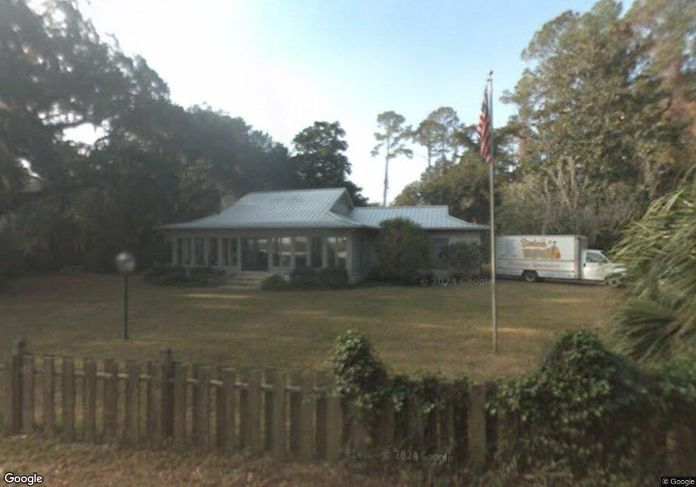
1232 Riverside Dr SE Townsend, GA 31331
Estimated Value: $480,000 - $654,000
3
Beds
2
Baths
3,313
Sq Ft
$172/Sq Ft
Est. Value
About This Home
This home is located at 1232 Riverside Dr SE, Townsend, GA 31331 and is currently estimated at $568,898, approximately $171 per square foot. 1232 Riverside Dr SE is a home located in McIntosh County with nearby schools including Todd Grant Elementary School, McIntosh County Middle School, and McIntosh County Academy.
Ownership History
Date
Name
Owned For
Owner Type
Purchase Details
Closed on
Jul 8, 2015
Sold by
Lane Ann Christine
Bought by
Gaddis Aimee G
Current Estimated Value
Home Financials for this Owner
Home Financials are based on the most recent Mortgage that was taken out on this home.
Original Mortgage
$186,400
Outstanding Balance
$72,860
Interest Rate
4.08%
Mortgage Type
New Conventional
Estimated Equity
$496,038
Purchase Details
Closed on
Nov 29, 2006
Sold by
Lane Ann Christine
Bought by
Lane Ann Christine and Lane Gerald
Purchase Details
Closed on
Apr 25, 1997
Bought by
Lane Ann Christine
Create a Home Valuation Report for This Property
The Home Valuation Report is an in-depth analysis detailing your home's value as well as a comparison with similar homes in the area
Home Values in the Area
Average Home Value in this Area
Purchase History
| Date | Buyer | Sale Price | Title Company |
|---|---|---|---|
| Gaddis Aimee G | $233,000 | -- | |
| Lane Ann Christine | -- | -- | |
| Lane Ann Christine | -- | -- |
Source: Public Records
Mortgage History
| Date | Status | Borrower | Loan Amount |
|---|---|---|---|
| Open | Gaddis Aimee G | $186,400 |
Source: Public Records
Tax History Compared to Growth
Tax History
| Year | Tax Paid | Tax Assessment Tax Assessment Total Assessment is a certain percentage of the fair market value that is determined by local assessors to be the total taxable value of land and additions on the property. | Land | Improvement |
|---|---|---|---|---|
| 2024 | $2,738 | $193,256 | $100,000 | $93,256 |
| 2023 | $2,747 | $190,760 | $100,000 | $90,760 |
| 2022 | $2,747 | $176,028 | $100,000 | $76,028 |
| 2021 | $4,191 | $157,692 | $100,000 | $57,692 |
| 2020 | $2,825 | $155,552 | $100,000 | $55,552 |
| 2019 | $2,945 | $111,036 | $60,000 | $51,036 |
| 2018 | $2,951 | $111,036 | $60,000 | $51,036 |
| 2017 | $3,205 | $107,076 | $60,000 | $47,076 |
| 2016 | $2,576 | $107,076 | $60,000 | $47,076 |
| 2015 | $2,610 | $95,200 | $51,000 | $44,200 |
| 2014 | -- | $104,717 | $60,000 | $44,717 |
Source: Public Records
Map
Nearby Homes
- 1356 Atwood Rd SE
- 1165 Durant Dr SE
- 1304 Old Smokey
- 11.73 Acres On Smith Rd SE
- 13 Seabreeze Dr
- 1334 Emma Ln SE
- 1042 Edgewater Dr NE
- 18 Doboy Ct
- 1156 Marsh Dr NE
- 1303 Marsh Dr NE
- Lot 45 Marsh Dr NE
- 1207 Lewis Ln NE
- 1262 Sapelo Gardens
- 1225 NE O'Neal Dr
- 1334 Azalea Rd NE
- 1629 River St NE
- 1474 Mcintosh Trail SE
- 0 Rice Planter
- 0 Crow Trail SE Unit 1654392
- 3261 Smith Rd SE
- 120 Riverside Dr
- 1194 Riverside Dr SE
- 1272 Riverside Dr SE
- 1278 Riverside Dr SE
- LOT 7 Riverside Dr
- 1198 Riverside Dr SE
- 1166 Riverside Dr SE
- 1208 Atwood Rd SE
- 1240 Atwood Rd SE
- 1338 Amason Ave SE
- 1224 Atwood Rd SE
- 1512 Amason Ave SE
- 1262 Atwood Rd SE
- 1061 Cedar Cottage Rd SE
- 1194 Amason Ave SE
- 1505 Cedar Point Rd SE
- 1107 Cedar Cottage Rd SE
- 0 Atwood Ln Unit 1566640
- 0 Atwood Ln Unit 1580557
- 0 Atwood Ln Unit 1581939