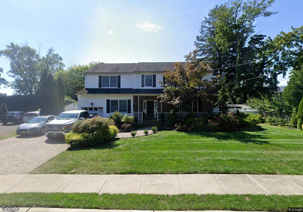
1232 Turf Dr Oceanport, NJ 07757
Estimated Value: $950,590 - $1,068,000
4
Beds
2
Baths
2,560
Sq Ft
$393/Sq Ft
Est. Value
About This Home
This home is located at 1232 Turf Dr, Oceanport, NJ 07757 and is currently estimated at $1,006,898, approximately $393 per square foot. 1232 Turf Dr is a home located in Monmouth County with nearby schools including Wolf Hill Elementary School, Maple Place Elementary and Middle School, and Shore Regional High School.
Ownership History
Date
Name
Owned For
Owner Type
Purchase Details
Closed on
Dec 23, 2009
Sold by
Citibank Na
Bought by
Nagy Christine and Nagy William
Current Estimated Value
Home Financials for this Owner
Home Financials are based on the most recent Mortgage that was taken out on this home.
Original Mortgage
$389,600
Outstanding Balance
$252,681
Interest Rate
4.79%
Mortgage Type
New Conventional
Estimated Equity
$754,217
Purchase Details
Closed on
Apr 26, 2006
Sold by
Gomer Robert E
Bought by
Pardi Jon
Home Financials for this Owner
Home Financials are based on the most recent Mortgage that was taken out on this home.
Original Mortgage
$77,500
Interest Rate
6.4%
Mortgage Type
Unknown
Purchase Details
Closed on
Nov 15, 1993
Sold by
O'Toole Richard
Bought by
Gomer Robert and Gomer Dorothy
Home Financials for this Owner
Home Financials are based on the most recent Mortgage that was taken out on this home.
Original Mortgage
$163,000
Interest Rate
6.69%
Create a Home Valuation Report for This Property
The Home Valuation Report is an in-depth analysis detailing your home's value as well as a comparison with similar homes in the area
Home Values in the Area
Average Home Value in this Area
Purchase History
| Date | Buyer | Sale Price | Title Company |
|---|---|---|---|
| Nagy Christine | $444,600 | First American Title Ins Co | |
| Pardi Jon | $775,000 | -- | |
| Gomer Robert | $181,000 | -- |
Source: Public Records
Mortgage History
| Date | Status | Borrower | Loan Amount |
|---|---|---|---|
| Open | Nagy Christine | $389,600 | |
| Previous Owner | Pardi Jon | $77,500 | |
| Previous Owner | Pardi Jon | $620,000 | |
| Previous Owner | Gomer Robert | $163,000 |
Source: Public Records
Tax History Compared to Growth
Tax History
| Year | Tax Paid | Tax Assessment Tax Assessment Total Assessment is a certain percentage of the fair market value that is determined by local assessors to be the total taxable value of land and additions on the property. | Land | Improvement |
|---|---|---|---|---|
| 2025 | $11,598 | $775,400 | $341,700 | $433,700 |
| 2024 | $11,212 | $734,500 | $319,700 | $414,800 |
| 2023 | $11,212 | $673,800 | $279,700 | $394,100 |
| 2022 | $11,043 | $606,600 | $259,700 | $346,900 |
| 2021 | $11,043 | $579,700 | $249,700 | $330,000 |
| 2020 | $10,418 | $569,900 | $241,700 | $328,200 |
| 2019 | $9,945 | $552,200 | $231,700 | $320,500 |
| 2018 | $9,875 | $552,000 | $231,700 | $320,300 |
| 2017 | $11,335 | $525,500 | $154,500 | $371,000 |
| 2016 | $11,315 | $528,000 | $160,500 | $367,500 |
| 2015 | $10,930 | $527,000 | $165,500 | $361,500 |
| 2014 | $10,507 | $513,800 | $180,500 | $333,300 |
Source: Public Records
Map
Nearby Homes
- 1236 Turf Dr
- 14 Burntmill Cir
- 15 Burntmill Cir
- 16 Burntmill Cir
- 1216 Turf Dr
- 1248 Eatontown Blvd
- 1263 Eatontown Blvd
- 1255 Eatontown Blvd
- 17 Burntmill Cir
- 12 Burntmill Cir
- 41 Burntmill Cir
- 1244 Turf Dr
- 1223 Turf Dr
- 13 Burntmill Cir
- 1247 Eatontown Blvd
- 1267 Eatontown Blvd
- 1245 Eatontown Blvd
- 42 Burntmill Cir
- 1246 Turf Dr
- 1219 Turf Dr