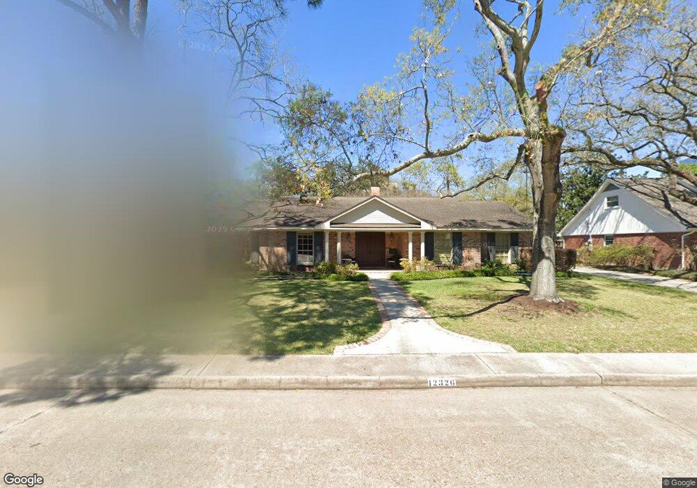
12326 Kimberley Ln Houston, TX 77024
Memorial NeighborhoodEstimated Value: $1,074,000 - $1,170,000
3
Beds
3
Baths
2,551
Sq Ft
$442/Sq Ft
Est. Value
About This Home
This home is located at 12326 Kimberley Ln, Houston, TX 77024 and is currently estimated at $1,128,118, approximately $442 per square foot. 12326 Kimberley Ln is a home located in Harris County with nearby schools including Bunker Hill Elementary School, Memorial Middle, and Memorial High School.
Ownership History
Date
Name
Owned For
Owner Type
Purchase Details
Closed on
Apr 7, 2025
Sold by
Spadafino William V and Spadafino Mary E
Bought by
Spadafino 2013 Family Trust and Spadafino
Current Estimated Value
Purchase Details
Closed on
Nov 8, 2022
Sold by
Sims Patricia Stewart
Bought by
Spadafino William V and Spadafino Mary E
Purchase Details
Closed on
Dec 29, 2011
Sold by
Stewart Mark Alan
Bought by
Sims Patricia Stewart
Create a Home Valuation Report for This Property
The Home Valuation Report is an in-depth analysis detailing your home's value as well as a comparison with similar homes in the area
Home Values in the Area
Average Home Value in this Area
Purchase History
| Date | Buyer | Sale Price | Title Company |
|---|---|---|---|
| Spadafino 2013 Family Trust | -- | None Listed On Document | |
| Spadafino William V | -- | Texas State Title | |
| Sims Patricia Stewart | -- | None Available |
Source: Public Records
Tax History Compared to Growth
Tax History
| Year | Tax Paid | Tax Assessment Tax Assessment Total Assessment is a certain percentage of the fair market value that is determined by local assessors to be the total taxable value of land and additions on the property. | Land | Improvement |
|---|---|---|---|---|
| 2025 | $12,395 | $1,038,675 | $668,800 | $369,875 |
| 2024 | $12,395 | $970,119 | $627,000 | $343,119 |
| 2023 | $12,395 | $1,041,550 | $627,000 | $414,550 |
| 2022 | $22,681 | $970,119 | $543,400 | $426,719 |
| 2021 | $18,682 | $765,183 | $501,600 | $263,583 |
| 2020 | $18,769 | $749,096 | $501,600 | $247,496 |
| 2019 | $19,519 | $745,580 | $501,600 | $243,980 |
| 2018 | $9,047 | $739,418 | $501,600 | $237,818 |
| 2017 | $19,344 | $739,418 | $501,600 | $237,818 |
| 2016 | $20,808 | $795,400 | $501,600 | $293,800 |
| 2015 | $18,423 | $829,329 | $501,600 | $327,729 |
| 2014 | $18,423 | $692,199 | $418,000 | $274,199 |
Source: Public Records
Map
Nearby Homes
- 12318 Queensbury Ln
- 12315 Barryknoll Ln
- 12231 Kimberley Ln
- 12454 Mooreknoll Ln
- 12406 Overcup Dr
- 12326 Old Oaks Dr
- 515 Tallowood Rd Unit 61
- 12511 Overcup Dr
- 12602 Overcup Dr
- 11933 Barryknoll Ln
- 601 Strey Ln
- 11905 Barryknoll Ln
- 538 Hallie Dr
- 12334 Beauregard Dr
- 939 Memorial Village Dr Unit 38
- 12 Gage Ct
- 979 Memorial Village Dr Unit 48
- 12564 Memorial Dr
- 358 Tealwood Dr
- 11910 Heritage Ln
- 12322 Kimberley Ln
- 12330 Kimberley Ln
- 12323 Pinerock Ln
- 12331 Pinerock Ln
- 12318 Kimberley Ln
- 12327 Kimberley Ln
- 12331 Kimberley Ln
- 12323 Kimberley Ln
- 12319 Pinerock Ln
- 12402 Kimberley Ln
- 12319 Kimberley Ln
- 12314 Kimberley Ln
- 12403 Pinerock Ln
- 12315 Pinerock Ln
- 12403 Kimberley Ln
- 12326 Woodthorpe Ln
- 12326 Pinerock Ln
- 12330 Woodthorpe Ln
- 12322 Pinerock Ln
- 12322 Woodthorpe Ln